MyTopo
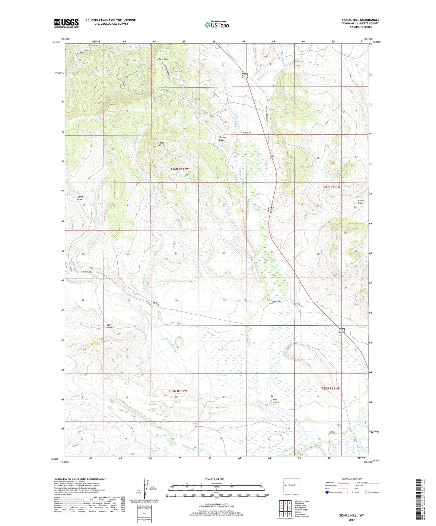
Signal Hill Wyoming US Topo Map
Couldn't load pickup availability
Also explore the Signal Hill Forest Service Topo of this same quad for updated USFS data
2021 topographic map quadrangle Signal Hill in the state of Wyoming. Scale: 1:24000. Based on the newly updated USGS 7.5' US Topo map series, this map is in the following counties: Sublette. The map contains contour data, water features, and other items you are used to seeing on USGS maps, but also has updated roads and other features. This is the next generation of topographic maps. Printed on high-quality waterproof paper with UV fade-resistant inks.
Quads adjacent to this one:
West: Kismet Peak
Northwest: Raspberry Ridge
North: Pass Peak
Northeast: Dodge Butte
East: Warren Bridge
Southeast: Daniel Junction
South: Webb Draw
Southwest: Merna
This map covers the same area as the classic USGS quad with code o43110a2.
Contains the following named places: Annie Draw, Aspen Ridge, Cow Gulch, Crooked Creek, Culbertson Creek, Franz Pit Mine, Hay Gulch, Jakes Pit Mine, Lena Ditch, Lot Two Pit Mine, Middle Beaver Creek, Miner Creek, North Beaver Creek, Pixley Creek, Quarter Corner Pit Mine, Signal Hill, South Beaver Creek, Watson Draw