
MyTopo
Red Creek Ranch Wyoming US Topo Map
Couldn't load pickup availability
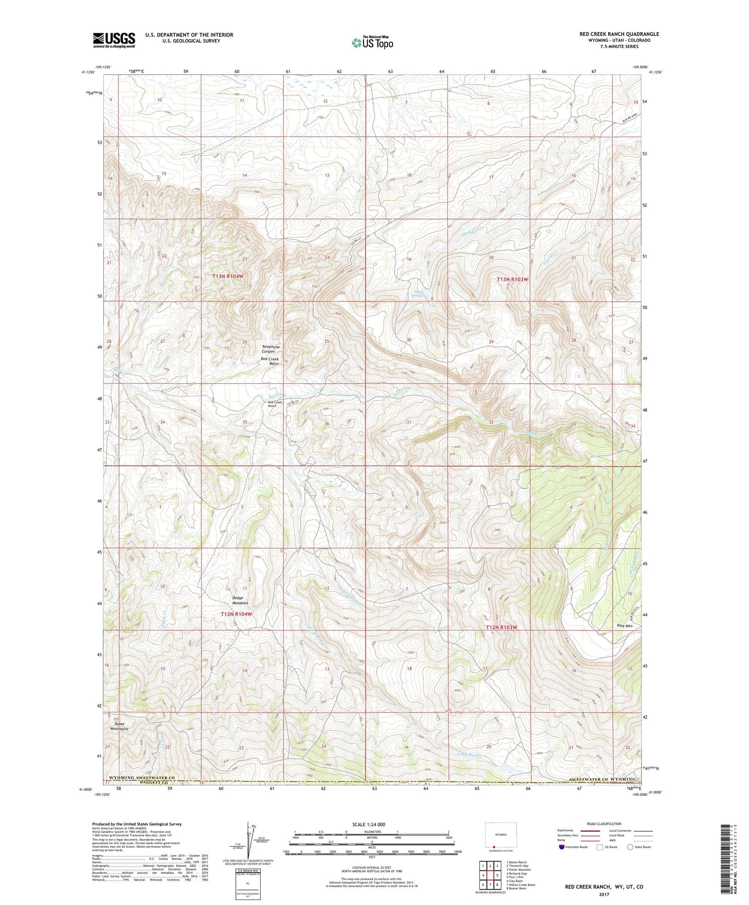
2021 topographic map quadrangle Red Creek Ranch in the state of Wyoming. Scale: 1:24000. Based on the newly updated USGS 7.5' US Topo map series, this map is in the following counties: Sweetwater, Daggett, Moffat. The map contains contour data, water features, and other items you are used to seeing on USGS maps, but also has updated roads and other features. This is the next generation of topographic maps. Printed on high-quality waterproof paper with UV fade-resistant inks.
Quads adjacent to this one:
West: Richards Gap
Northwest: Maxon Ranch
North: Titsworth Gap
Northeast: Potter Mountain
East: Four J Rim
Southeast: Beaver Basin
South: Willow Creek Butte
Southwest: Clay Basin
Contains the following named places: Alkali Springs, Basin Creek, Corral Creek, Dodge Meadows, John Erickson Dam, John Erickson Reservoir, June Creek, Little Red Creek, Lizzie Spring Creek, Meadow Gulch Ranch, Petes Place, Red Creek Ranch, Red Creek Ranch Airport, Star Numbers Five and Six Mine, Telephone Canyon, Tepee Creek


