MyTopo
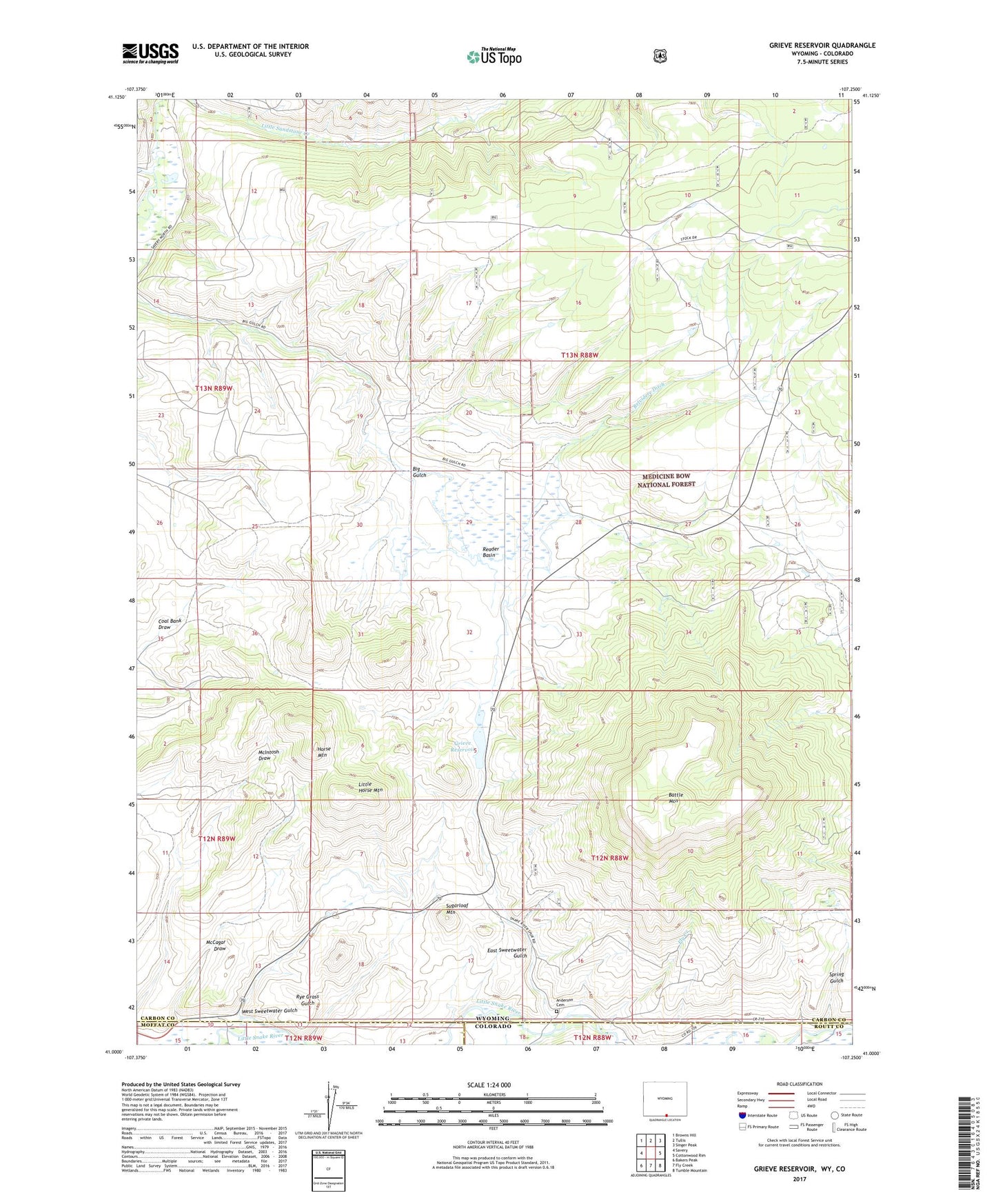
Grieve Reservoir Wyoming US Topo Map
Couldn't load pickup availability
Also explore the Grieve Reservoir Forest Service Topo of this same quad for updated USFS data
2021 topographic map quadrangle Grieve Reservoir in the states of Wyoming, Colorado. Scale: 1:24000. Based on the newly updated USGS 7.5' US Topo map series, this map is in the following counties: Carbon, Routt, Moffat. The map contains contour data, water features, and other items you are used to seeing on USGS maps, but also has updated roads and other features. This is the next generation of topographic maps. Printed on high-quality waterproof paper with UV fade-resistant inks.
Quads adjacent to this one:
West: Savery
Northwest: Browns Hill
North: Tullis
Northeast: Singer Peak
East: Cottonwood Rim
Southeast: Tumble Mountain
South: Fly Creek
Southwest: Bakers Peak
This map covers the same area as the classic USGS quad with code o41107a3.
Contains the following named places: Anderson Cemetery, Battle Mountain, Boyer Ranch, Divide Headquarters Corral, East Sweetwater Gulch, Fly Creek, Grieve Reservoir, Highline Dam, Horse Mountain, Linde Opening Mine, Little Horse Mountain, Loco Creek, Lucksinger Opening Mine, McCagar Draw, Reader Basin, Rye Grass Gulch, Savery Corral, Spring Gulch, Sugarloaf Mountain, West Sweetwater Gulch, ZIP Code: 82332