MyTopo
South Baxter Wyoming US Topo Map
Couldn't load pickup availability
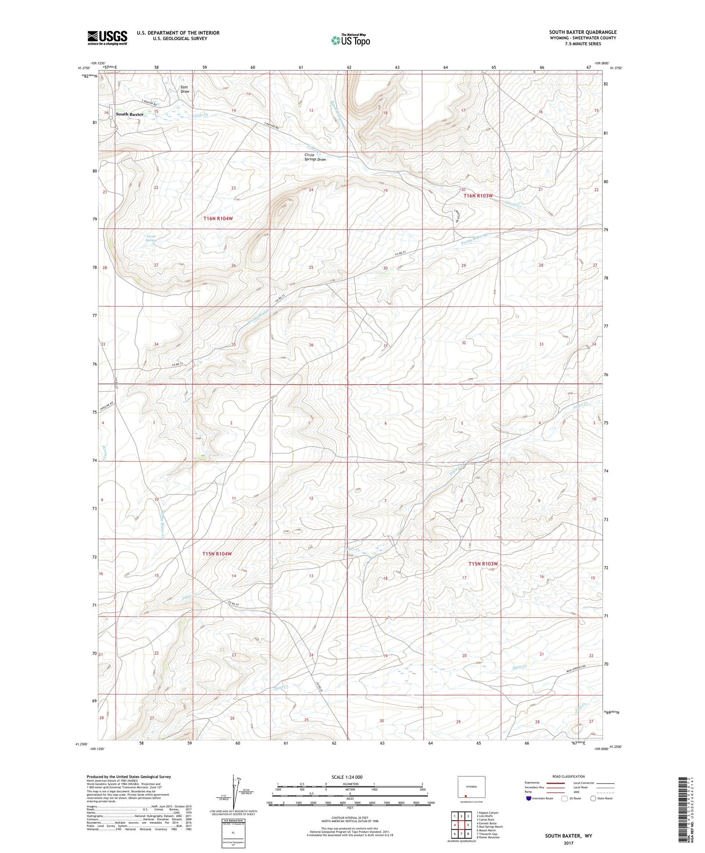
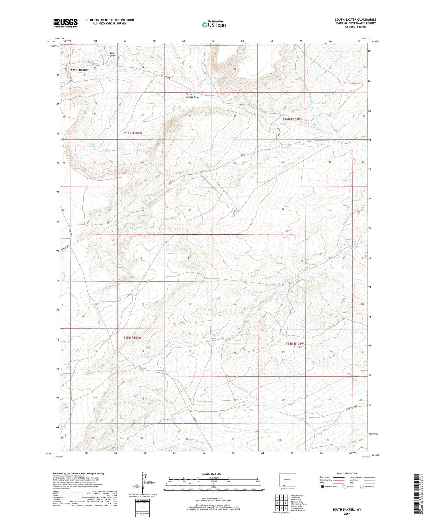
2021 topographic map quadrangle South Baxter in the state of Wyoming. Scale: 1:24000. Based on the newly updated USGS 7.5' US Topo map series, this map is in the following counties: Sweetwater. The map contains contour data, water features, and other items you are used to seeing on USGS maps, but also has updated roads and other features. This is the next generation of topographic maps. Printed on high-quality waterproof paper with UV fade-resistant inks.
Quads adjacent to this one:
West: Earnest Butte
Northwest: Kappes Canyon
North: Lion Bluffs
Northeast: Camel Rock
East: Mud Springs Ranch
Southeast: Potter Mountain
South: Titsworth Gap
Southwest: Maxon Ranch
Contains the following named places: Burnt Canyon Creek, Circle Creek, Circle Springs, Circle Springs Draw, East Draw, South Baxter