MyTopo
Warren Bridge Wyoming US Topo Map
Couldn't load pickup availability
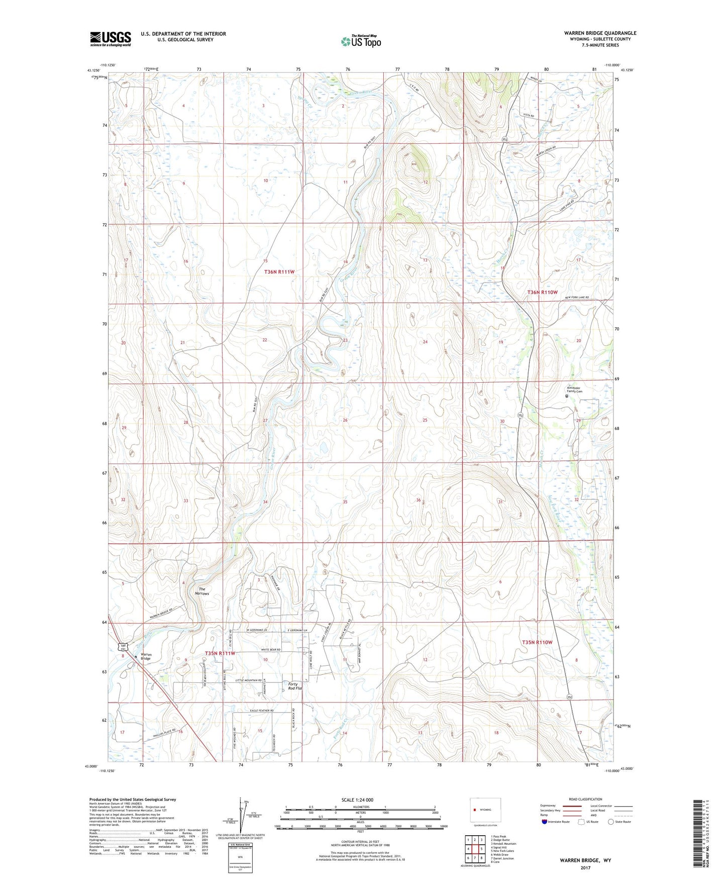
2021 topographic map quadrangle Warren Bridge in the state of Wyoming. Scale: 1:24000. Based on the newly updated USGS 7.5' US Topo map series, this map is in the following counties: Sublette. The map contains contour data, water features, and other items you are used to seeing on USGS maps, but also has updated roads and other features. This is the next generation of topographic maps. Printed on high-quality waterproof paper with UV fade-resistant inks.
Quads adjacent to this one:
West: Signal Hill
Northwest: Pass Peak
North: Dodge Butte
Northeast: Kendall Mountain
East: New Fork Lakes
Southeast: Cora
South: Daniel Junction
Southwest: Webb Draw
Contains the following named places: Alexander Family Cemetery, Bickel Ditch, Buds Pit Mine, Canyon Ditch, Daylite Pit Mine, Five Eighty-two Pit Number Two Mine, Five Thirty-two Pit Number One Mine, Forty Rod Flat Well, Franz Reservoir, Horsefly Ditch, L L Pit Mine, Marsh Creek, Marsh Creek Pit Mine, Pine Grove Ditch, Pinedale Division, Pocket Pit Mine, Que Pit Mine, Rexs Pit Mine, Spring Creek, The Narrows, Wardell Pit Mine, Warren Bridge