MyTopo
Wood Canyon Wyoming US Topo Map
Couldn't load pickup availability
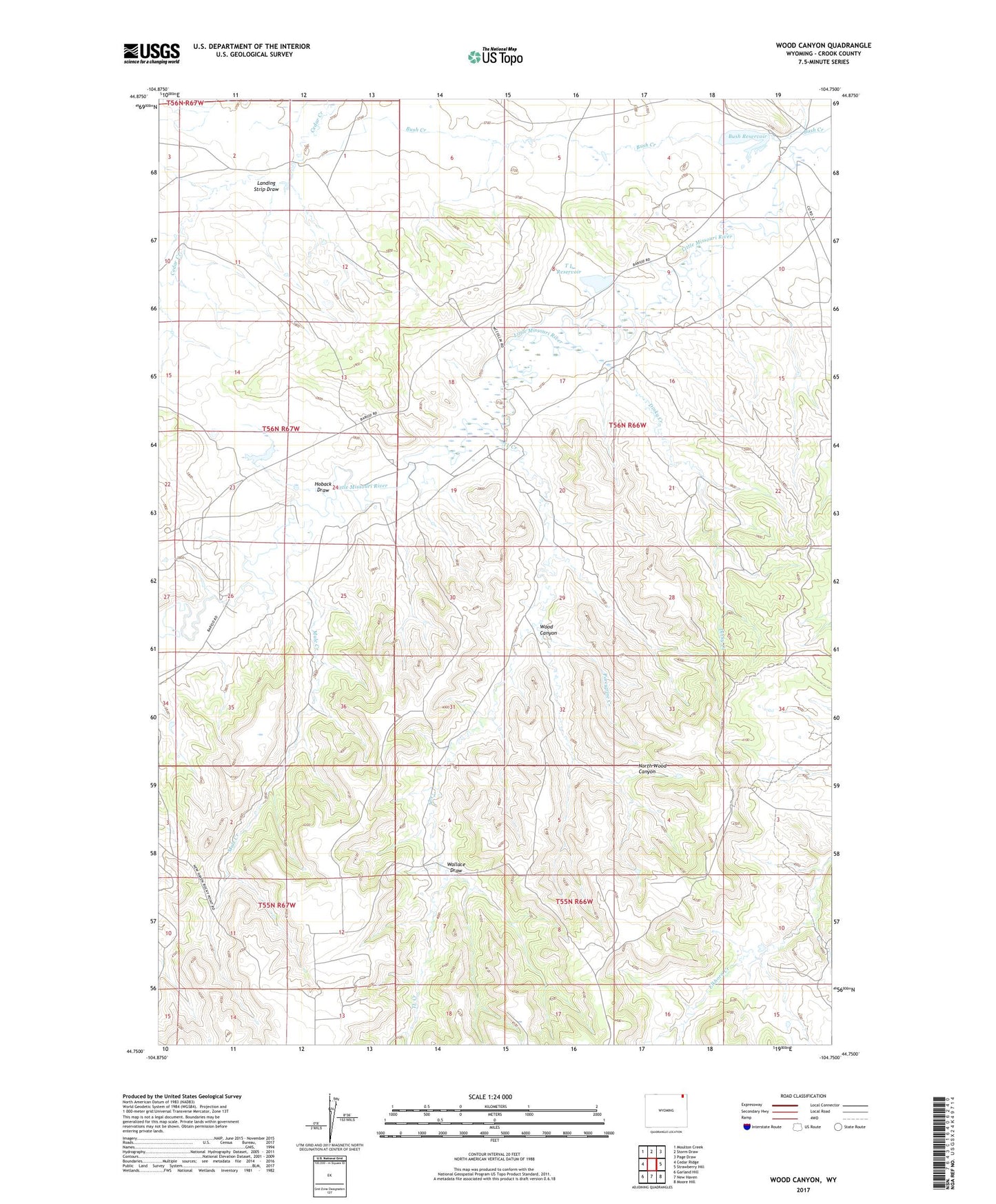
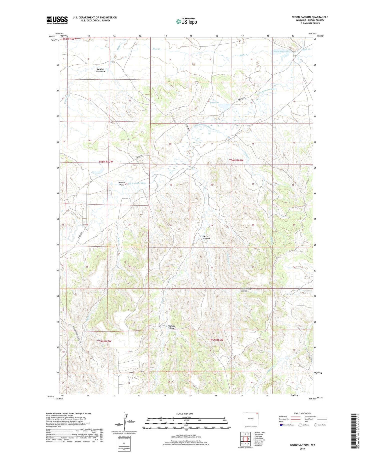
2021 topographic map quadrangle Wood Canyon in the state of Wyoming. Scale: 1:24000. Based on the newly updated USGS 7.5' US Topo map series, this map is in the following counties: Crook. The map contains contour data, water features, and other items you are used to seeing on USGS maps, but also has updated roads and other features. This is the next generation of topographic maps. Printed on high-quality waterproof paper with UV fade-resistant inks.
Quads adjacent to this one:
West: Cedar Ridge
Northwest: Moulton Creek
North: Storm Draw
Northeast: Page Draw
East: Strawberry Hill
Southeast: Moore Hill
South: New Haven
Southwest: Garland Hill
Contains the following named places: Ackerman Mine, Busfield Mine, Bush Dam, Bush Reservoir, Cedar Creek Dam, Cedar Creek Irrigation Dam, Cedar Creek Irrigation Reservoir, Cedar Creek Number Two Mine, Cedar Creek Reservoir, Croppie Number 2 Dam, Dennis Mine, Dinky Creek, Hauber Mine, Hoback Draw, Landing Strip Draw, Mule Creek, Music Creek, North Wood Canyon, Porcupine Creek, Storm Mine, T L Dam, T L Reservoir, TL Creek, Wallace Draw, Wood Canyon, Wood School