
MyTopo
Loango Alabama US Topo Map
Couldn't load pickup availability
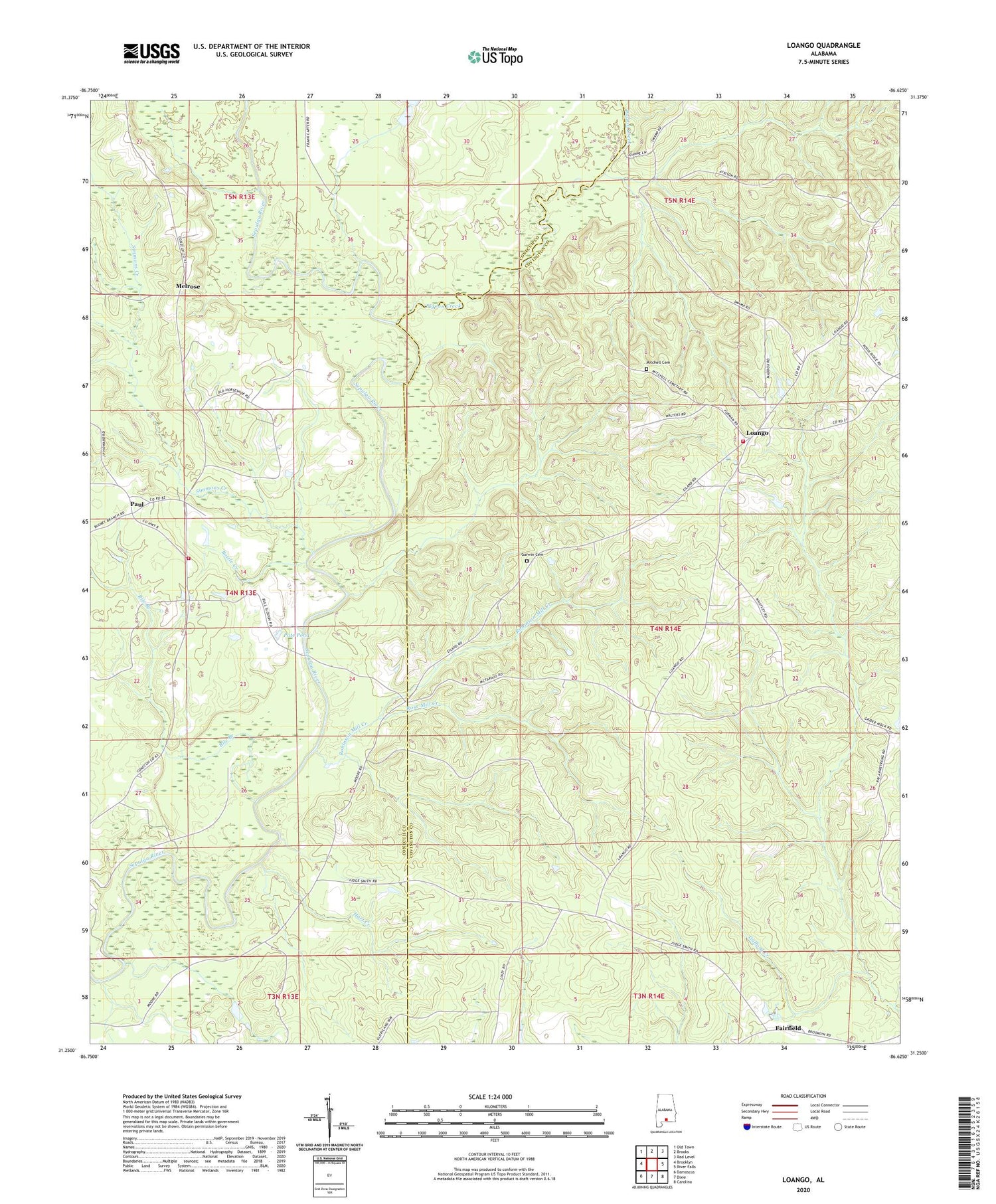
2024 topographic map quadrangle Loango in the state of Alabama. Scale: 1:24000. Based on the newly updated USGS 7.5' US Topo map series, this map is in the following counties: Covington, Conecuh. The map contains contour data, water features, and other items you are used to seeing on USGS maps, but also has updated roads and other features. This is the next generation of topographic maps. Printed on high-quality waterproof paper with UV fade-resistant inks.
Quads adjacent to this one:
West: Brooklyn
Northwest: Old Town
North: Brooks
Northeast: Red Level
East: River Falls
Southeast: Carolina
South: Dixie
Southwest: Damascus
This map covers the same area as the classic USGS quad with code o31086c6.
Contains the following named places: Bethesda Primitive Baptist Church, Chapman Quarters, Fairfield, Gafford Creek, Garwin Cemetery, Hart Creek, Loango, Loango Volunteer Fire Department, Melrose, Mitchell Cemetery, Mount Hored School, Mount Pilgrim Baptist Church, New Providence Church, Pate Pond, Paul, Paul Church, Paul Volunteer Fire Department, Pigeon Creek, Pleasant Grove Baptist Church, Providence Church, Rile Branch, Robinson Mill Creek, Rose Mill Creek, Simmons Creek, Watson School


