MyTopo
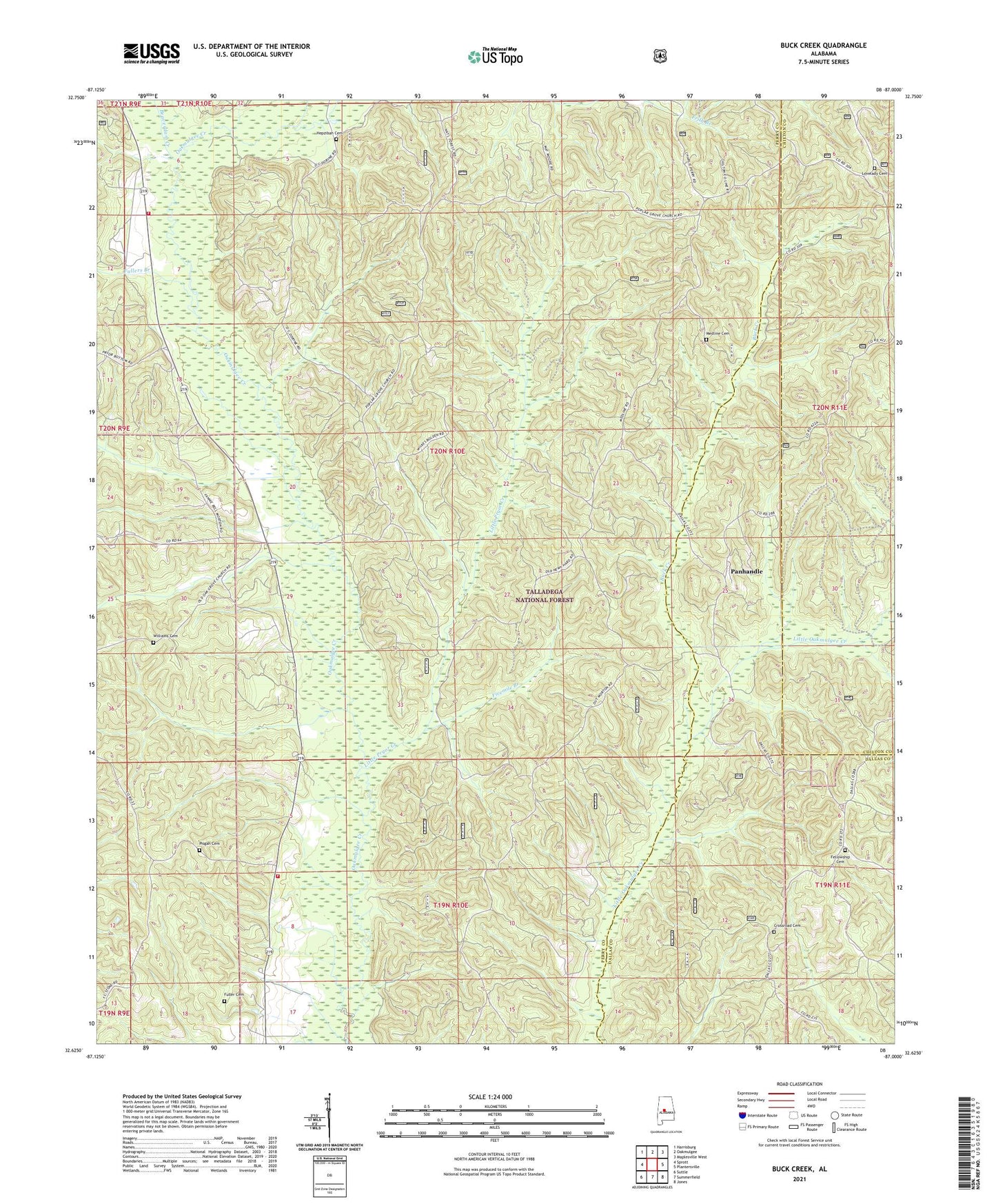
Buck Creek Alabama US Topo Map
Couldn't load pickup availability
Also explore the Buck Creek Forest Service Topo of this same quad for updated USFS data
2024 topographic map quadrangle Buck Creek in the state of Alabama. Scale: 1:24000. Based on the newly updated USGS 7.5' US Topo map series, this map is in the following counties: Perry, Dallas, Chilton. The map contains contour data, water features, and other items you are used to seeing on USGS maps, but also has updated roads and other features. This is the next generation of topographic maps. Printed on high-quality waterproof paper with UV fade-resistant inks.
Quads adjacent to this one:
West: Sprott
Northwest: Harrisburg
North: Oakmulgee
Northeast: Maplesville West
East: Plantersville
Southeast: Jones
South: Summerfield
Southwest: Suttle
This map covers the same area as the classic USGS quad with code o32087f1.
Contains the following named places: Beaverdam Creek, Bliss, Bliss School, Buck Creek, Chadwick, Crossroad Cemetery, Crossroad Church, Dallas Lookout Tower, Dupheys Landing, East Perry Volunteer Fire Department, Fellowship Baptist Church, Fellowship Cemetery, Fivemile Branch, Fuller Cemetery, Fullers Branch, Hepzibah Baptist Church, Hepzibah Cemetery, Lawson Lake Number 1, Lawson Lake Number 1 Dam, Little Pryor Creek, Lovelady Cemetery, Medline, Medline Baptist Church, Medline Cemetery, Moro, Mount Pilgrim Church, Oakmulgee Creek Volunteer Fire Department, Osborn Creek, Panhandle, Panhandle School, Pisgah, Pisgah Baptist Church, Pisgah Cemetery, Pisgah School, Poplar Grove Church, Welcome School, Williams Cemetery