MyTopo
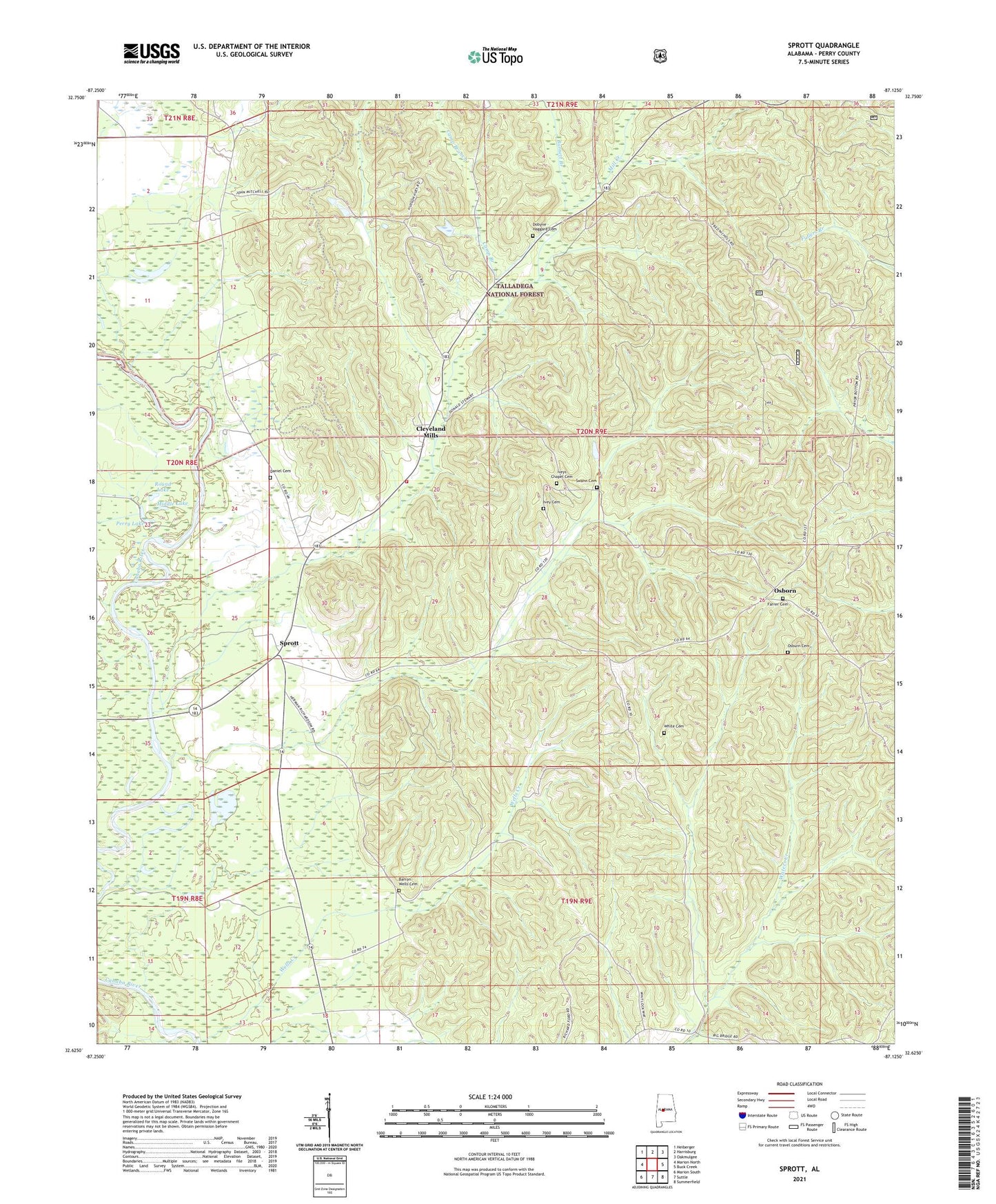
Sprott Alabama US Topo Map
Couldn't load pickup availability
Also explore the Sprott Forest Service Topo of this same quad for updated USFS data
2024 topographic map quadrangle Sprott in the state of Alabama. Scale: 1:24000. Based on the newly updated USGS 7.5' US Topo map series, this map is in the following counties: Perry. The map contains contour data, water features, and other items you are used to seeing on USGS maps, but also has updated roads and other features. This is the next generation of topographic maps. Printed on high-quality waterproof paper with UV fade-resistant inks.
Quads adjacent to this one:
West: Marion North
Northwest: Heiberger
North: Harrisburg
Northeast: Oakmulgee
East: Buck Creek
Southeast: Summerfield
South: Suttle
Southwest: Marion South
This map covers the same area as the classic USGS quad with code o32087f2.
Contains the following named places: Athahatchee, Barnett Branch, Barron - Wells Cemetery, Camp Branch, Cleveland Mills, Cleveland Mills Church, Concord Baptist Church, Daniel Cemetery, Dobyne - Haggard Cemetery, Ephesus Baptist Church, Farrer Cemetery, Ivey Cemetery, Iveys Chapel, Iveys Chapel Cemetery, Little Creek, Middle Lake, Mill Creek, Mount Pisgah Church, Mount Pleasant Freewill Baptist Church, New Hope Methodist Church, Oak Grove Church, Oak Grove School, Osborn, Osburn Cemetery, Perry Lake, Provewell Church, Provewell School, Round Lake, Sprott, Sprott Division, Sprott Volunteer Fire Department, Stone Branch, Swann Cemetery, Theo, Warren Academy, White Branch, White Cemetery