MyTopo
Harrisburg Alabama US Topo Map
Couldn't load pickup availability
Also explore the Harrisburg Forest Service Topo of this same quad for updated USFS data
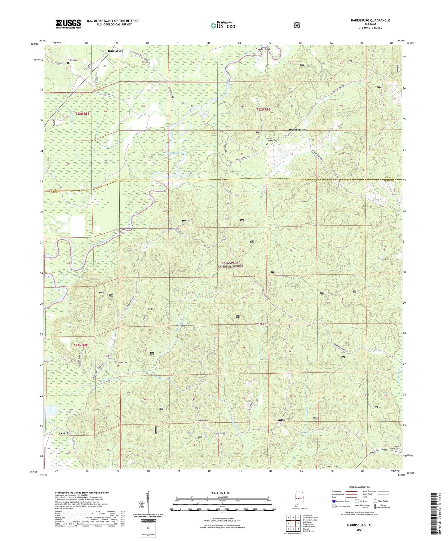
2024 topographic map quadrangle Harrisburg in the state of Alabama. Scale: 1:24000. Based on the newly updated USGS 7.5' US Topo map series, this map is in the following counties: Perry, Bibb. The map contains contour data, water features, and other items you are used to seeing on USGS maps, but also has updated roads and other features. This is the next generation of topographic maps. Printed on high-quality waterproof paper with UV fade-resistant inks.
Quads adjacent to this one:
West: Heiberger
Northwest: Pondville
North: Centreville West
Northeast: Centreville East
East: Oakmulgee
Southeast: Buck Creek
South: Sprott
Southwest: Marion North
This map covers the same area as the classic USGS quad with code o32087g2.
Contains the following named places: Abercrombie, Adler, Affonee Creek, Antioch African Methodist Episcopal Church, Barnett School, Blue Girth Creek, Bonnet Creek, Cahaba Lookout Tower, Cahaba Picnic Area, Ebenezer, Levert, Levert School, Lilly Hill Church, Mount Gilead Baptist Church, Mount Gilead Cemetery, Mount Gilead Church, Mount Gilead School, Mount Olive Baptist Church, Payne Chapel Methodist Church, Paynes Cemetery, Perkins Cemetery, Pleasant Grove Church, Stewart Cemetery, Taylor Creek