MyTopo
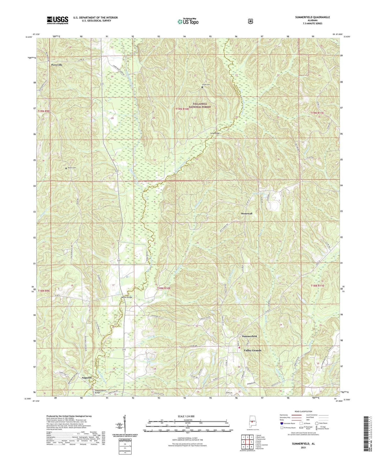
Summerfield Alabama US Topo Map
Couldn't load pickup availability
Also explore the Summerfield Forest Service Topo of this same quad for updated USFS data
2024 topographic map quadrangle Summerfield in the state of Alabama. Scale: 1:24000. Based on the newly updated USGS 7.5' US Topo map series, this map is in the following counties: Dallas, Perry. The map contains contour data, water features, and other items you are used to seeing on USGS maps, but also has updated roads and other features. This is the next generation of topographic maps. Printed on high-quality waterproof paper with UV fade-resistant inks.
Quads adjacent to this one:
West: Suttle
Northwest: Sprott
North: Buck Creek
Northeast: Plantersville
East: Jones
Southeast: Burnsville
South: Selma
Southwest: Marion Junction
This map covers the same area as the classic USGS quad with code o32087e1.
Contains the following named places: Augustin, Bogg Branch, Chestnut Hill, College Hill Church, D C Beville Lake, Evergreen School, Holliman Lake, Holliman Lake Dam, Independence Bridge, J M Gentry Dam, Little Oakmulgee Creek, Long Bridge, Macedonia Church, Martin Cemetery, Mary Etta Church, Melton Bridge, Melton School, Mitchell Creek, New Macedonia Church, Oak Grove, Oak Grove Church, Oak Grove School, Ocmulgee Baptist Church, Pardue Lake, Pardue Lake Dam, Perryville, Perryville Baptist Church, Perryville School, Section Valley School, Shiloh Baptist Church, Shiloh Cemetery, Stonewall, Summerfield, Summerfield Church, Summerfield Volunteer Fire Department, Tadlocks Store, Tate Branch