MyTopo
Suttle Alabama US Topo Map
Couldn't load pickup availability
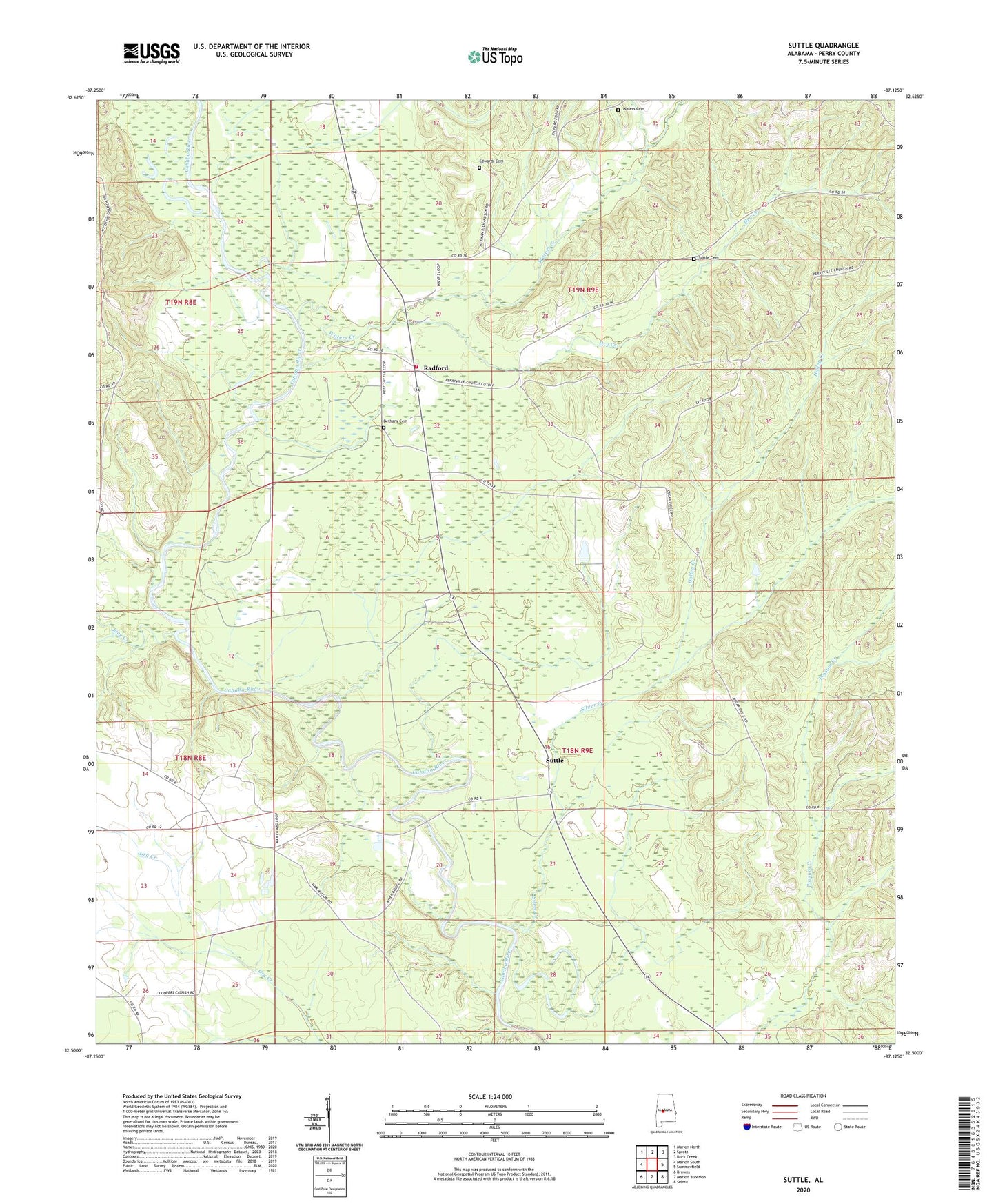
2024 topographic map quadrangle Suttle in the state of Alabama. Scale: 1:24000. Based on the newly updated USGS 7.5' US Topo map series, this map is in the following counties: Perry. The map contains contour data, water features, and other items you are used to seeing on USGS maps, but also has updated roads and other features. This is the next generation of topographic maps. Printed on high-quality waterproof paper with UV fade-resistant inks.
Quads adjacent to this one:
West: Marion South
Northwest: Marion North
North: Sprott
Northeast: Buck Creek
East: Summerfield
Southeast: Selma
South: Marion Junction
Southwest: Browns
This map covers the same area as the classic USGS quad with code o32087e2.
Contains the following named places: Bethany Cemetery, Bethany Church, Bethany School, Bingham Creek, Center School, Dry Creek, East Perry High School, Edwards Cemetery, Holley Creek, Lakeland Farms Dam Number Nineteen, Lakeland Farms Pond Number Nineteen, Lillie Grove Church, Lilly Grove School, Mount Olive Church, New Hope Church, Pine Flat Church, Radford, Rice Creek, Sand Creek, Santa Felix Church, Silver Creek, Suttle, Suttle Cemetery, Suttle Post Office, Suttle School, Suttle Volunteer Fire Department, Vaughans Lake, Waters Cemetery, Waters Creek, Waters Store, Wells Creek