MyTopo
Land Alabama US Topo Map
Couldn't load pickup availability
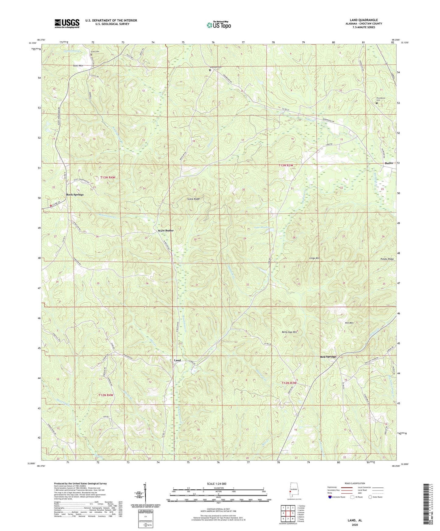
2024 topographic map quadrangle Land in the state of Alabama. Scale: 1:24000. Based on the newly updated USGS 7.5' US Topo map series, this map is in the following counties: Choctaw. The map contains contour data, water features, and other items you are used to seeing on USGS maps, but also has updated roads and other features. This is the next generation of topographic maps. Printed on high-quality waterproof paper with UV fade-resistant inks.
Quads adjacent to this one:
West: Hinton
Northwest: Yantley
North: Lisman
Northeast: Jachin
East: Butler
Southeast: Ararat
South: Toxey
Southwest: Melvin
This map covers the same area as the classic USGS quad with code o32088a3.
Contains the following named places: Armstrong School, Betty Gap Mountain, Butler Mountain Lookout Tower, Choctaw County, Church Branch, Community Church, Ebenezer Cemetery, Faith Chapel, Hill Mountain, Hunnicut Creek, Lake Meadow, Land, Land Church, Lingo Mountain, Owens Mill, Pine Grove School, Potato Ridge, Providence Cemetery, Red Spring School, Red Springs, Red Springs Assembly of God Church, Red Springs Baptist Church, Rock Springs, Rock Springs Baptist Church, Rock Springs Branch, Rock Springs Church, Salem Church, Scott Cemetery, Scott Mountain Volunteer Fire Department, Shady Grove Church, Short Forks, Sickle Ridge, Sikes Creek, Ulmer Creek, Wahalak Baptist Church, West Butler, ZIP Code: 36904