MyTopo
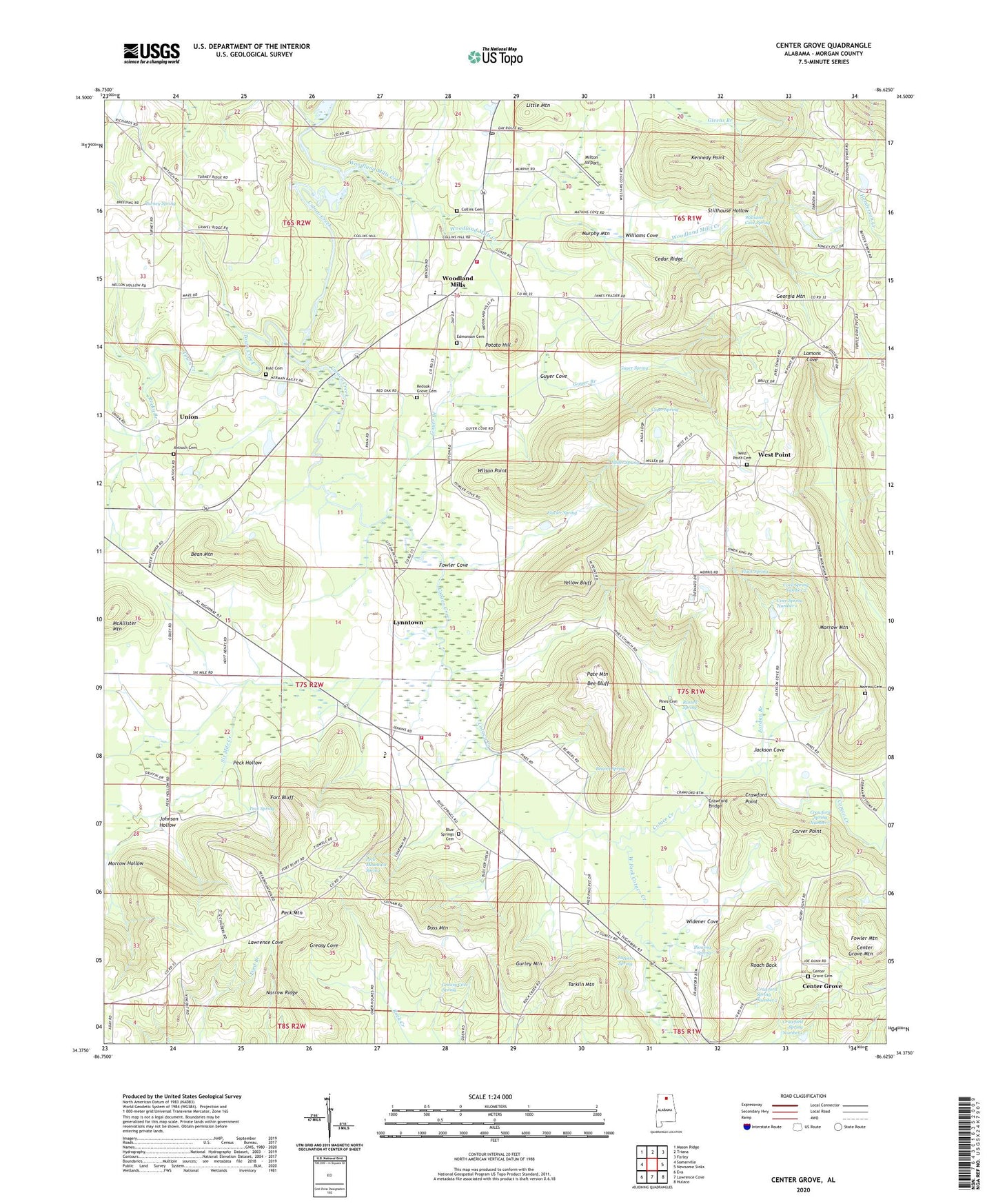
Center Grove Alabama US Topo Map
Couldn't load pickup availability
2024 topographic map quadrangle Center Grove in the state of Alabama. Scale: 1:24000. Based on the newly updated USGS 7.5' US Topo map series, this map is in the following counties: Morgan. The map contains contour data, water features, and other items you are used to seeing on USGS maps, but also has updated roads and other features. This is the next generation of topographic maps. Printed on high-quality waterproof paper with UV fade-resistant inks.
Quads adjacent to this one:
West: Somerville
Northwest: Mason Ridge
North: Triana
Northeast: Farley
East: Newsome Sinks
Southeast: Hulaco
South: Lawrence Cove
Southwest: Eva
This map covers the same area as the classic USGS quad with code o34086d6.
Contains the following named places: Albert P Brewer Area Vocational and High School, Antioch Cemetery West, Antioch United Methodist Church, Bean Mountain, Beaver Spring, Bee Bluff, Blowing Spring, Blue Springs Baptist Church, Blue Springs Cemetery, Brindley Mountain, Carver Point, Cedar Ridge, Center Grove, Center Grove Cemetery North, Center Grove Mountain, Collins Cemetery, Cotaco Fire Department, Cotaco High School, Cotaco United Methodist Church, Cove Spring Number 1, Cove Spring Number 2, Crawford Bridge, Crawford Point, Crawford Spring Number 1, Crawford Spring Number 2, Crawford Spring Number 3, Cryer Spring, Doss Mountain, Edmonson Cemetery, Flack Spring, Florette, Florette Church, Florette Volunteer Fire Department, Fort Bluff, Fort Bluff Post Office, Fowler Cove, Fowler Mountain, Fowler Spring, Georgia Mountain, Gravel Ridge School, Greasy Cove Spring, Gurley Mountain, Guyer Branch, Guyer Cove, Guyer Spring, Jackson Cove, Jaquess Spring, Johnson Hollow, Jordan Branch, Kennedy Point, Kyle Cemetery, Laceys Spring Division, Little Mountain, Lynntown, McAllister Mountain, Miller Spring, Milton Airport, Morrow Hollow, Morrow Mountain, Murphy Mountain, Narrow Ridge, New Salem Baptist Church, Pate Mountain, Peach Grove, Peck Hollow, Peck Mountain, Peck Mountain Spring, Peck Spring, Pines Church, Pines School, Potato Hill, Red Oak Grove, Red Oak Grove Cemetery, Red Oak Grove Methodist Church, Roach Back, Rocky Branch, Russell Cemetery, Russell Spring, Six Mile Creek, Stillhouse Hollow, Tarkiln Mountain, Town Creek, Turney Spring, Union, Union Church of Christ, Valhermoso Springs Post Office, Watson and Morrow Cemetery, West Fork Cotaco Creek, West Point, West Point Cemetery, West Point Church, West Point School, Widener Cove, Williams Cove, Williams Cove Spring, Wilson Point, Woodland Mills, Woodland Mills Creek, Woodland Mills School, Yellow Bluff, ZIP Code: 35670