MyTopo
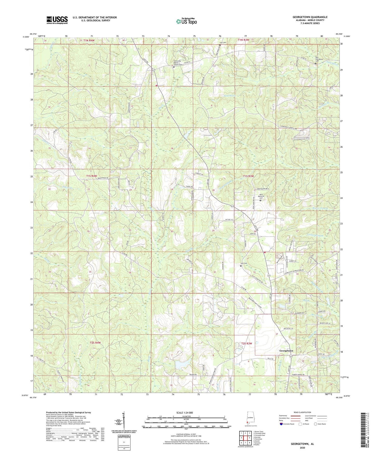
Georgetown Alabama US Topo Map
Couldn't load pickup availability
2024 topographic map quadrangle Georgetown in the state of Alabama. Scale: 1:24000. Based on the newly updated USGS 7.5' US Topo map series, this map is in the following counties: Mobile. The map contains contour data, water features, and other items you are used to seeing on USGS maps, but also has updated roads and other features. This is the next generation of topographic maps. Printed on high-quality waterproof paper with UV fade-resistant inks.
Quads adjacent to this one:
West: Earlville
Northwest: Brown Town
North: Citronelle West
Northeast: Citronelle East
East: Chunchula
Southeast: Kushla
South: Semmes
Southwest: Howell
This map covers the same area as the classic USGS quad with code o30088h3.
Contains the following named places: Bad Branch, Bee Tree Branch, Boothetown, Byrd Memorial Cemetery, Fellowship Baptist Church Cemetery, Fellowship Church, Garrison Lookout Tower, Georgetown, Georgetown Baptist Church, Georgetown Church, Georgetown Fellowship Volunteer Fire Department Station 1, Georgetown Fellowship Volunteer Fire Department Station 2, Lott Cemetery, Mill Branch, Old Providence Cemetery, Pond Branch, R L Lambert Dam