MyTopo
Citronelle West Alabama US Topo Map
Couldn't load pickup availability
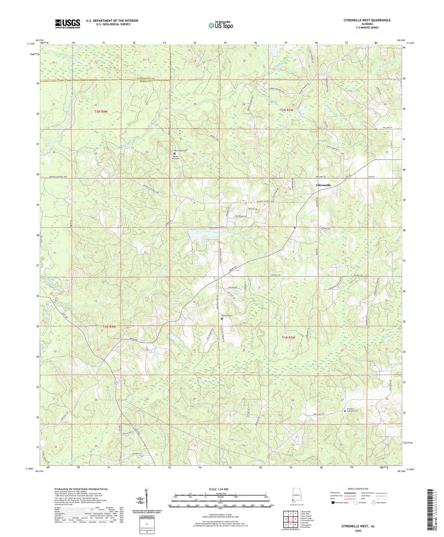
2024 topographic map quadrangle Citronelle West in the state of Alabama. Scale: 1:24000. Based on the newly updated USGS 7.5' US Topo map series, this map is in the following counties: Mobile, Washington. The map contains contour data, water features, and other items you are used to seeing on USGS maps, but also has updated roads and other features. This is the next generation of topographic maps. Printed on high-quality waterproof paper with UV fade-resistant inks.
Quads adjacent to this one:
West: Brown Town
Northwest: Rounsaville
North: Deer Park
Northeast: Sims Chapel
East: Citronelle East
Southeast: Chunchula
South: Georgetown
Southwest: Earlville
This map covers the same area as the classic USGS quad with code o31088a3.
Contains the following named places: Baxter Will Cemetery, Beaver Pond Branch, Bennett Creek, Bethel Church, Brannan Cemetery, Citronelle Division, Citronelle Lake, Citronelle Municipal Park Lake Dam, Citronelle Volunteer Fire Department, Lotts Mill Creek, Mill Branch, Mill Creek Golf Course, New Home Church, New Hope Cemetery, New Hope Church, Nobodies Creek, Oil City Speedway, Okwakee Creek, Rascoe Farm Pond, Rascoe Farm Pond Dam, Sandy Ford Branch, Silver Hill Church, Walker School, Whatley Church, Whatley Holiness Cemetery, ZIP Code: 36522