
MyTopo
Ewell Alabama US Topo Map
Couldn't load pickup availability
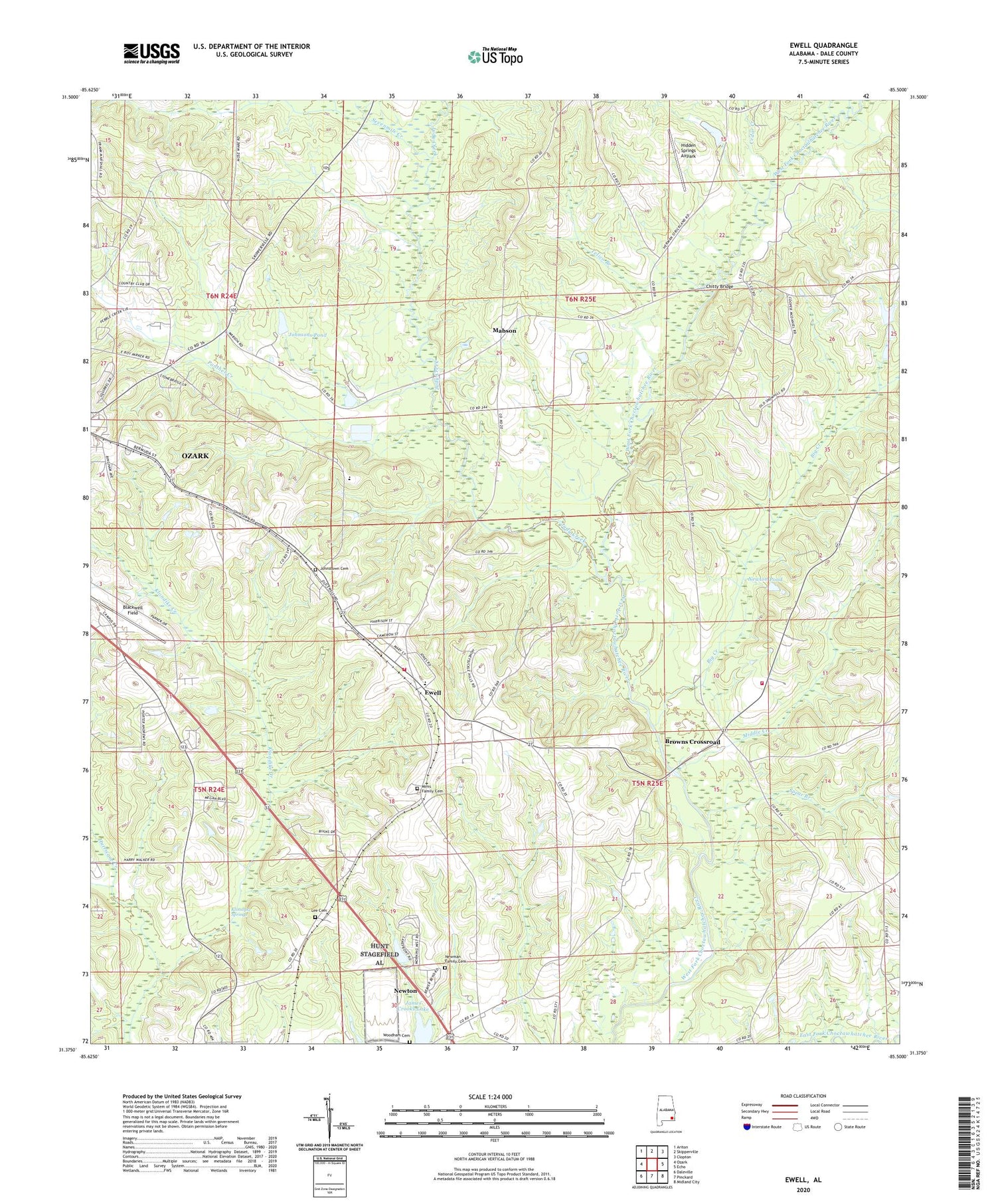
2024 topographic map quadrangle Ewell in the state of Alabama. Scale: 1:24000. Based on the newly updated USGS 7.5' US Topo map series, this map is in the following counties: Dale. The map contains contour data, water features, and other items you are used to seeing on USGS maps, but also has updated roads and other features. This is the next generation of topographic maps. Printed on high-quality waterproof paper with UV fade-resistant inks.
Quads adjacent to this one:
West: Ozark
Northwest: Ariton
North: Skipperville
Northeast: Clopton
East: Echo
Southeast: Midland City
South: Pinckard
Southwest: Daleville
This map covers the same area as the classic USGS quad with code o31085d5.
Contains the following named places: Bethel Church, Bethel United Methodist Church, Big Creek, Blackwell Field, Brown School, Browns Church, Browns Crossroad, Carver Johnson Lake Dam, Cedar Creek, Chalkhead Baptist Church, Chitty Bridge, Choctawhatchee Volunteer Fire Department, Corinth Free Will Baptist Church, Dale County, Dale County Christian School, Ewell, Ewell Assembly of God Church, Ewell Bible Baptist Church, Ewell Fire Department, Ewell Methodist Church, Freedom Church, Friendship Church, Heart of Dixie Hunting Club, Hidden Springs Airpark, Holy Church, Hunt AHP Airport, James Crooks Lake, James Crooks Lake Dam, Johnsons Pond, Johnstown Cemetery, Judy Creek, Klondike Creek, Klondike School, Klondyke Baptist Church, Klondyke Springs, Lee Cemetery, Mabson, Mabson United Methodist Church, Middle Creek, Mims Family Cemetery, Newman Family Cemetery, Newton Pond, Ozark Country Club, Panther Creek, Pleasant Grove Primitive Baptist Church, Rocky Mount Baptist Church, Rocky Mount School, Sevenmile Creek, Southside Baptist Church, Spear Branch, Spring Hill Church, Telico Branch, Union Grove Church, Union Hill Church, Vivian B Adams School, Woodham Cemetery, Zion Church, ZIP Code: 36360


