MyTopo
Deatsville Alabama US Topo Map
Couldn't load pickup availability
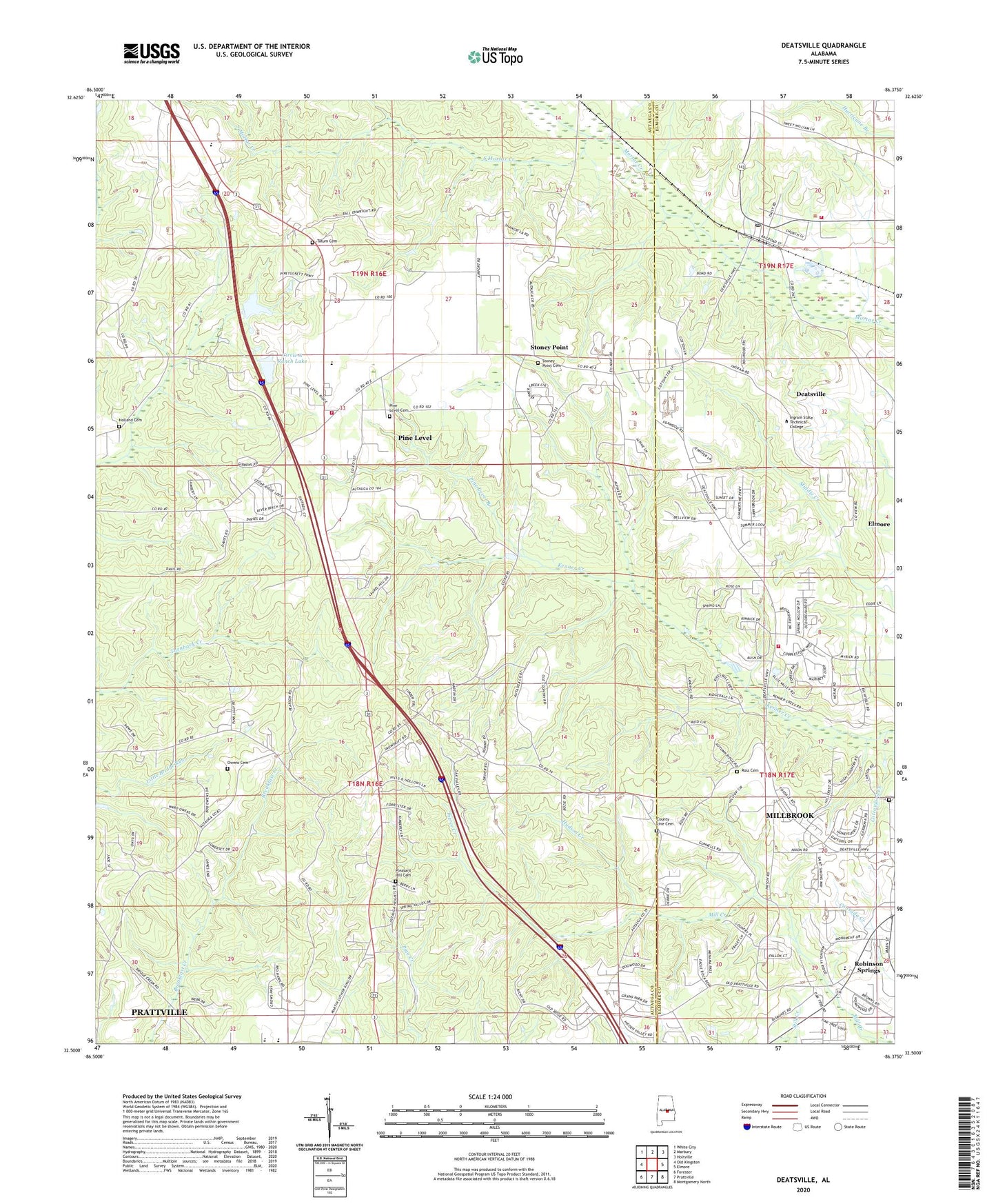
2024 topographic map quadrangle Deatsville in the state of Alabama. Scale: 1:24000. Based on the newly updated USGS 7.5' US Topo map series, this map is in the following counties: Autauga, Elmore. The map contains contour data, water features, and other items you are used to seeing on USGS maps, but also has updated roads and other features. This is the next generation of topographic maps. Printed on high-quality waterproof paper with UV fade-resistant inks.
Quads adjacent to this one:
West: Old Kingston
Northwest: White City
North: Marbury
Northeast: Holtville
East: Elmore
Southeast: Montgomery North
South: Prattville
Southwest: Forester
This map covers the same area as the classic USGS quad with code o32086e4.
Contains the following named places: Alpha Springs, Andrew, Boones Chapel Baptist Church, Camp Montauga, Circle A Ranch Dam, Circle A Ranch Lake, County Line Cemetery, County Line Church, Deatsville, Deatsville Church, Deatsville Elementary School, Deatsville Fire Department, Deatsville Post Office, Faith Church, Franklee Correctional Youth Center, Grandview Pines, Holland Cemetery, Hudson Creek, Ingram State Technical Institute, Kenner Creek, Knollwood, Liberty Baptist Church, Lily Green Church, Maranatha Church, McKeithen Cemetery, Millbrook Fire Department Station 2, New Nazareth Church, Owens Cemetery, Pierce Creek, Pine Haven School, Pine Level, Pine Level Branch, Pine Level Cemetery, Pine Level Census Designated Place, Pine Level Methodist Church, Pine Level Volunteer Fire Department, Pink Lily Baptist Church, Pleasant Hill African Methodist Episcopal Church, Pleasant Hill Cemetery, Prattville Country Club, Prattville High School, Robinson Springs, Robinson Springs United Methodist Church, Ross Cemetery, Shady Acres, South Mortar Creek, Stoney Point, Stoney Point Cemetery, Tatum Cemetery, Town of Deatsville, Tuskpoka, White School, ZIP Code: 36022