
MyTopo
Elmore Alabama US Topo Map
Couldn't load pickup availability
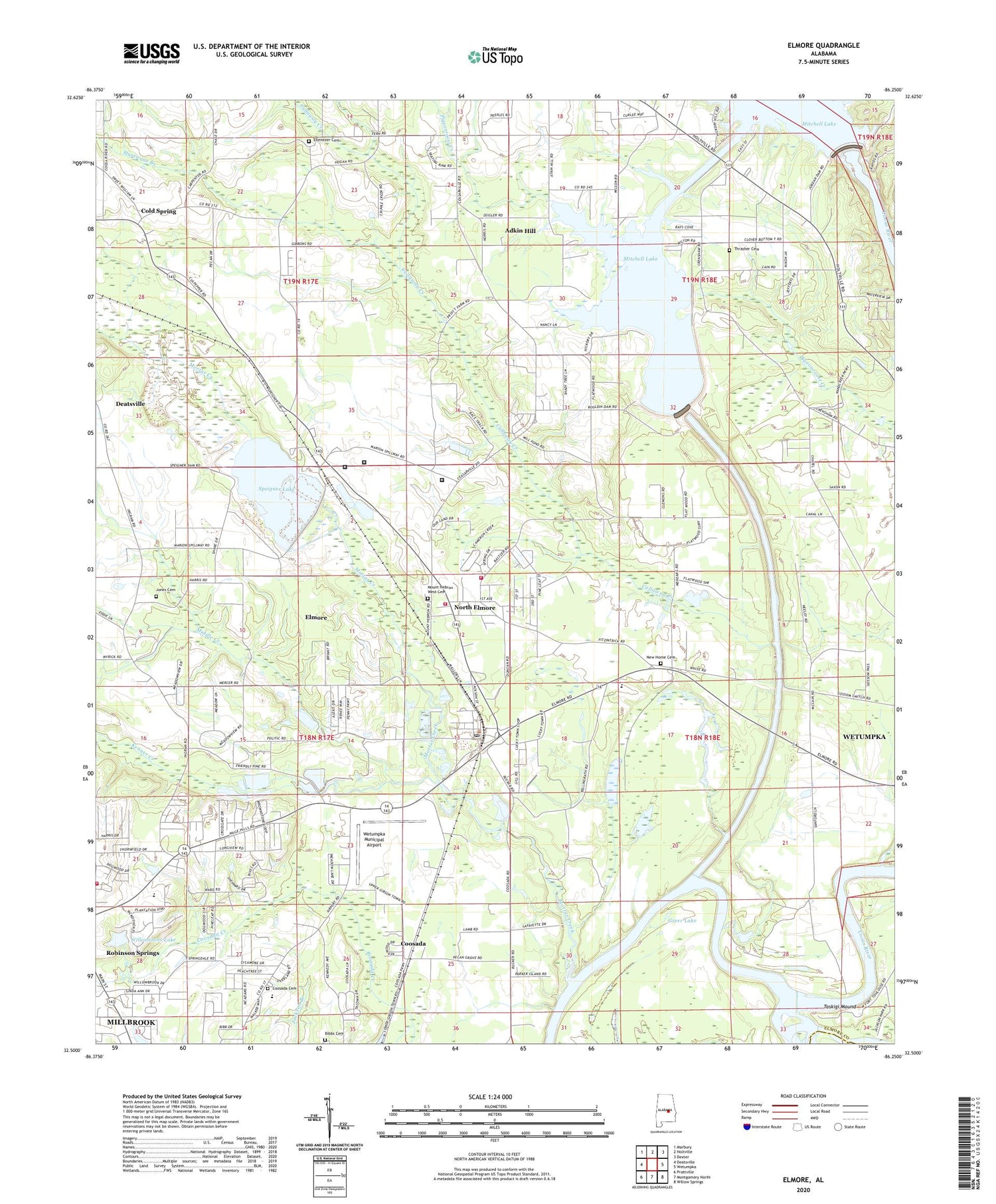
2024 topographic map quadrangle Elmore in the state of Alabama. Scale: 1:24000. Based on the newly updated USGS 7.5' US Topo map series, this map is in the following counties: Elmore, Montgomery. The map contains contour data, water features, and other items you are used to seeing on USGS maps, but also has updated roads and other features. This is the next generation of topographic maps. Printed on high-quality waterproof paper with UV fade-resistant inks.
Quads adjacent to this one:
West: Deatsville
Northwest: Marbury
North: Holtville
Northeast: Dexter
East: Wetumpka
Southeast: Willow Springs
South: Montgomery North
Southwest: Prattville
This map covers the same area as the classic USGS quad with code o32086e3.
Contains the following named places: Adkin Hill, Adkin Hill Church, Alabama River Canal, Atoka Station, B D Greer Dam, Bibbs Cemetery, Broadmoor, Callaway Creek, City of Millbrook, Cold Spring, Cold Springs Church, Coosada Cemetery, Coosada Elementary School, Cottonford Creek, Crenshaw School, Dead River, Draper Correctional Facility, Ebenezer Cemetery, Ebenezer Church, Edgewood Academy, Elmore, Elmore Bible Chapel, Elmore Church, Elmore Church of Christ, Elmore Correctional Facility, Elmore Division, Elmore Elmentary School, Elmore Fire and Rescue, Elmore Post Office, Elmore Volunteer Fire Department Station 2, Fitzpatrick School, Fort Jackson, Fort Toulouse, Fort Toulouse National Historic Park, Fort Toulouse State Park, Greer Lake, Harris Chapel, Holtville Church, Holy Assembly Church of Jesus Christ, Hurricane Branch, Jones Cemetery, Jones Chapel, Jordan Dam, Jordan Lake, Jordan Lake Diversion, Liberty Hill Church, Log Landing, Middle Creek, Millbrook Fire Department Station 3, Mitts Chapel, Mortar Creek, Mount Hebron West Baptist Church, Mount Hebron West Cemetery, Mount Zion, Mount Zion Chapel, New Home Cemetery, New Home Missionary Baptist Church, North Elmore, Odshiapofa, Okchayudshi, Overton Heights, Pakana, Parker Ferry, Parker Island, Pine Grove Church, Robinson Primary School, Speigner, Speigner Dam, Speigner Lake, Springdale, Springfield, Staton Correctional Facility, Sunny Hill School, Sweetening Junior High School, Tallapoosa River, Taskigi Mound, Thrasher Cemetery, Tomonpa, Town of Elmore, Tuskugu, Union Rosenwald School, W A Williamson Dam, Walter Bouldin Dam, Wetumpka Institute, Wetumpka Municipal Airport, Williamsons Lake, ZIP Code: 36025


