MyTopo
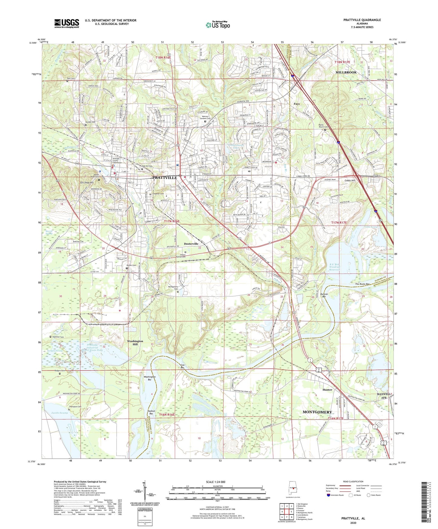
Prattville Alabama US Topo Map
Couldn't load pickup availability
2024 topographic map quadrangle Prattville in the state of Alabama. Scale: 1:24000. Based on the newly updated USGS 7.5' US Topo map series, this map is in the following counties: Autauga, Montgomery, Elmore. The map contains contour data, water features, and other items you are used to seeing on USGS maps, but also has updated roads and other features. This is the next generation of topographic maps. Printed on high-quality waterproof paper with UV fade-resistant inks.
Quads adjacent to this one:
West: Forester
Northwest: Old Kingston
North: Deatsville
Northeast: Elmore
East: Montgomery North
Southeast: Montgomery South
South: Cantelous
Southwest: Lowndesboro
This map covers the same area as the classic USGS quad with code o32086d4.
Contains the following named places: Auburn University Prattville Experimental Field, Autauga, Autauga County Courthouse, Autauga County High School, Autauga County Rescue Squad, Autauga County Sheriff's Office, Autauga Creek, Autauga Heights Baptist Church, Autauga Vocational School, Bell Park, Bethlehem Christian Methodist Episcopal Church, Bills Marina, Burt Cemetery, C W Trenholm School, Calvary Baptist Church, Camellia Baptist Church, Camp Grandview, Chapman Cemetery, City of Prattville, Cobbs Ford, Cobbs Hill, Cobbs School, Cobbs Swamp, Cooter Pond, Cooters Pond Park, Country Club Estates, Cox Bar, Crestview Baptist Church, Crestview Shopping Center, Daniel Pratt Cemetery, Daniel Pratt Historic District, Doster Family Cemetery, Dosterville, Duncan Bar, Dunn Branch, Durden Cemetery, Durdin Cemetery, Fay Branch, Fays, First Assembly of God Church, First Baptist Church, First Christian Church, First Presbyterian Church, First United Methodist Church, Fountain City Baptist Church, Gin Shop Hill, Grace Baptist School, Grace Baptist Temple, Grahamhaven Lake, Grandview Branch, Hadnot Bar, Hamilton Cemetery, Heritage Park, Hunter, Hunter Station Baptist Church, Hunter Station Church of Christ, Hunting Ridge, Hunting Ridge Church of God, International Paper Corporation Fire Department - Emergency Medical Services, Jacobs Swamp, Jimmys Landing, King Arthur Manor, Kingston Methodist Protestant Church, Langford Mobile Home Park, Lilly Hill Church, Live Oaks, Macedonia Baptist Church, McGray Park, Melmar, Memory Gardens Cemetery, Merritt Swamp, Montgomery Cemetery, Mount Pleasant African Methodist Episcopal Zion Church, New Hope Baptist Church, Newton Park, North Highland Park, Oak Grove Church, Oak Hill Cemetery, Onoqua, Overlook, Pilgrim Rest Baptist Church, Pine Creek, Poplar Grove Church, Pratt Court Baptist Church, Prattaugan Museum, Prattmont, Prattmont Baptist Church, Prattville, Prattville Alliance Church, Prattville Baptist Hospital, Prattville Church of Christ, Prattville Church of God, Prattville City Hall, Prattville Community Church, Prattville East Shopping Center, Prattville Elementary School, Prattville Fire Department Station 1, Prattville Fire Department Station 2, Prattville Fire Department Station 3, Prattville Industrial Board Waste Pond, Prattville Intermediate School, Prattville Lake Dam, Prattville Landfill, Prattville Mission Church, Prattville Missionary Baptist Church, Prattville Plaza Shopping Center, Prattville Police Department, Prattville Post Office, Prattville Primary School, Prattville Square Shopping Center, R E 'Bob' Woodruff Reservoir, Rocky Mount Cemetery, Rocky Mount Church, Rodgers Cemetery, Saint Josephs Catholic Church, Saint Marks Episcopal Church, Scenic Hills, Skyline Shopping Center, Smith School, Smithboro, Spinner Park, Spring Hill African Methodist Episcopal Zion Church, Still Creek, The Rocks Bar, Thompson Cemetery, Upper Kingston, W C Rices Trailer Park, Ward African Methodist Episcopal Chapel, Washington, Washington Bar, Washington Ferry, Washington Ferry Marina, Washington Hill, Wesleyan Church of Prattville, Whispering Pines, Willowbrook, Woodland Heights, WQIM-FM (Prattville), ZIP Code: 36066


