MyTopo
Forester Alabama US Topo Map
Couldn't load pickup availability
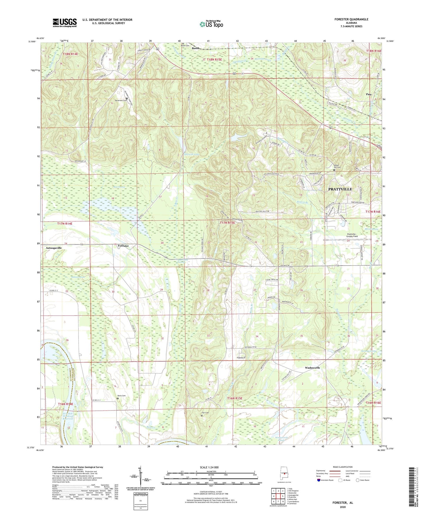
2024 topographic map quadrangle Forester in the state of Alabama. Scale: 1:24000. Based on the newly updated USGS 7.5' US Topo map series, this map is in the following counties: Autauga, Lowndes. The map contains contour data, water features, and other items you are used to seeing on USGS maps, but also has updated roads and other features. This is the next generation of topographic maps. Printed on high-quality waterproof paper with UV fade-resistant inks.
Quads adjacent to this one:
West: Autaugaville
Northwest: Vida
North: Old Kingston
Northeast: Deatsville
East: Prattville
Southeast: Cantelous
South: Lowndesboro
Southwest: White Hall
This map covers the same area as the classic USGS quad with code o32086d5.
Contains the following named places: Allen Chapel, Autauga Academy, Autauga Hill African Methodist Episcopal Zion Church, Autauga Hill School, Bear Creek Swamp, Bear Swamp, Booth Cemetery, Booth United Methodist Church, Breakfast Creek, Bridge Creek, Davis Cemetery, Davis Chapel, DeJarnett Cemetery, Dry Branch, Fair Cemetery, Forester, Greenwood Baptist Church, Gum Cypress Lake, Haney Branch, Idlewild Lake, Idlewood Lake Dam, Indian Hill Cemetery, Indian Springs Post Office, Kingdom Hall of Jehovahs Witnesses, Mill Creek, Mount Ramoth Church, New Jerico Baptist Church, Newport Ferry, Old Vernon, Pate, Peace and Goodwill Church, Poplar Springs Church, Popular Spring African Methodist Episcopal Zion Church, Prattville - Grouby Field, Prattville Church, Prattville Division, Robinson Pond, Rogers Branch, Savanna Swamp, Wadsworth, Wadsworth Ponds, WIQR-AM (Prattville)