MyTopo
Brown Town Mississippi US Topo Map
Couldn't load pickup availability
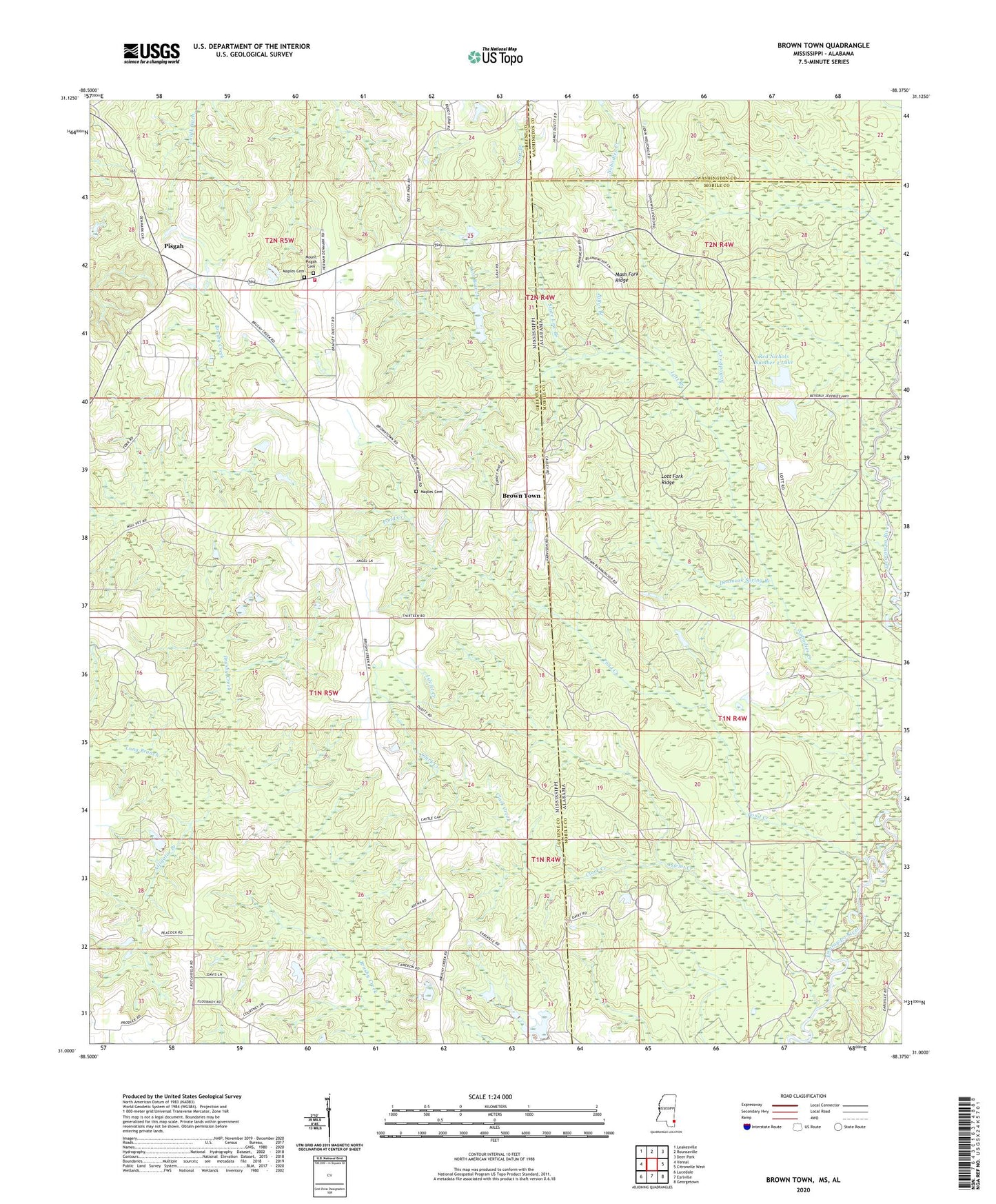
2024 topographic map quadrangle Brown Town in the states of Mississippi, Alabama. Scale: 1:24000. Based on the newly updated USGS 7.5' US Topo map series, this map is in the following counties: Greene, Mobile, Washington. The map contains contour data, water features, and other items you are used to seeing on USGS maps, but also has updated roads and other features. This is the next generation of topographic maps. Printed on high-quality waterproof paper with UV fade-resistant inks.
Quads adjacent to this one:
West: Vernal
Northwest: Leakesville
North: Rounsaville
Northeast: Deer Park
East: Citronelle West
Southeast: Georgetown
South: Earlville
Southwest: Lucedale
This map covers the same area as the classic USGS quad with code o31088a4.
Contains the following named places: Alligator Branch, Bethel Church, Billys Branch, Brown Town, Clark Creek, Denmark Spring Branch, Islelet Creek, Long Branch, Lott Branch, Lott Fork Ridge, Maples Cemetery, Mash Fork Ridge, McCann School, Mohoba, Mohoba Church, Morgan Hicks Lake Dam, Mount Pisgah Cemetery, Mount Pisgah Church, Mount Pisgah Pentecostal Church, Mount Pisgah School, Mount Pisgah Volunteer Fire Department, Pisgah, Pond Creek, Red Nichols Dam, Red Nichols Number 2 Lake, Red Nichols Number One Dam, Rieking, State Line Branch