MyTopo
Earlville Alabama US Topo Map
Couldn't load pickup availability
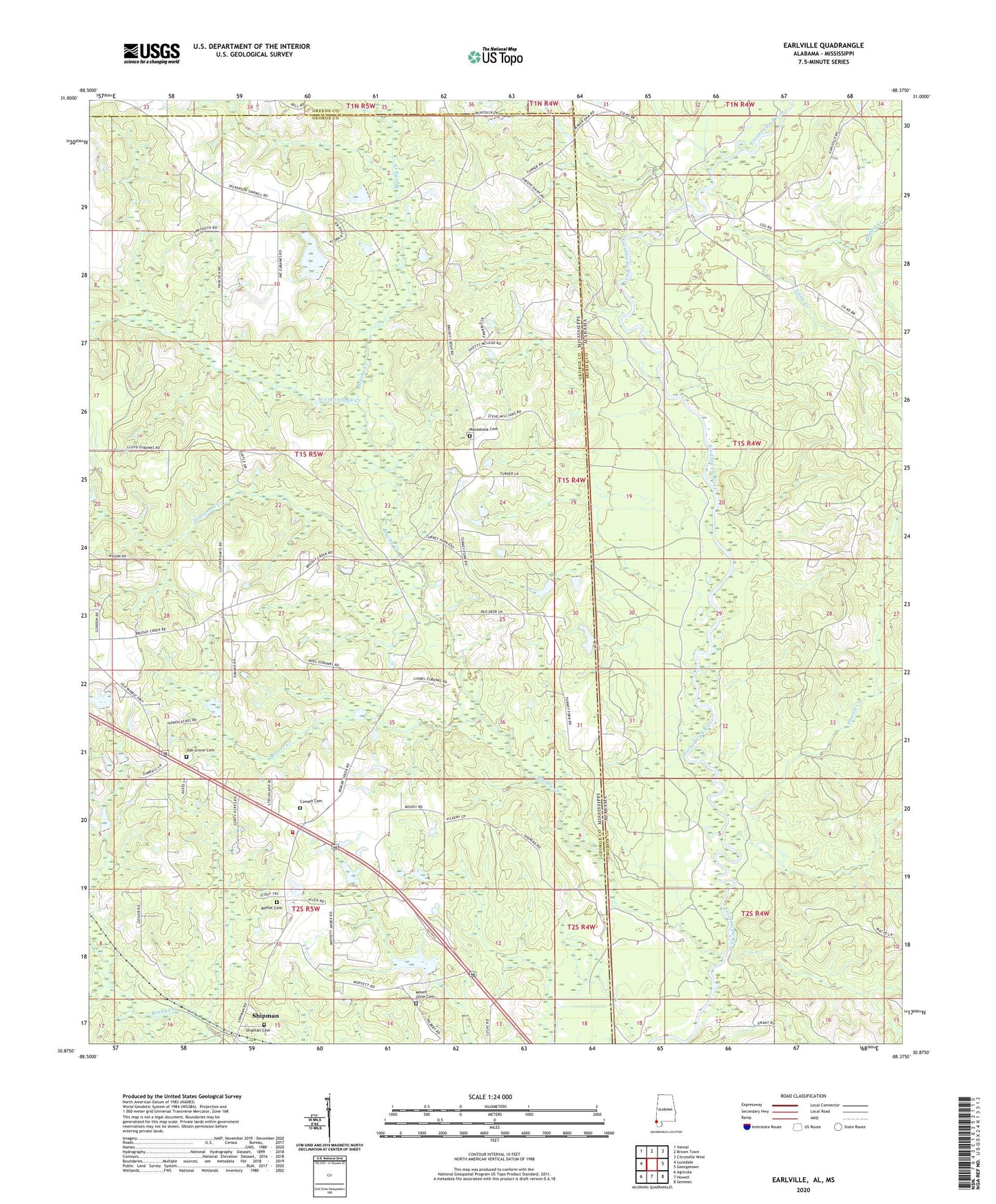
2024 topographic map quadrangle Earlville in the states of Mississippi, Alabama. Scale: 1:24000. Based on the newly updated USGS 7.5' US Topo map series, this map is in the following counties: Mobile, George, Greene. The map contains contour data, water features, and other items you are used to seeing on USGS maps, but also has updated roads and other features. This is the next generation of topographic maps. Printed on high-quality waterproof paper with UV fade-resistant inks.
Quads adjacent to this one:
West: Lucedale
Northwest: Vernal
North: Brown Town
Northeast: Citronelle West
East: Georgetown
Southeast: Semmes
South: Howell
Southwest: Agricola
Contains the following named places: Beaver Creek, Brushy Creek, Brushy Creek Church, Cowart Cemetery, Dream Fields Airport, Earlville, Family Life Fellowship Church, Little Creek, Luce Fire Tower, Macedonia Cemetery, Macedonia Missionary Baptist Church, Moffet Cemetery, Mount Olive Baptist Church, Mount Olive Cemetery, Oak Grove Baptist Church, Oak Grove Cemetery, Powell Creek, Puppy Creek, Rocky Branch, Rocky Creek Church, Scarborough Creek, Shipman, Shipman Cemetery, Shipman United Methodist Church, Shipman Volunteer Fire Department, Supervisor District 1, Tennessee Creek