
MyTopo
Estill Fork Alabama US Topo Map
Couldn't load pickup availability
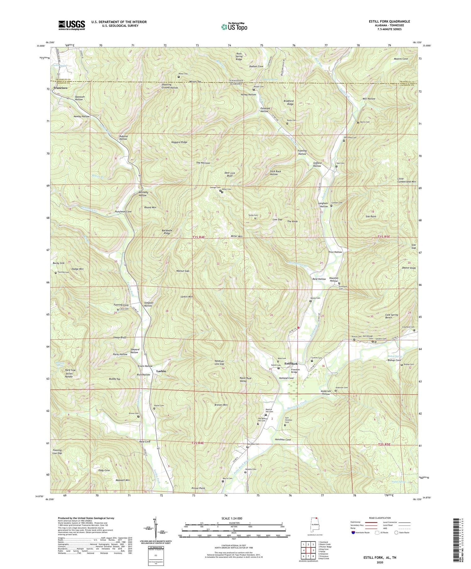
2024 topographic map quadrangle Estill Fork in the states of Alabama, Tennessee. Scale: 1:24000. Based on the newly updated USGS 7.5' US Topo map series, this map is in the following counties: Jackson, Franklin. The map contains contour data, water features, and other items you are used to seeing on USGS maps, but also has updated roads and other features. This is the next generation of topographic maps. Printed on high-quality waterproof paper with UV fade-resistant inks.
Quads adjacent to this one:
West: King Cove
Northwest: Huntland
North: Beans Creek
Northeast: Pitcher Ridge
East: Hytop
Southeast: Mud Creek
South: Princeton
Southwest: Hollytree
Contains the following named places: Anderson Cemetery, Anderson Hollow, Backbone Ridge, Bear Creek, Beaver Branch, Beech Grove Church, Beech Grove Methodist Church, Beech Grove School, Bishop Cemetery, Bishop Cove, Bishop Spring, Bostick Hill Church, Bouldin Cemetery, Bradford Ridge, Brewer Mountain, Bucky Sink, Buddy Top, Bull Run, Burks Creek, Butler Cemetery, Chapel Hill School, Cold Spring Bench, Collins Cemetery, Crawford Cemetery, Deer Lick Bluff, Doctor Knob, Dodson Cove, Duboise Hollow, Earwood Hollow, Erwin Hollow, Estill Fork, Estillfork, Fanning Cemetery, Fanning Cove, Fanning Hollow, Fanning Low Gap, Francisco, Freedom Bridge, Freedom Church, Freedom School, Gifford Hollow, Granny Branch, Grays Chapel, Grays Chapel Church, Grays Chapel School, Halls Chapel, Hard Sink, Henshaw Cemetery, Henshaw Cove, Hodge Mountain, Hogyard Ridge, Holland Cove, Honey Hollow, Houston Hollow, Hurricane Creek, Jack Cemetery, Kennedy Hollow, Langham Hollow, Larkin, Larkin Mountain, Larkin Spring, Larkin Spring Branch, Little Cumberland Mountain, Low Gap, Maxwell Mountain, McCullough Cemetery, Milan, Mill Hollow, Mill Seat Spring, Miller Cemetery, Miller Mountain, Moores Cove, Newby Hollow, Oakley Church, Oakley School, Old Bostick Hill Cemetery, Old Grays Cemetery, Opossum Hollow, Parks Hollow, Poplar Spring, Posey Cemetery, Prince Cemetery, Prince Point, Puncheon Cove, Puncheon Creek, Putman Spring, Reid Cemetery, Reid Cove, Reid Hollow, Reid Hollow Creek, Rich Hollow, Round Mountain, Sheep Bluff, Shepard Hollow, Shooting Ground Hollow, Simpson Hollow, Sisk Cemetery, Sisk Gap, Sisk Point, Skillet Handle, Slick Rock Hollow, Suck Branch, Swaim Cemetery, The Knob, The Narrows, Trice Hollow, Turley Cemetery, Valley Volunteer Fire Department Station 3, Vandiver Low Gap, Walnut Gap, Wilson Cemetery, Wilson Top, ZIP Code: 35745


