MyTopo
Beans Creek Tennessee US Topo Map
Couldn't load pickup availability
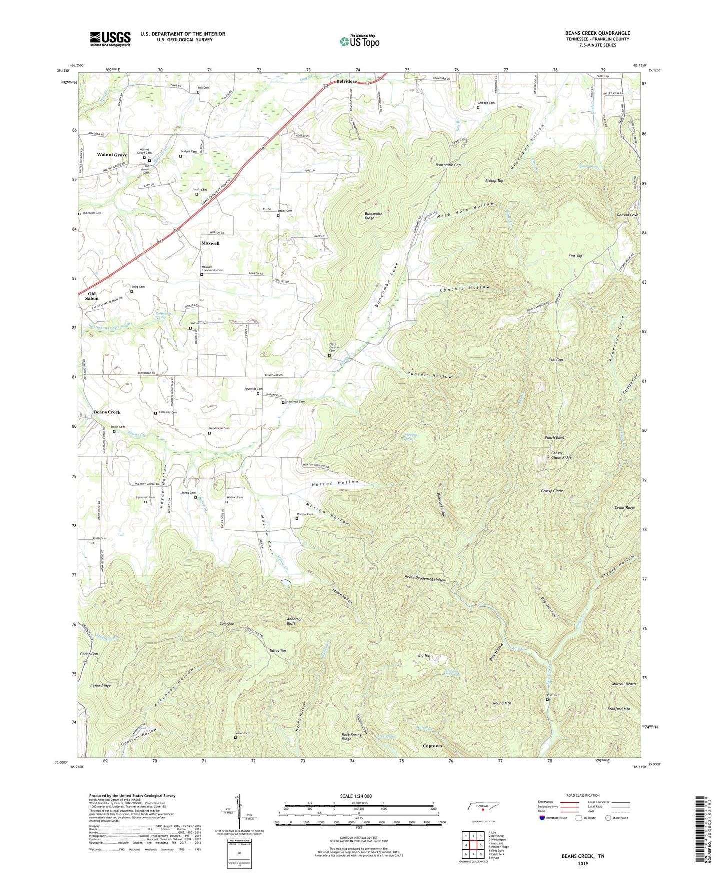
2022 topographic map quadrangle Beans Creek in the state of Tennessee. Scale: 1:24000. Based on the newly updated USGS 7.5' US Topo map series, this map is in the following counties: Franklin. The map contains contour data, water features, and other items you are used to seeing on USGS maps, but also has updated roads and other features. This is the next generation of topographic maps. Printed on high-quality waterproof paper with UV fade-resistant inks.
Quads adjacent to this one:
West: Huntland
Northwest: Lois
North: Belvidere
Northeast: Winchester
East: Pitcher Ridge
Southeast: Hytop
South: Estill Fork
Southwest: King Cove
This map covers the same area as the classic USGS quad with code o35086a2.
Contains the following named places: Anderson Bluff, Arkansas Hollow, Arledge Cemetery, Baker Branch, Baker Cemetery, Beans Creek, Beans Creek Church, Bear Hollow, Belvidere Church, Big Hollow, Big Top, Bishop Top, Blooin Hollow, Bradford Mountain, Bridges Cemetery, Buncombe Cove, Buncombe Gap, Buncombe Ridge, Callaway Cemetery, Caroline Cove, Cedar Gap, Cedar Ridge, Clark School, Coptown, Cumberland Church, Cynthia Hollow, Dog Branch, Dripping Spring, Dry Creek, Flat Top, Grassy Glade, Grassy Glade Ridge, Gugelman Hollow, Hatchett Cemetery, Hatchett School, Hickory Grove, Hickory Grove School, Hickory Mill Spring, Hill Cemetery, Horton Hollow, Huntland Division, Iron Gap, Jones Cemetery, Keith Cemetery, Keller Creek, Lipscomb Cemetery, Low Gap, Mason Cemetery, Mathias Branch, Maxwell, Maxwell Baptist Church, Maxwell Community Cemetery, Maxwell School, Motlow Cemetery, Motlow Cove, Motlow Hollow, Needmore Cemetery, Noah Cemetery, Old Salem Church, Old stovall Cemetery, Pogue Hollow, Polecat Hollow, Polly Crockett Cemetery, Pratt Cemetery, Punch Bowl, Ransom Hollow, Rattlesnake Spring, Reese Deadening Hollow, Reynolds Cemetery, Roberson Cove, Rock Spring, Rock Spring Ridge, Round Mountain, Rowe Gap, Smith Cemetery, Spout Spring, Steele Hollow, Talley Top, Talley Top School, Trigg Cemetery, Vanzandt Cemetery, Walnut Grove, Walnut Grove Cemetery, Walnut Grove School, Walnut Grove United Methodist Church, Wash Hole Hollow, Watson Cemetery, Wilhie Creek, Williams Cemetery, ZIP Codes: 37306, 37345