
MyTopo
Wellington Alabama US Topo Map
Couldn't load pickup availability
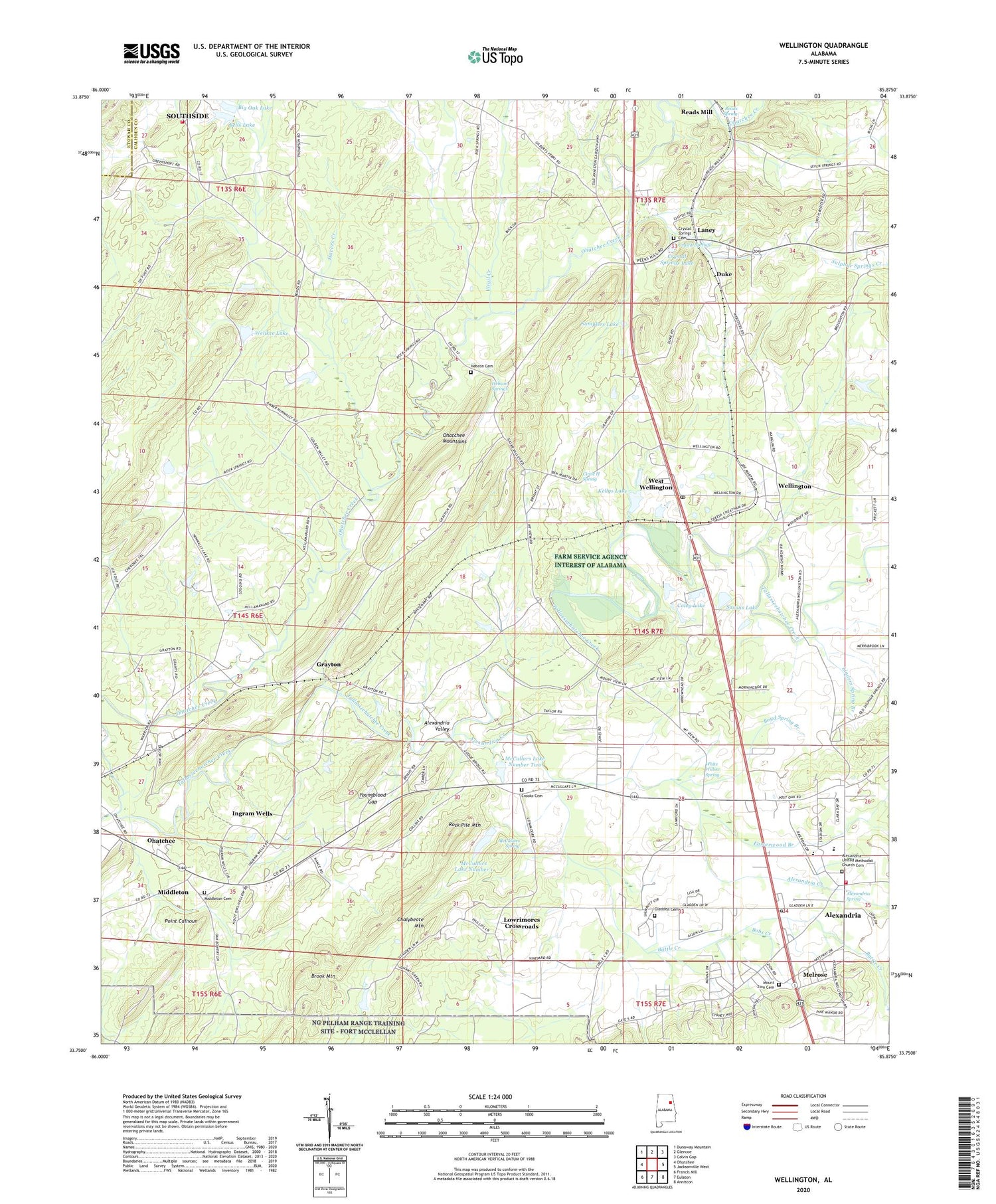
2024 topographic map quadrangle Wellington in the state of Alabama. Scale: 1:24000. Based on the newly updated USGS 7.5' US Topo map series, this map is in the following counties: Calhoun, Etowah. The map contains contour data, water features, and other items you are used to seeing on USGS maps, but also has updated roads and other features. This is the next generation of topographic maps. Printed on high-quality waterproof paper with UV fade-resistant inks.
Quads adjacent to this one:
West: Ohatchee
Northwest: Dunaway Mountain
North: Glencoe
Northeast: Colvin Gap
East: Jacksonville West
Southeast: Anniston
South: Eulaton
Southwest: Francis Mill
This map covers the same area as the classic USGS quad with code o33085g8.
Contains the following named places: Alexandria, Alexandria Baptist Church, Alexandria Census Designated Place, Alexandria Church of God, Alexandria Creek, Alexandria Fire Department, Alexandria High School, Alexandria Post Office, Alexandria Spring, Alexandria United Methodist Church, Alexandria United Methodist Church Cemetery, Alexandria Valley, Alexandria-Webster Chapel Division, Battle Creek, Beasley, Bells Dam, Bells Lake, Bethel, Bethel Methodist Church, Big Oak Community Volunteer Fire Department, Big Oak Dam, Big Oak Lake, Bobs Creek, Boozers Lake, Boyd Spring Branch, Brook Mountain, Chalybeate Mountain, Chigger Ridge, Circle H Spring, Clark, Coley Dam, Coley Lake, Crook Cemetery, Crystal Springs, Crystal Springs Cemetery, Crystal Springs Lake, Crystal Springs Speedway, Donner Dam, Donner Lake, Duke, Duke Junior High School, Duke Missionary Baptist Church, Easterwood Branch, Ebenezer Baptist Church, Fairview Missionary Baptist Church, Farm Service Agency Interest of Alabama, Gladden Cemetery, Grayton, Grayton Junior High School, Havers Creek, Hebron, Hebron Baptist Church, Hebron Cemetery, Hebron Springs, Hebron Station, Hill Top, Hopewell Church, Ingram Wells, Kellys Dam, Kellys Lake, Laney, Linders Spring Branch, Lowrimores Crossroads, Martins Crossroads, Martins Crossroads Post Office, McCullars, McCullars Lake Number 1, McCullars Lake Number Two, McCullars Number 1 Dam, McCullars Number 2 Dam, McCullars Spring, Melrose, Middleton, Middleton Cumberland Presbyterian Church Cemetery, Mount View Missionary Baptist Church, Mount Zion Baptist Church, Mount Zion Baptist Church Cemetery, Nunally Dam, Oak Bowery Missionary Baptist Church, Ohatchee Missionary Baptist Church, Ohatchee Mountains, Ohatchee Quarry, Peeks Hill, Peeks Hill United Methodist Church, Point Calhoun, Reads Mill, Reads Spring, Rock Pile Mountain, Rudd, Rudd Post Office, S D Walker Nursery Farms, Samplers Lake, Saxon Dam, Saxons Lake, Shiloh Primitive Baptist Church, Tallaseehatchee, Tallasseehatchee Creek, Thrasher Dam, Thrasher Lake, Union, Union Methodist Church, Virgil Creek, Welikee Lake, Wellington, Wellington Baptist Church, Wellington Church, Wellington Post Office, West Wellington, White Willow Spring, Woodruff, Youngblood Gap, ZIP Codes: 36250, 36279


