MyTopo
Franklin Alabama US Topo Map
Couldn't load pickup availability
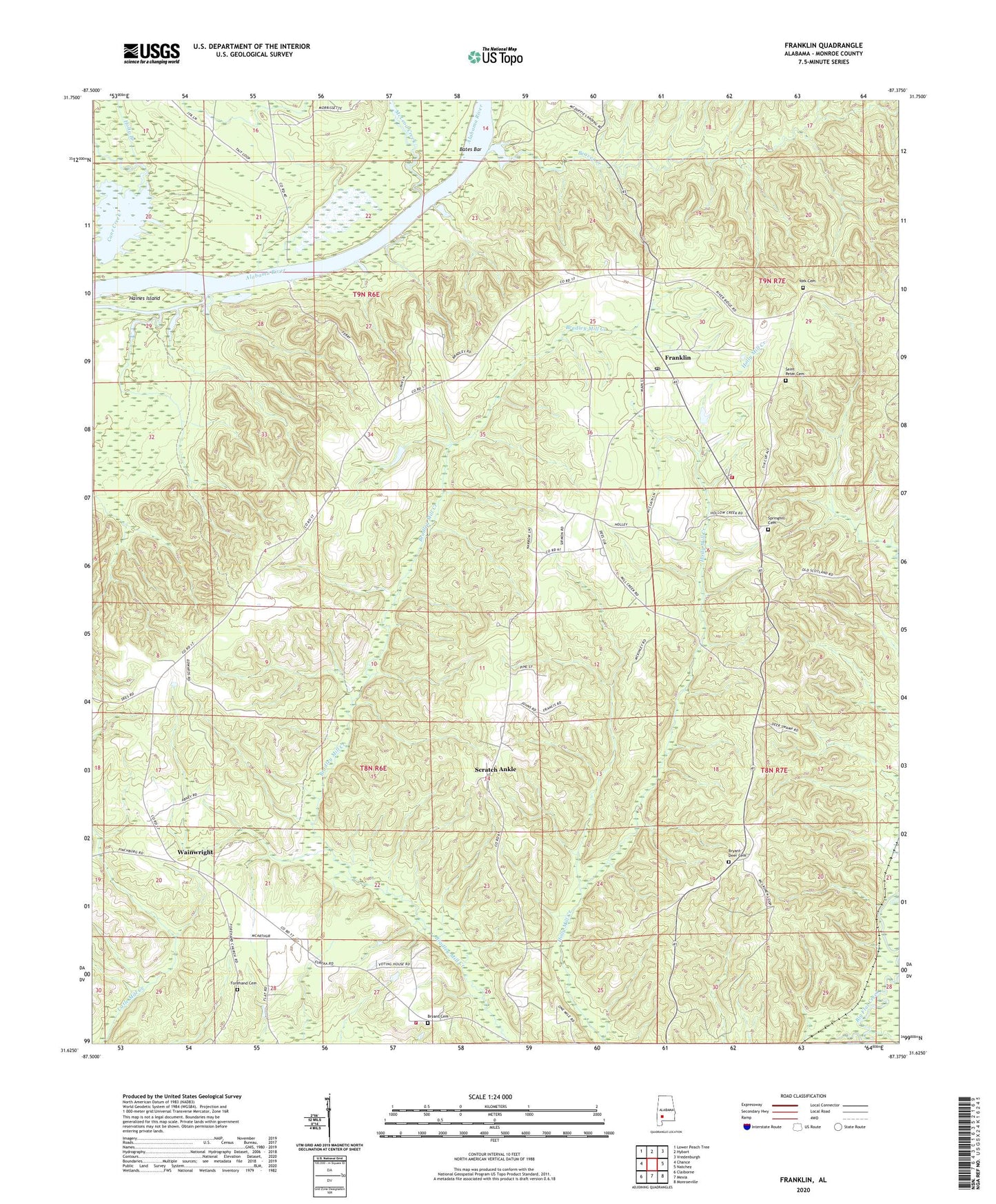
2024 topographic map quadrangle Franklin in the state of Alabama. Scale: 1:24000. Based on the newly updated USGS 7.5' US Topo map series, this map is in the following counties: Monroe. The map contains contour data, water features, and other items you are used to seeing on USGS maps, but also has updated roads and other features. This is the next generation of topographic maps. Printed on high-quality waterproof paper with UV fade-resistant inks.
Quads adjacent to this one:
West: Chance
Northwest: Lower Peach Tree
North: Hybart
Northeast: Vredenburgh
East: Natchez
Southeast: Monroeville
South: Mexia
Southwest: Claiborne
This map covers the same area as the classic USGS quad with code o31087f4.
Contains the following named places: Bates Bar, Beaver Creek, Bryant Cemetery, Bryant Deer Cemetery, Davis Ferry, Eureka Baptist Church, Faith Chapel, Finchburg Volunteer Fire Department, Forehand African Methodist Episcopal Church, Forehand Cemetery, Franklin, Franklin Church, Franklin Post Office, Franklin Volunteer Fire Department, Haines Island, Haines Island Park, Johnson Woodyard Landing, Leggett Landing, McLeod Creek, Miles Chapel, Mount Ararat Church, Pilgrim Rest Church, Saint Peter Baptist Church, Saint Peter Cemetery, Scratch Ankle, Spring Hill Church, Springhill Baptist Church, Springhill Cemetery, Vredenburgh Division, Wainwright, York Cemetery, York Chapel, ZIP Code: 36444