MyTopo
Hybart Alabama US Topo Map
Couldn't load pickup availability
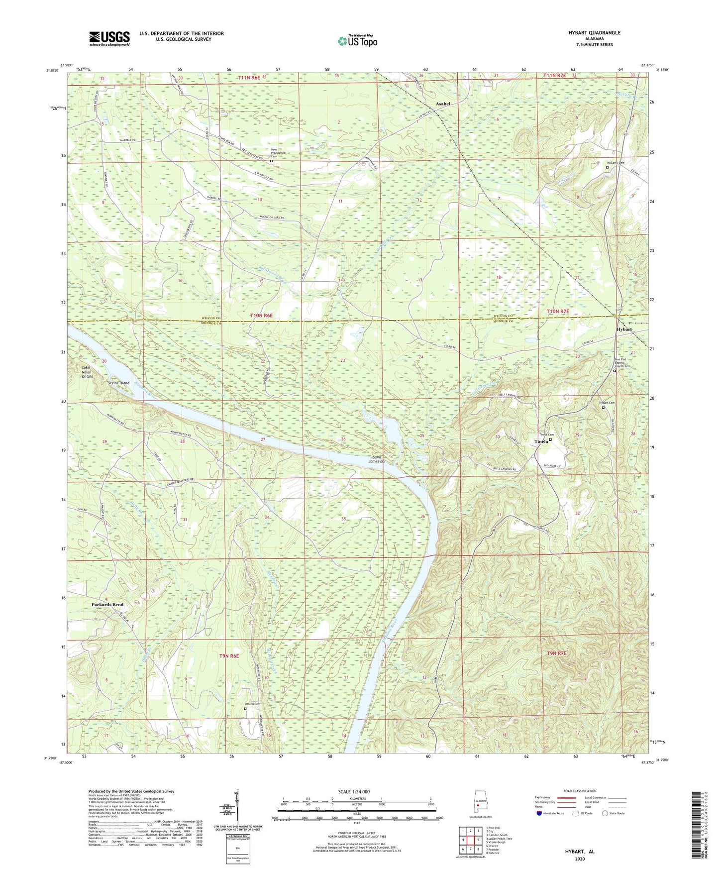
2024 topographic map quadrangle Hybart in the state of Alabama. Scale: 1:24000. Based on the newly updated USGS 7.5' US Topo map series, this map is in the following counties: Monroe, Wilcox. The map contains contour data, water features, and other items you are used to seeing on USGS maps, but also has updated roads and other features. This is the next generation of topographic maps. Printed on high-quality waterproof paper with UV fade-resistant inks.
Quads adjacent to this one:
West: Lower Peach Tree
Northwest: Pine Hill
North: Coy
Northeast: Camden South
East: Vredenburgh
Southeast: Natchez
South: Franklin
Southwest: Chance
This map covers the same area as the classic USGS quad with code o31087g4.
Contains the following named places: Adams Store, Asahel, Backers Landing, Belle Landing, Bells Landing Church, Bells Landing Park, Bells Landing Presbyterian Church, Buckhorn Creek, Burntwood Branch, Greater Bells Chapel, Holly Branch, Hybart, Hybart Cemetery, Independent Church, Jones Chapel, Kings Log Landing, Lambert Landing, Little Zion Number 1 Baptist Church, McCalls Creek, McCarty Cemetery, Monroe Senior High School, Morrisette Landing, Morrisons Ferry, Mount Gilead Church, Mount Sinai Church, Nettles Chapel, New Providence Cemetery, Packards Bend, Packards Bend School, Pine Flat Baptist Church, Pine Flat Baptist Church Cemetery, Powell Cemetery, Saint James Bar, Saint James Landing, Saint Peter Church, Steins Island, Tallatchee Creek, Tinela, Tinela Cemetery, ZIP Codes: 36435, 36481