MyTopo
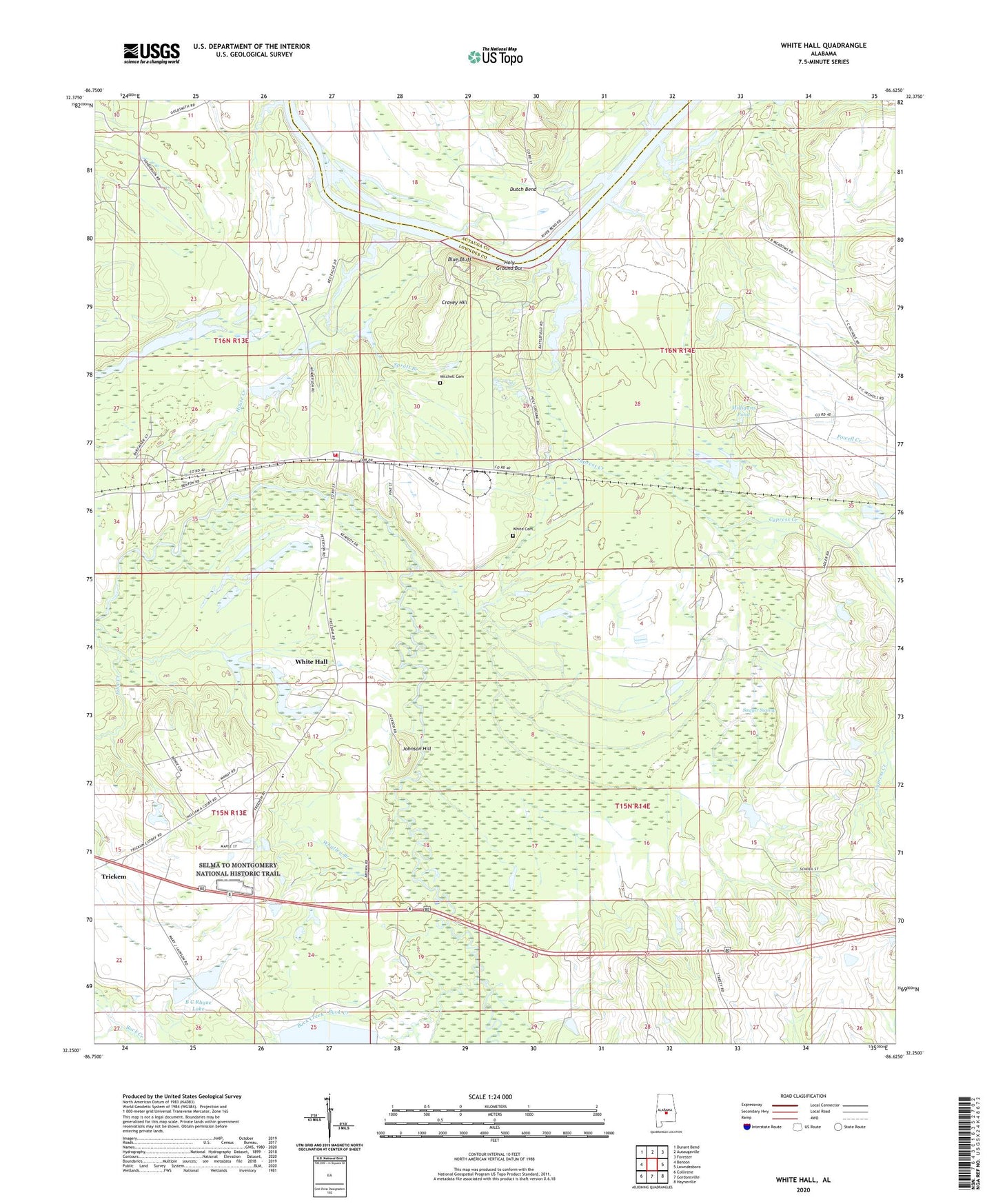
White Hall Alabama US Topo Map
Couldn't load pickup availability
2024 topographic map quadrangle White Hall in the state of Alabama. Scale: 1:24000. Based on the newly updated USGS 7.5' US Topo map series, this map is in the following counties: Lowndes, Autauga. The map contains contour data, water features, and other items you are used to seeing on USGS maps, but also has updated roads and other features. This is the next generation of topographic maps. Printed on high-quality waterproof paper with UV fade-resistant inks.
Quads adjacent to this one:
West: Benton
Northwest: Durant Bend
North: Autaugaville
Northeast: Forester
East: Lowndesboro
Southeast: Hayneville
South: Gordonsville
Southwest: Collirene
This map covers the same area as the classic USGS quad with code o32086c6.
Contains the following named places: B C Rhyne Lake, B C Rhyne Lake Dam, Blue Bluff, Buck Creek, C H Rhyne Dam, Cooper Branch Narrows Lake Dam, Cravey Hill, Cypress Creek, De Bardeleben Landing, Gordon Bend Church, Hoffman Rhyne Lake, Holy Ground Bar, Hopewell Church, House Creek, Johnson Hill, Lowndesboro Division, Milligans Pond, Mitchell Cemetery, Molly Branch, Morning Star School, Mount Zion School, Northwest Lowndes Division, Panther Creek, Pleasant Green Church, Powells Ferry, Roland Industrial School, Saint Marks Church, Sanctified Church, Sawyer Swamp, Selma to Montgomery National Historic Trail, Spratt Branch, The Narrows Lake, Town of White Hall, Trickem, Unity Church, Whatley Branch, White Cemetery, White Hall, White Hall Elementary School, White Hall Volunteer Fire Department, Wright Chapel, ZIP Code: 36752