MyTopo
Honoraville Alabama US Topo Map
Couldn't load pickup availability
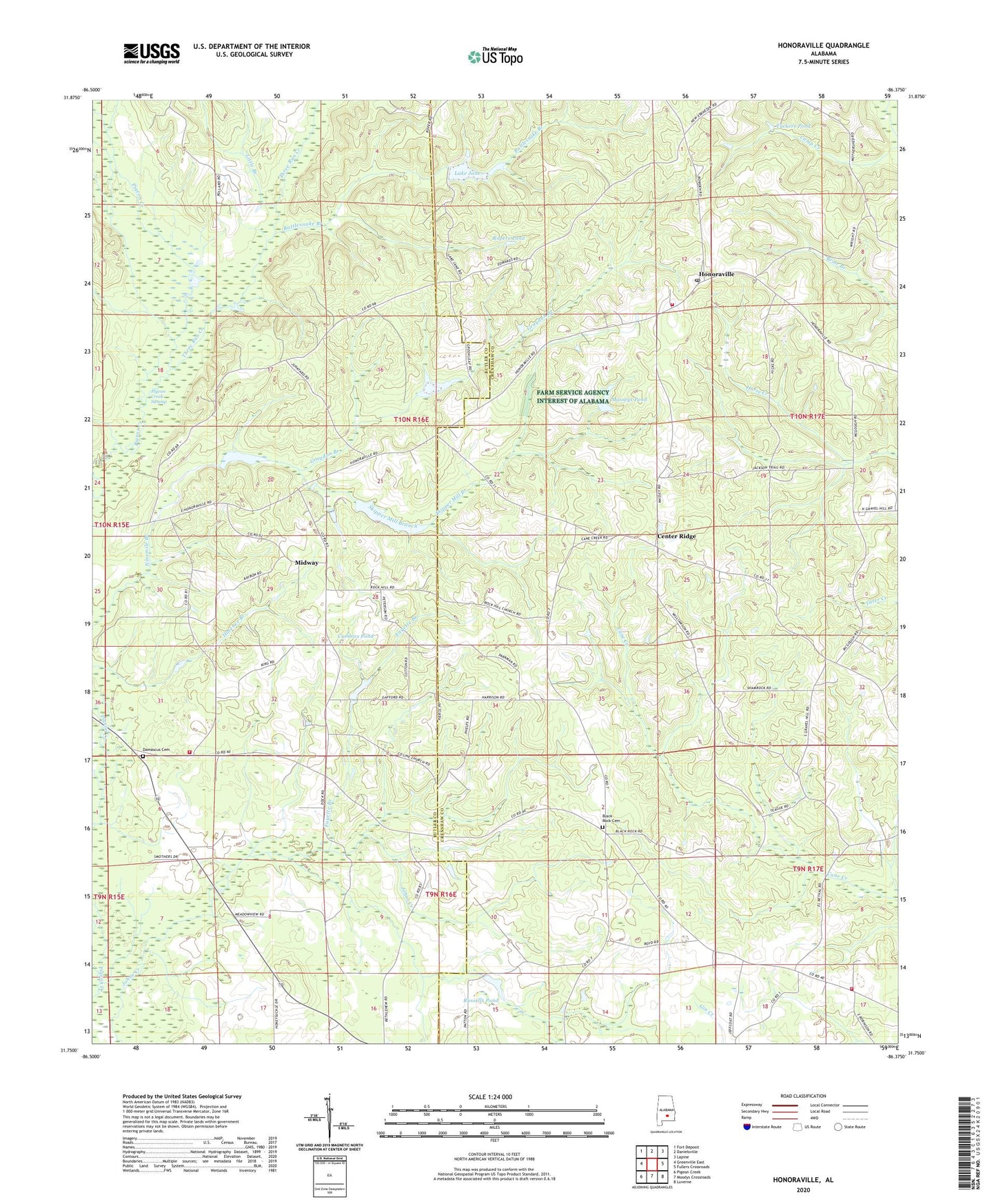
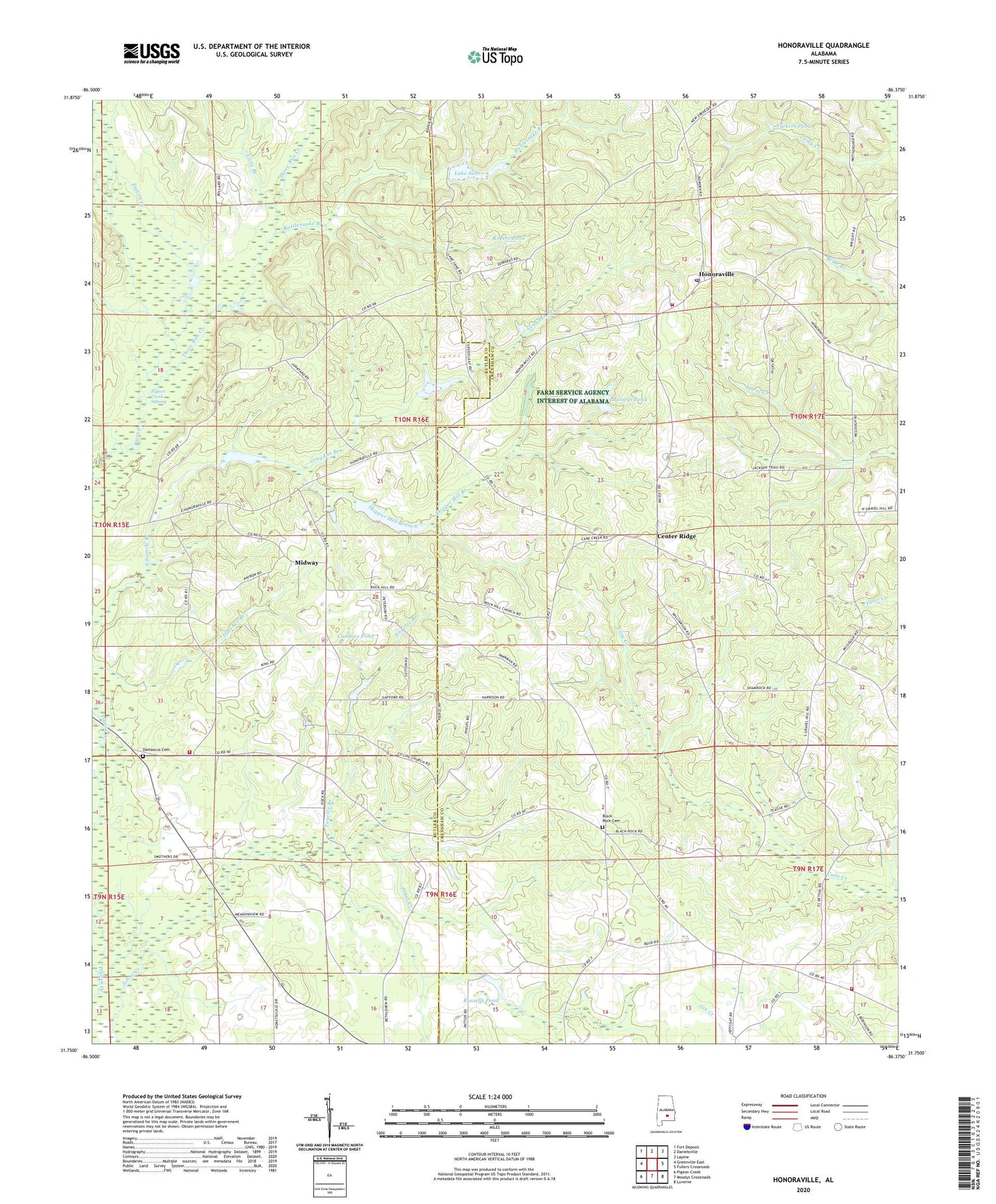
2024 topographic map quadrangle Honoraville in the state of Alabama. Scale: 1:24000. Based on the newly updated USGS 7.5' US Topo map series, this map is in the following counties: Crenshaw, Butler. The map contains contour data, water features, and other items you are used to seeing on USGS maps, but also has updated roads and other features. This is the next generation of topographic maps. Printed on high-quality waterproof paper with UV fade-resistant inks.
Quads adjacent to this one:
West: Greenville East
Northwest: Fort Deposit
North: Danielsville
Northeast: Lapine
East: Fullers Crossroads
Southeast: Luverne
South: Moodys Crossroads
Southwest: Pigeon Creek
This map covers the same area as the classic USGS quad with code o31086g4.
Contains the following named places: B C Massey Dam, Bethlehem Church, Bible Church, Black Rock, Black Rock Cemetery, Black Rock Primitive Baptist Church, Camp Creek, Center Ridge, Center Ridge School, Chapel Hill Church, Chapel Hill School, Chapel Hill Volunteer Fire Department, Church of Christ, County Line Church, Cumbies Pond, Damascus Baptist Church, Damascus Cemetery, Damascus Volunteer Fire Department, El Bethel Church, Fayette Branch, Friendship Church, Gravel Hill Church, Graydon Branch, Holy Tabernacle Church, Honoraville, Honoraville Church, Honoraville Junior High School, Honoraville Post Office, Honoraville Volunteer Fire Department, Kellys Store, L E Skipper Pond, L E Skipper Pond Dam, Lake Jane, Little Branch, Masseys Pond, Midway, Midway Church, Mount Zion Church, Oak Grove Church, R Killough Dam, Rattlesnake Branch, Rock Hill Church, Ropers Pond, Russells Pond, Sims Pond, Skipper Mill Branch, Three Run Creek, Tuckers Pond, Whiddon Farms, ZIP Code: 36042