MyTopo
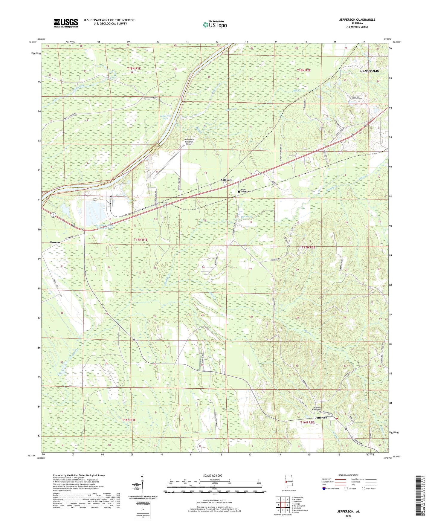
Jefferson Alabama US Topo Map
Couldn't load pickup availability
2024 topographic map quadrangle Jefferson in the state of Alabama. Scale: 1:24000. Based on the newly updated USGS 7.5' US Topo map series, this map is in the following counties: Marengo, Sumter. The map contains contour data, water features, and other items you are used to seeing on USGS maps, but also has updated roads and other features. This is the next generation of topographic maps. Printed on high-quality waterproof paper with UV fade-resistant inks.
Quads adjacent to this one:
West: Coatopa
Northwest: Brewersville
North: McDowell
Northeast: Demopolis
East: Old Spring Hill
Southeast: Linden
South: Myrtlewood North
Southwest: Whitfield
This map covers the same area as the classic USGS quad with code o32087d8.
Contains the following named places: Allen Creek, Bethel Church, Bethel School, Cypress Creek, Demopolis Division, Demopolis Regional Airport, Ellis Landing, Falling Creek, Friendship Baptist Church, Gulf States Paper Company Dam, Gulf States Paper Company Lake, Jefferson, Jefferson Church, Jefferson Elementary School, Jefferson Post Office, Jefferson Smalls Cemetery, Jefferson Volunteer Fire Department, Jems Landing, John Essex High School, Mill Creek, Miller Church, Miller's Chapel African Methodist Episcopal Zion Church, Millers Chapel Cemetery, Millers School, Moscow, Moscow Church, Moscow Providence Church, Mount Zion Church, New Hope Church, Paces, Paces Landing East, Paces Landing West, Pandora, Reeds Hunting Lodge, Salt Well, Simmons Landing, Small Memorial African Methodist Episcopal Zion Church, Ulmers Landing, ZIP Code: 36732