MyTopo
Whitfield Alabama US Topo Map
Couldn't load pickup availability
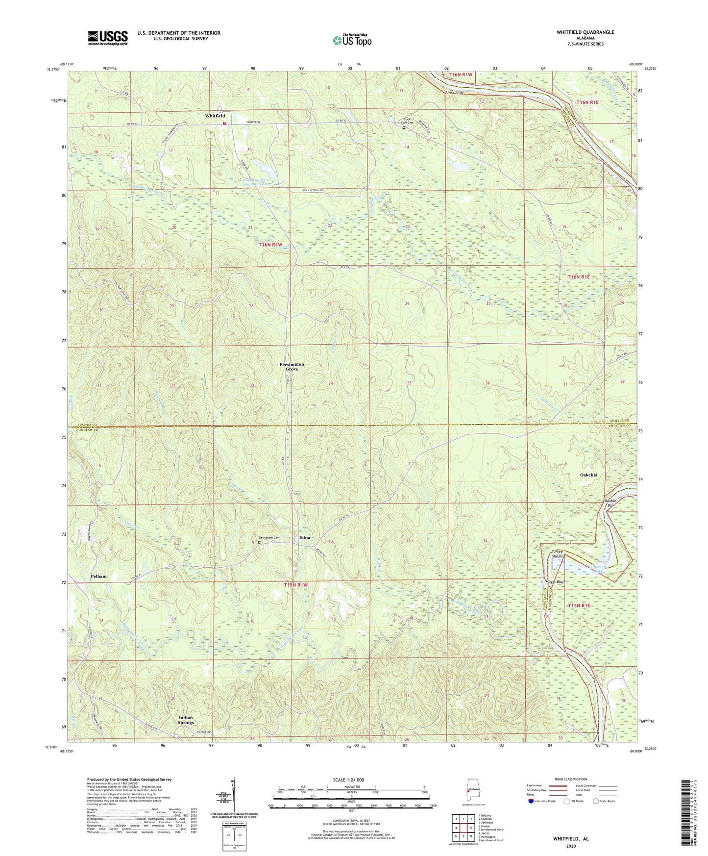
2024 topographic map quadrangle Whitfield in the state of Alabama. Scale: 1:24000. Based on the newly updated USGS 7.5' US Topo map series, this map is in the following counties: Choctaw, Sumter, Marengo. The map contains contour data, water features, and other items you are used to seeing on USGS maps, but also has updated roads and other features. This is the next generation of topographic maps. Printed on high-quality waterproof paper with UV fade-resistant inks.
Quads adjacent to this one:
West: Gaston
Northwest: Bellamy
North: Coatopa
Northeast: Jefferson
East: Myrtlewood North
Southeast: Myrtlewood South
South: Pennington
Southwest: Jachin
This map covers the same area as the classic USGS quad with code o32088c1.
Contains the following named places: American Can Company Dam, American Can Company Lake, Bethlehem Cemetery, Bethlehem Church, Black Bluff, Black Bluff Cemetery, Black Bluff Church, Black Bluff Landing, Bullock Branch, Burll Creek, Cane Creek, Cetahoma Landing, Crooms Bar, Crooms Lower Landing, Crooms Upper Landing, Cypress Branch, Double Bar, Dry Creek, Ebenezer Baptist Church, Edna, Indian Springs, Kinterbish Creek, Liberty Landing, Maggs Bluff, Montevallo Church, Oakchia, Oakchia Fire Tower, Oakchia Landing, Pelham, Pelham United Methodist Church, Persimmon Grove, Pine Grove Church, Robinson, Saint Matthew Baptist Church, Steiners Landing, T C Null Dam, T C Null Lake, Troy, Turkey Shoals, Whitfield, Whitfield Church, Whitfield Volunteer Fire Department, Zion Church