
MyTopo
Aquilla Alabama US Topo Map
Couldn't load pickup availability
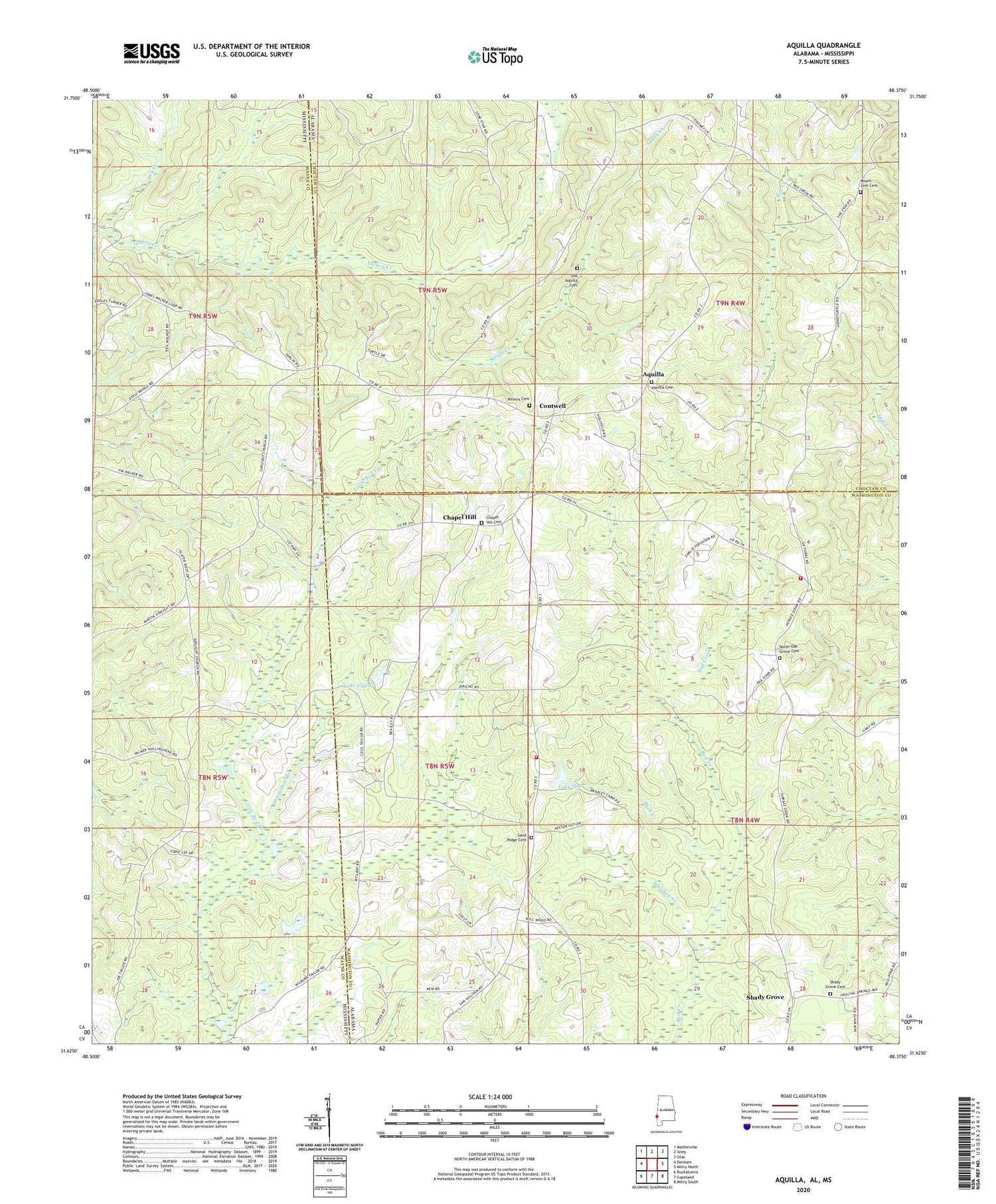
2024 topographic map quadrangle Aquilla in the states of Alabama, Mississippi. Scale: 1:24000. Based on the newly updated USGS 7.5' US Topo map series, this map is in the following counties: Washington, Choctaw, Wayne. The map contains contour data, water features, and other items you are used to seeing on USGS maps, but also has updated roads and other features. This is the next generation of topographic maps. Printed on high-quality waterproof paper with UV fade-resistant inks.
Quads adjacent to this one:
West: Denham
Northwest: Matherville
North: Isney
Northeast: Silas
East: Millry North
Southeast: Millry South
South: Copeland
Southwest: Buckatunna
Contains the following named places: Aquilla, Aquilla Cemetery, Aquilla Lookout Tower, Aquilla Post Office, Aquilla United Methodist Church, Browns Store, Buck Creek, Canaz Field, Chapel Hill, Chapel Hill Baptist Church, Chapel Hill Cemetery, Contwell, Dearmon Church, Dry Creek, Fail, Ganus Mill, Ganus School, Healing Springs Gas Field, Horseshoe Branch, Jordan Church, Kings Chapel African Methodist Episcopal Church, Knight's Chapel Baptist Church, Lake Gypsy, Lake Ola, Lake Ola Dam, Mount Zion Cemetery, New Rock Missionary Baptist Church, North Oak Grove Baptist Church, North Oak Grove Cemetery, North Oak Grove Volunteer Fire Department, Old Aquilla Cemetery, Red Creek, Red Creek Volunteer Fire Department, Saint Louis Church, Sand Ridge Baptist Church, Sand Ridge Cemetery, Sand Ridge Church of God, Sandy Creek, Shady Grove, Shady Grove Baptist Church, Shady Grove Cemetery, Sunlight Church, Whiskey Creek, Wilkins Cemetery, Zion Chapel Oil Field


