
MyTopo
Isney Alabama US Topo Map
Couldn't load pickup availability
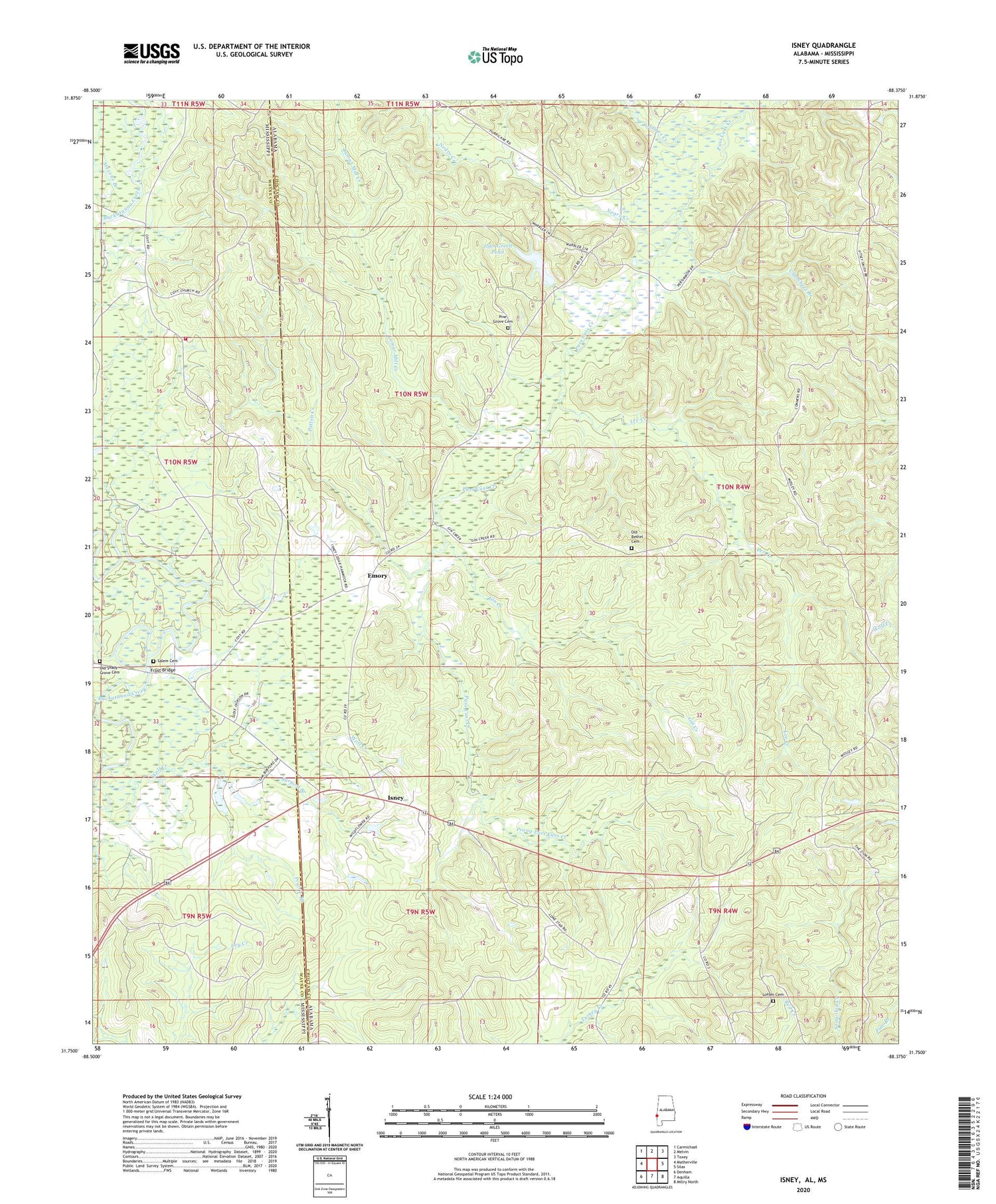
2024 topographic map quadrangle Isney in the states of Alabama, Mississippi. Scale: 1:24000. Based on the newly updated USGS 7.5' US Topo map series, this map is in the following counties: Choctaw, Wayne. The map contains contour data, water features, and other items you are used to seeing on USGS maps, but also has updated roads and other features. This is the next generation of topographic maps. Printed on high-quality waterproof paper with UV fade-resistant inks.
Quads adjacent to this one:
West: Matherville
Northwest: Carmichael
North: Melvin
Northeast: Toxey
East: Silas
Southeast: Millry North
South: Aquilla
Southwest: Denham
Contains the following named places: Burford Branch, Carroll School, Chambers Branch, Coyt Church, Emory, Frost Bridge, Frost Bridge Camp, Gin Branch, Gin Creek, Gin Creek Baptist Church, Gin Creek Oil Field, Isney, Isney Baptist Church, James Creek, John Green Dam, John Green Pond, Lamar Mill Creek, Lee Creek, Loften Cemetery, Negro Creek, Old Bethel Cemetery, Old Shady Grove Cemetery, Patton Creek, Pine Grove Cemetery, Prairie Branch, Prong Puss Cuss Creek, Puss Cuss Creek Oil Field, Salem Cemetery, Sanderson Pond Dam, Sandfield Church, Silas Oil Field, Souwilpa Creek Gas Field, Stevens Branch, Tabernacle Church, Wayne County Volunteer Fire Department Coyt Station, West Point Church, ZIP Code: 36908


