
MyTopo
Pinckard Alabama US Topo Map
Couldn't load pickup availability
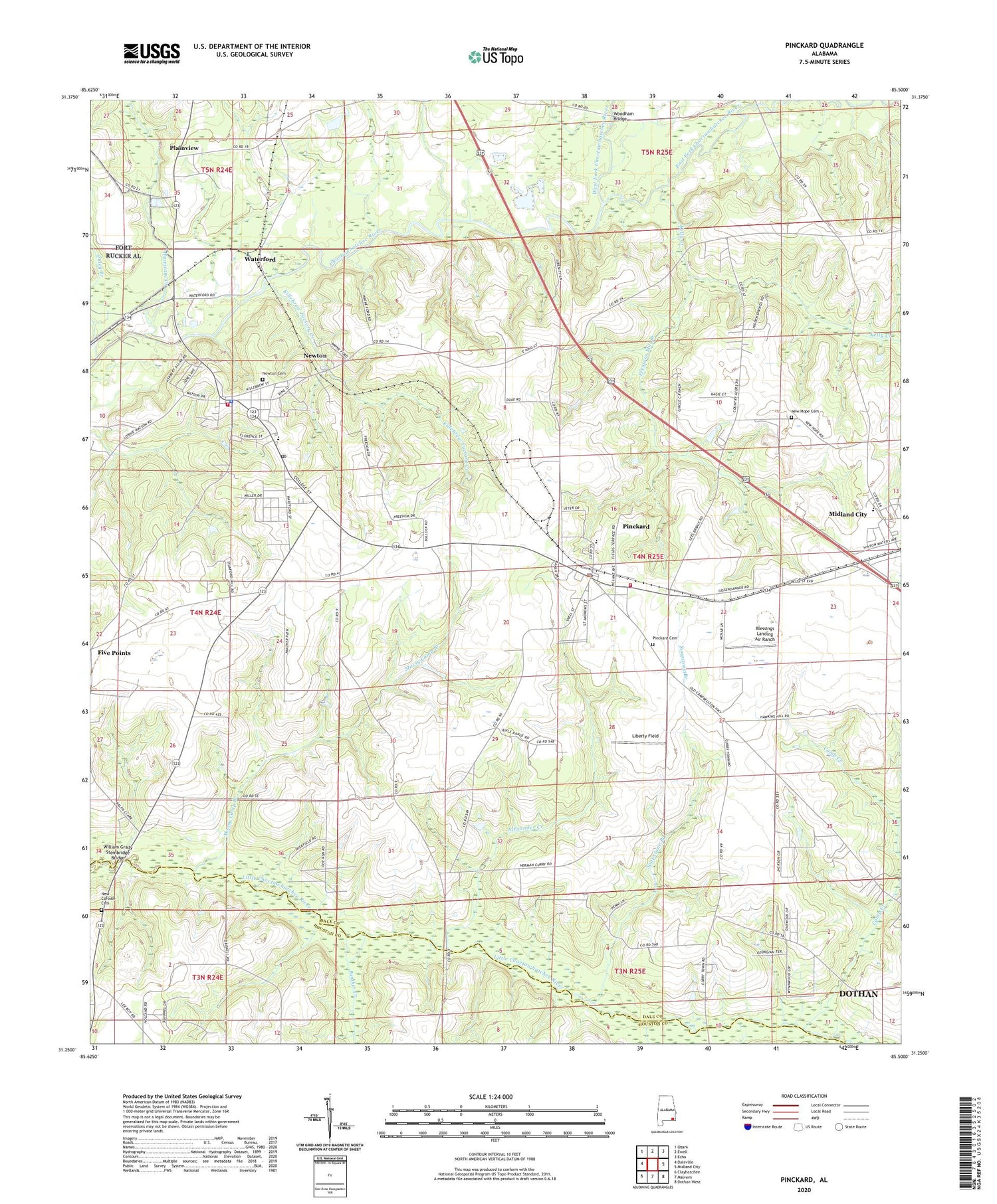
2024 topographic map quadrangle Pinckard in the state of Alabama. Scale: 1:24000. Based on the newly updated USGS 7.5' US Topo map series, this map is in the following counties: Dale, Houston. The map contains contour data, water features, and other items you are used to seeing on USGS maps, but also has updated roads and other features. This is the next generation of topographic maps. Printed on high-quality waterproof paper with UV fade-resistant inks.
Quads adjacent to this one:
West: Daleville
Northwest: Ozark
North: Ewell
Northeast: Echo
East: Midland City
Southeast: Dothan West
South: Malvern
Southwest: Clayhatchee
This map covers the same area as the classic USGS quad with code o31085c5.
Contains the following named places: Adams Mill, Alexander Creek, Antioch Baptist Church, Bear Creek, Blessings Landing Air Ranch, Box Quarry, Camp Creek, Camp Timothy, Carmichael School, Cedar Grove Church, City of Choctawhatchee Wastewater Treatment Plant, Corinth Church, Dale County High School, Dale Industrial School, East Fork Choctawhatchee River, First Assembly of God Church, Friendship Church, Gin Branch, Greater Saint Paul Missionary Church, Harrison Mill Creek, Hurricane Creek, Kelly Creek, Killebrew Factory Creek, Liberty Field, McKee School, Mossy Camp Branch, Mount Hebron, Mount Hebron Church, New Corinth Cemetery, New Corinth Church, New Covenant Church, New Hope Cemetery, New Hope Church, New Hope School, Newton, Newton Baptist Church, Newton Cemetery, Newton Elementary School, Newton Fire Department, Newton Police Department, Newton Post Office, Newton United Methodist Church, Newton-Midland City Division, No Greater Love Holiness Church, Panther Creek, Pinckard, Pinckard Baptist Church, Pinckard Cemetery, Pinckard Elementary School, Pinckard High School, Pinckard Police Department, Pinckard Post Office, Pinckard United Methodist Church, Pinckard Volunteer Fire Department, Pittman School, Plainview, Poley Branch, Prestons Mill Branch, Soapstone Branch, Town of Newton, Town of Pinckard, Union Church, Union School, Waterford, West Fork Choctawhatchee River, William Grady Stembridge Bridge, Woodham Bridge, ZIP Codes: 36352, 36371


