
MyTopo
Daleville Alabama US Topo Map
Couldn't load pickup availability
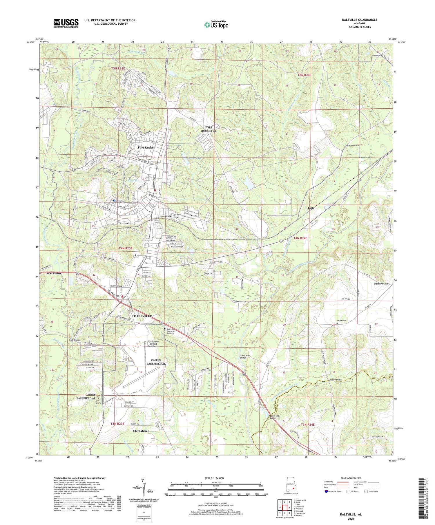
2024 topographic map quadrangle Daleville in the state of Alabama. Scale: 1:24000. Based on the newly updated USGS 7.5' US Topo map series, this map is in the following counties: Dale, Houston. The map contains contour data, water features, and other items you are used to seeing on USGS maps, but also has updated roads and other features. This is the next generation of topographic maps. Printed on high-quality waterproof paper with UV fade-resistant inks.
Quads adjacent to this one:
West: Enterprise
Northwest: Enterprise NE
North: Ozark
Northeast: Ewell
East: Pinckard
Southeast: Malvern
South: Clayhatchee
Southwest: Bellwood
This map covers the same area as the classic USGS quad with code o31085c6.
Contains the following named places: Allen Heights, Beaver Lake, Bethel Baptist Church, Bethel Cemetery, Bethel School, Bowden Terrace, Brooking Mill Creek, Burnt Mill Bridge, Byrds Branch, Cairns Army Airfield (Fort Rucker), Chapel of the Flags, Choctawhatchee Wells, City of Daleville, Cowpen Creek, Daleville, Daleville Church, Daleville Division, Daleville Fire Department, Daleville High School, Daleville Memorial Gardens, Daleville Police Department, Daleville Post Office, Daleville Station, Directorate of Public Safety Fire and Emergency Services, Fifth Avenue Chapel, First Baptist Church of Kelly, Five Points, Fort Rucker Census Designated Place, Fort Rucker Dam, Fort Rucker Elementary School, Fort Rucker Post Office, Fort Rucker Primary School, Four Mile Creek, Golden Bridge, Hanchey AHP Airport, Harrand Creek, Hutton Plaza Shopping Center, Kelly, Knox Heliport, Line Creek, Little Choctawhatchee River, Lowe AHP Airport, Lower Iron Bridge, Marchman Church, Moores Chapel, Munson Heights, New Sumnerhill Church, Peters Branch, Piney Grove Church, Rocky Hill Church, Rocky Hill School, Saint Marys School, Shiloh Church, Silver Wings Golf Course, Snell Bridge, Snell Mill Branch, Steep Head Creek, Summer Hill Church, United States Army Aeromedical Center Lyster Army Hospital, United States Army Aviation Museum, ZIP Codes: 36322, 36362


