MyTopo
Marion Junction Alabama US Topo Map
Couldn't load pickup availability
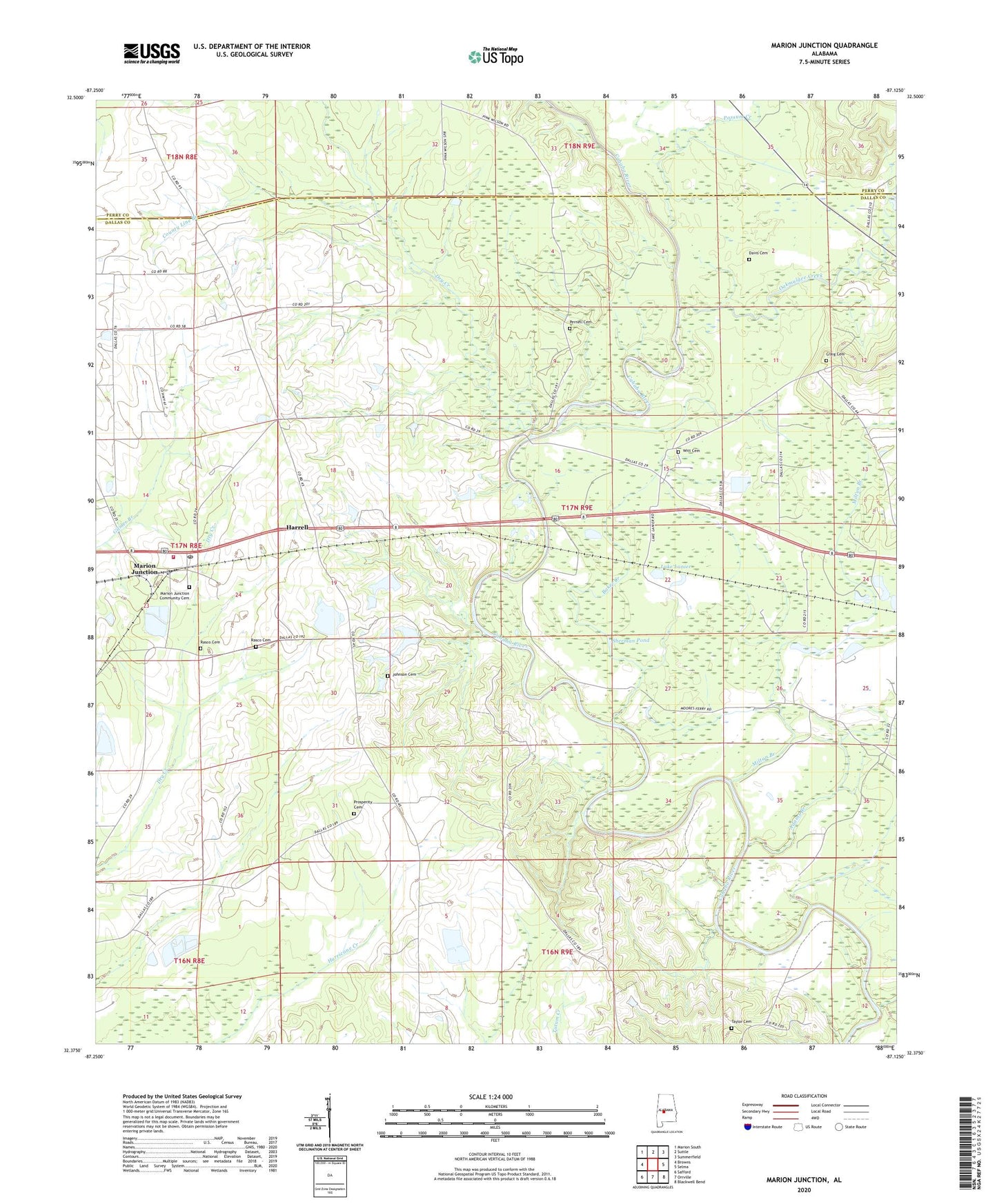
2024 topographic map quadrangle Marion Junction in the state of Alabama. Scale: 1:24000. Based on the newly updated USGS 7.5' US Topo map series, this map is in the following counties: Dallas, Perry. The map contains contour data, water features, and other items you are used to seeing on USGS maps, but also has updated roads and other features. This is the next generation of topographic maps. Printed on high-quality waterproof paper with UV fade-resistant inks.
Quads adjacent to this one:
West: Browns
Northwest: Marion South
North: Suttle
Northeast: Summerfield
East: Selma
Southeast: Blackwell Bend
South: Orrville
Southwest: Safford
This map covers the same area as the classic USGS quad with code o32087d2.
Contains the following named places: Adams Branch, Baker Creek, Black Belt Agricultural Experiment Station, Camp Selma, County Line Branch, Craig Cemetery, Davis Cemetery, Dry Creek, Fortune Ferry, Harrell, Harrell Crossroads School, J M Gaston Number 1 Dam, J M Gaston Number 2 Dam, J M Gaston Number One Lake, J M Gaston Number Two Lake, Johnson Cemetery, Lake Lanier, Marion Junction, Marion Junction Church, Marion Junction Community Cemetery, Marion Junction Post Office, Marion Junction Volunteer Fire Department, Milton Branch, Morning Star School, Mount Olive Church, Mount Olive School, New Morning Star Church, New Shady Grove Church, New Shiloh Church, Oakmulgee Creek, Pernell, Pernell Cemetery, Pernell Church, Pernell School, Pine Grove Church, Pine Grove School, Possum Creek, Prosperity Cemetery, Purnells Ferry, Rasco Cemetery, Saint James Church, Sherman Pond, Shiloh Junior High School, Taylor Cemetery, Union Grove Church, Union Grove School, Witt Cemetery