MyTopo
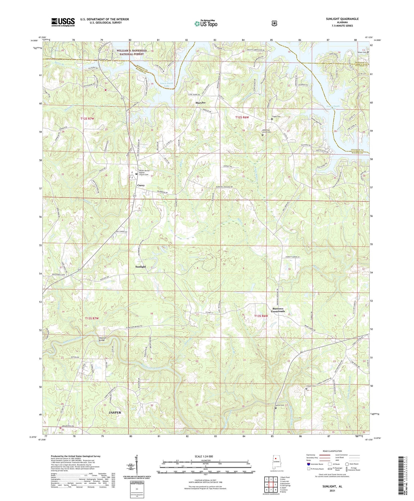
Sunlight Alabama US Topo Map
Couldn't load pickup availability
Also explore the Sunlight Forest Service Topo of this same quad for updated USFS data
2024 topographic map quadrangle Sunlight in the state of Alabama. Scale: 1:24000. Based on the newly updated USGS 7.5' US Topo map series, this map is in the following counties: Walker, Winston, Cullman. The map contains contour data, water features, and other items you are used to seeing on USGS maps, but also has updated roads and other features. This is the next generation of topographic maps. Printed on high-quality waterproof paper with UV fade-resistant inks.
Quads adjacent to this one:
West: Manchester
Northwest: Black Pond
North: Arley
Northeast: Crane Hill
East: Cold Springs
Southeast: Sipsey
South: Cordova
Southwest: Jasper
This map covers the same area as the classic USGS quad with code o33087h2.
Contains the following named places: Aaron Cemetery, Battle Branch, Bear Branch, Blooming Grove Baptist Church, Blooming Grove Cemetery, Burrows Crossroads, Camp Jimmy Goodwin, Camp O'Rear, Curry, Curry Cemetery, Curry Church, Curry Church of Christ, Curry Elementary School, Curry High School, Curry Volunteer Fire and Rescue, Duncan Creek, Friendship Church, Herman Church, Ice Branch, Jasper Fire Department Station 3, Little Mill Creek, Macedonia Baptist Church, Marylee, Mill Creek Mine, Mount Joy Baptist Church, Mount Olive Church, Mount Vernon Baptist Church, New Hope Church, Philadelphia Church, Pleasant Field Church, Racoon Branch, Rock Creek, Shady Ridge Church, Sipsey Division, Smith Lake Church, Sunlight, Sunlight Baptist Church, Thompson Branch, Tidwell Cemetery, Tingle Cemetery, Trimbles Mill, Tubbs Branch, Valley Hill Church, Walston Bridge, Walston Church, Wilson Cemetery, ZIP Code: 35504