MyTopo
Cold Springs Alabama US Topo Map
Couldn't load pickup availability
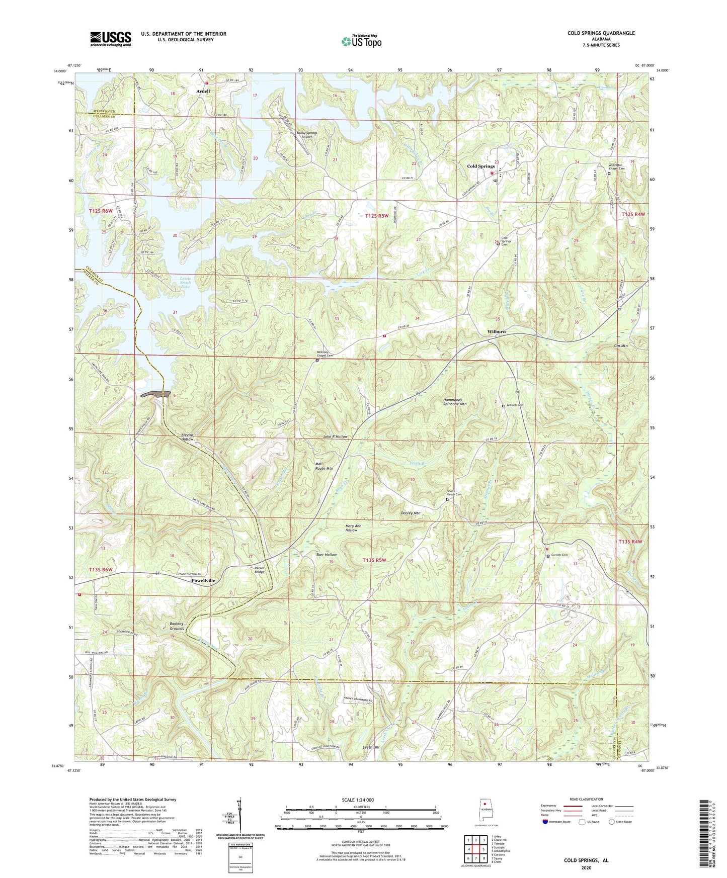
2024 topographic map quadrangle Cold Springs in the state of Alabama. Scale: 1:24000. Based on the newly updated USGS 7.5' US Topo map series, this map is in the following counties: Cullman, Walker, Winston. The map contains contour data, water features, and other items you are used to seeing on USGS maps, but also has updated roads and other features. This is the next generation of topographic maps. Printed on high-quality waterproof paper with UV fade-resistant inks.
Quads adjacent to this one:
West: Sunlight
Northwest: Arley
North: Crane Hill
Northeast: Trimble
East: Arkadelphia
Southeast: Creel
South: Sipsey
Southwest: Cordova
This map covers the same area as the classic USGS quad with code o33087h1.
Contains the following named places: Addington Chapel Cemetery, Addington Chapel School, Addington Chapel United Methodist Church, Antioch Cemetery, Antioch Missionary Baptist Church, Ardell, Arkadelphia Volunteer Fire Department Station 2, Banking Grounds, Barr Hollow, Bear Pen Branch, Big Branch, Blevins Hollow, Boyd Creek, Brazeal Branch, Bremen Post Office, Bronson Ford, Browns Ferry, Clinton Branch, Cold Springs, Cold Springs Cemetery, Cold Springs Church, Cold Springs High School, Cold Springs Mine, Cold Springs Missionary Baptist Church, Cold Springs Volunteer Fire Department Station 1, Cold Springs Volunteer Fire Department Station 2, Coon Creek, Corinth Cemetery, Corinth Church of Christ, Crane Hill Volunteer Fire Department Station 3, Doctor Harris Spring Branch, Dooley Mountain, Drummond, Drummond Church, Drummond School, Gin Mountain, Gravlee Junction, Hammonds Shinbone Mountain, Henrys Mill, Hope Mine, Jane Branch, John R Hollow, Leeth Hill, Lewis Smith, Lick Creek, Lindseys Ferry, Long Branch, Macedonia Baptist Church, Mail Route Mountain, Mary Ann Hollow, McKinley Chapel Cemetery, McKinley Chapel Methodist Church, McKinley Chapel School, Mill Creek, Mount Hope Church, New Hope Church, Oscar McGuffs Mine, Parker Branch, Parker Bridge, Parker Ford, Piney Woods Church, Piney Woods Community Church, Pineywoods Volunteer Fire Department, Powellville, Rocky Springs Airpark, Ryan Creek, Ryan Creek Mine, Sandlin Chapel United Methodist Church, Shady Grove Cemetery, Shady Grove Primitive Baptist Church, Stewart Branch, Union Grove Baptist Church, Vaughans Crossroad, Walls Branch, Wilburn, Williams Chapel, Willoughby Branch, Wilson Branch, ZIP Code: 35033