MyTopo
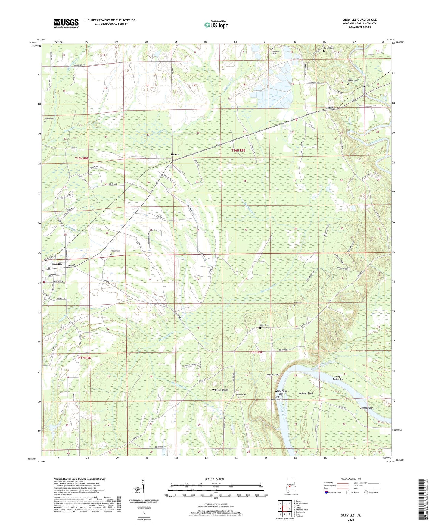
Orrville Alabama US Topo Map
Couldn't load pickup availability
2024 topographic map quadrangle Orrville in the state of Alabama. Scale: 1:24000. Based on the newly updated USGS 7.5' US Topo map series, this map is in the following counties: Dallas. The map contains contour data, water features, and other items you are used to seeing on USGS maps, but also has updated roads and other features. This is the next generation of topographic maps. Printed on high-quality waterproof paper with UV fade-resistant inks.
Quads adjacent to this one:
West: Safford
Northwest: Browns
North: Marion Junction
Northeast: Selma
East: Blackwell Bend
Southeast: Elm Bluff
South: Tasso
Southwest: Crumptonia
This map covers the same area as the classic USGS quad with code o32087c2.
Contains the following named places: Aimwell Church, Barnes Cemetery, Beloit, Beloit Volunteer Fire Department, Big Swamp Branch, Calhoun Bend, Calhoun Bend School, Childers Creek, Church of the Immaculate Conception, First Church, Freewill Church, Fulton Cemetery, Gloss School, Hazen, Hopewell Church, Hurricane Creek, John the Baptist Church, John the Baptist School, Keith High School, Lake Cemetery, Liberty Cemetery, Lucy Gastrell Bar, Mary Taylor Bar, Mitchell Bar, Mount Calvary Church, New Home Church, Orrville, Orrville Baptist Church, Orrville Division, Orrville Post Office, Orrville Volunteer Fire Department, Parnell Cemetery, Rosehill Cemetery, Shiloh Chapel, Shiloh Church, Siloam Church, Siloma Church, Silome School, Sugar Bottom Cemetery, The True Way Church, Threemile Ditch, Town of Orrville, Watts Cemetery, White Bluff Bar, Whites Bluff, ZIP Code: 36767