
MyTopo
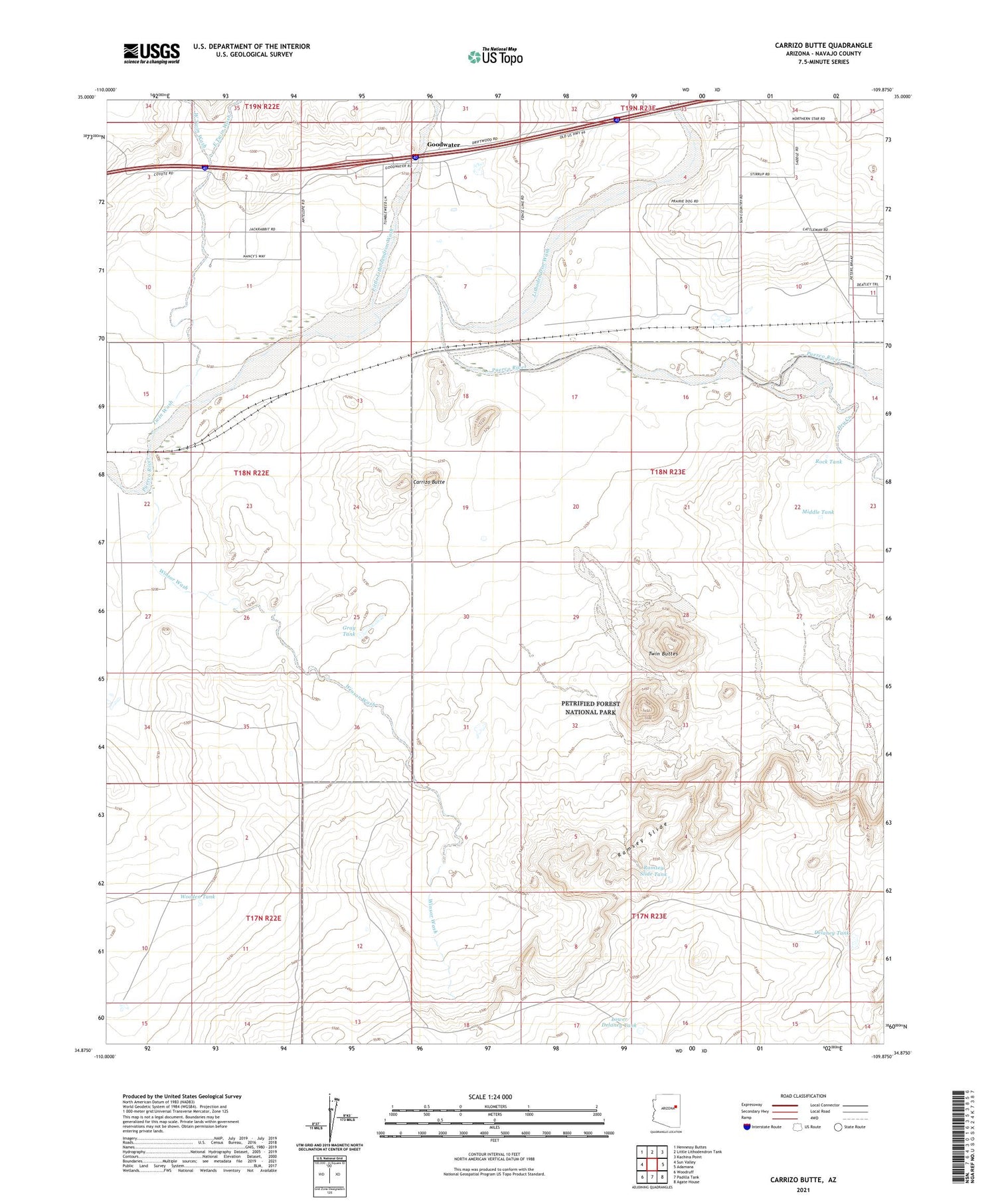
Carrizo Butte Arizona US Topo Map
Couldn't load pickup availability
2021 topographic map quadrangle Carrizo Butte in the state of Arizona. Scale: 1:24000. Based on the newly updated USGS 7.5' US Topo map series, this map is in the following counties: Navajo. The map contains contour data, water features, and other items you are used to seeing on USGS maps, but also has updated roads and other features. This is the next generation of topographic maps. Printed on high-quality waterproof paper with UV fade-resistant inks.
Quads adjacent to this one:
West: Sun Valley
Northwest: Hennessy Buttes
North: Little Lithodendron Tank
Northeast: Kachina Point
East: Adamana
Southeast: Agate House
South: Padilla Tank
Southwest: Woodruff
This map covers the same area as the classic USGS quad with code o34109h8.
Contains the following named places: Carrizo Butte, Delaney Tank, Dry Creek, East Twin Wash, Goodwater, Gray Tank, Lithodendron Wash, Little Lithodendron Wash, Lower Delaney Tank, Middle Tank, Ortegas Ranch, Partnership Well, Puerco Tank, Ramsey Slide, Ramsey Slide Tank, Rock Tank, Twin Buttes, Twin Wash, Ubank Place, West Twin Wash, Winsor Wash, Wooden Tank


