MyTopo
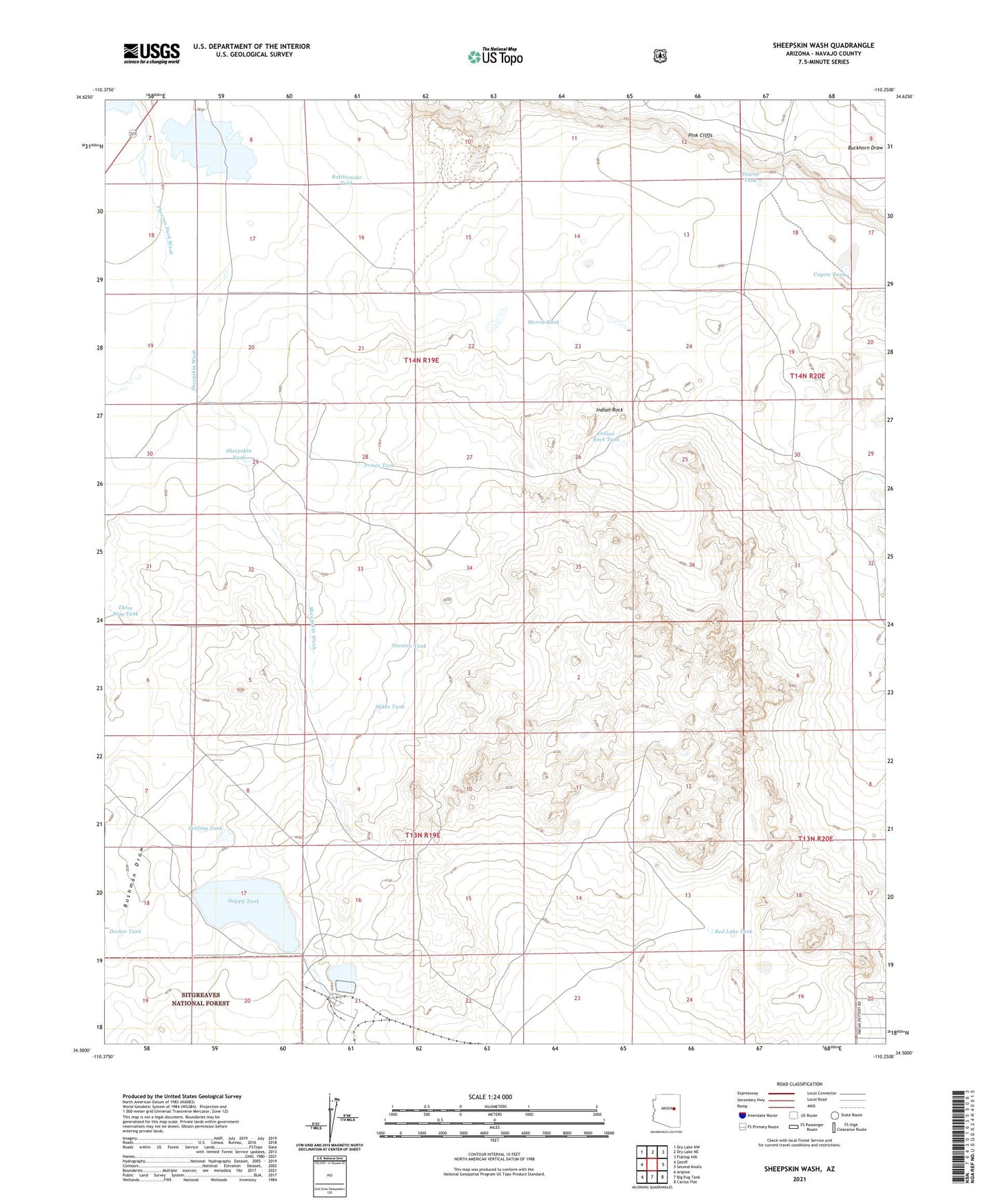
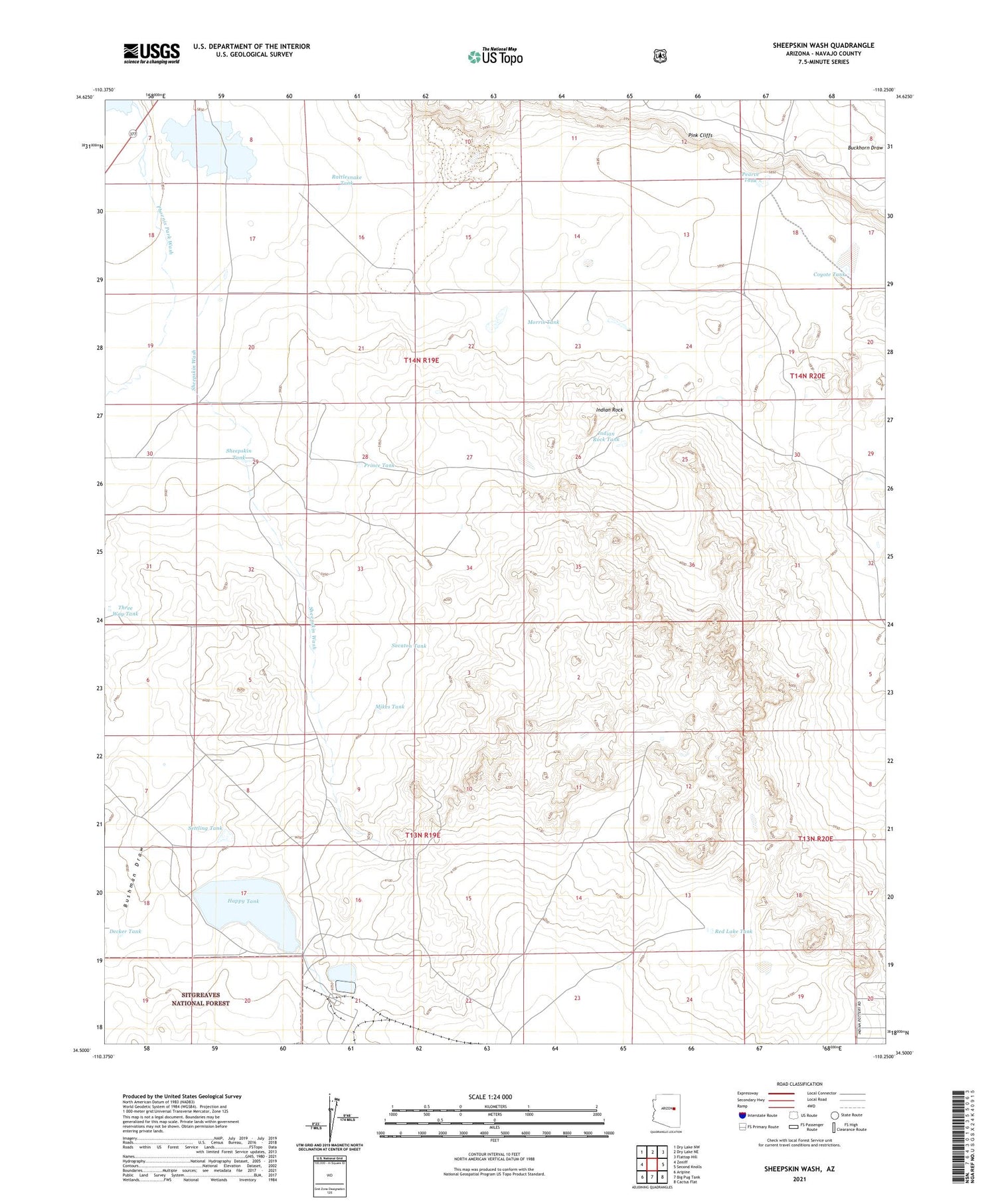
Sheepskin Wash Arizona US Topo Map
Couldn't load pickup availability
Also explore the Sheepskin Wash Forest Service Topo of this same quad for updated USFS data
2021 topographic map quadrangle Sheepskin Wash in the state of Arizona. Scale: 1:24000. Based on the newly updated USGS 7.5' US Topo map series, this map is in the following counties: Navajo. The map contains contour data, water features, and other items you are used to seeing on USGS maps, but also has updated roads and other features. This is the next generation of topographic maps. Printed on high-quality waterproof paper with UV fade-resistant inks.
Quads adjacent to this one:
West: Zeniff
Northwest: Dry Lake NW
North: Dry Lake NE
Northeast: Flattop Hill
East: Second Knolls
Southeast: Cactus Flat
South: Big Pug Tank
Southwest: Aripine
This map covers the same area as the classic USGS quad with code o34110e3.
Contains the following named places: Bushman Draw, Coyote Tank, Decker Tank, Happy Tank, Indian Rock, Indian Rock Tank, Mikes Tank, Morris Tank, Morris Windmill, Pearce Tank, Phoenix Park Wash, Prince Tank, Rattlesnake Tank, Red Lake Tank, Rocking Chair Ranch, Sacaton Tank, Settling Tank, Sheepskin Tank, Sheepskin Wash, Three Way Tank, Twin Lakes, Zeniff Substation