MyTopo
Avra Arizona US Topo Map
Couldn't load pickup availability
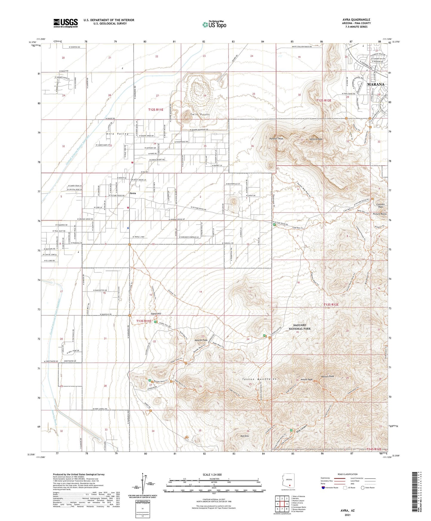
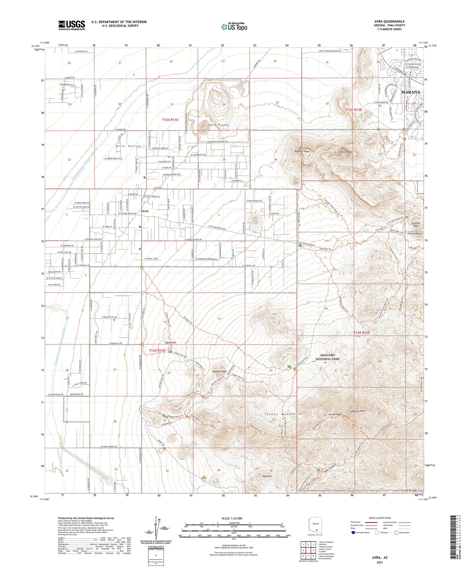
2021 topographic map quadrangle Avra in the state of Arizona. Scale: 1:24000. Based on the newly updated USGS 7.5' US Topo map series, this map is in the following counties: Pima. The map contains contour data, water features, and other items you are used to seeing on USGS maps, but also has updated roads and other features. This is the next generation of topographic maps. Printed on high-quality waterproof paper with UV fade-resistant inks.
Quads adjacent to this one:
West: West of Avra
Northwest: West of Marana
North: Marana
Northeast: Ruelas Canyon
East: Jaynes
Southeast: Cat Mountain
South: Brown Mountain
Southwest: Cocoraque Butte
This map covers the same area as the classic USGS quad with code o32111c2.
Contains the following named places: Amole Peak, Apache Peak, Avra, Busterville Mine, Cam-Boh Picnic Area, Clarey Ranch, Contzen Pass, Desert Discovery Nature Trail, Desert Winds Elementary School, Ez-Kim-In-Zin Picnic Area, Gould Mine, Hugh Norris Trail, King Canyon Trail, Kingdom Hall of Jehovahs Witnesses, Mam-A-Gah Picnic Area, Marana High School, Mile-Wide Mine, M-Z Bar Ranch, Panther Peak, Picture Rocks, Picture Rocks Elementary School, Picture Rocks Fire Station 120, Picture Rocks Fire Station 121, Picture Rocks Intermediate School, Pima County Sheriff's Office Tucson Mountain District, Praise Center Assembly of God Church, Rancho del Esperanza, Rattlesnake Ridge Elementary School, Red Hills, Red Hills Visitor Center, Redeemer Evangelical Lutheran Church, Redeemer Lutheran School, Safford Peak, Sandario Baptist Church, Sendero Esperanza Trail, Signal Hill, Sus Picnic Area, Sweetwater Trail, Thunderbird Mine, Tucson Mountain Wildlife Area, Twin Peaks, Twin Peaks Elementary School, Valley View Overlook Trail, Valley View Picnic Area, Wasson Peak, ZIP Code: 85743