
MyTopo
Ruelas Canyon Arizona US Topo Map
Couldn't load pickup availability
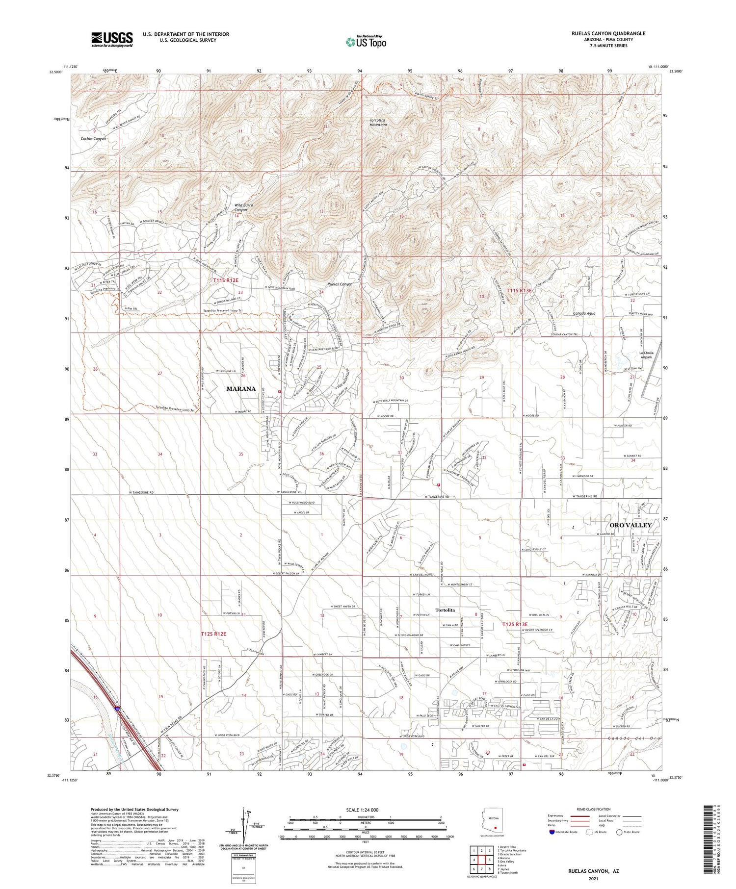
2021 topographic map quadrangle Ruelas Canyon in the state of Arizona. Scale: 1:24000. Based on the newly updated USGS 7.5' US Topo map series, this map is in the following counties: Pima. The map contains contour data, water features, and other items you are used to seeing on USGS maps, but also has updated roads and other features. This is the next generation of topographic maps. Printed on high-quality waterproof paper with UV fade-resistant inks.
Quads adjacent to this one:
West: Marana
Northwest: Desert Peak
North: Tortolita Mountains
Northeast: Oracle Junction
East: Oro Valley
Southeast: Tucson North
South: Jaynes
Southwest: Avra
This map covers the same area as the classic USGS quad with code o32111d1.
Contains the following named places: Alive Church, Arthur Pack Regional Park, Bonnie Brae Ranch, Canada Agua, Canyon Del Oro Assembly of God, Casas Christian School, Cochie Canyon, Copper Mountain Assembly of God, Crooked Tree Golf Course, Desert Foothills Baptist Church, Dove Mountain Golf Resort, El Conquistador Country Club, Episcopal Church of the Apostles, Estrellita Ranch, Grace Community Covenant Church, Ironwood Elementary School, Ironwood Ridge High School, Jurko Ranch, KFLT-AM (Tucson), Kingdom Hall of Jehovahs Witnesses, KOPO-FM (Marana), KVOI-AM (Oro Valley), KXMG-FM (Marana), La Cholla Airpark, Messiah Lutheran Church, Mountain View High School, Northwest Fire District Station 37, Oasis Ranch, Palo Ferro Ranch, Plata Railroad Station, Richard B Wilson Junior K - 8 School, Ruelas Canyon, Sabino Railroad Station, Sage Valley School, Saint Mark Catholic Church, T-Bench-Bar Ranch, Thornydale Family Church, Tortolita, Tortolita Census Designated Place, Tortolita Mountains, Tortolita Presbyterian Church, Wild Burro Canyon, ZIP Code: 85742


