MyTopo
Marana Arizona US Topo Map
Couldn't load pickup availability
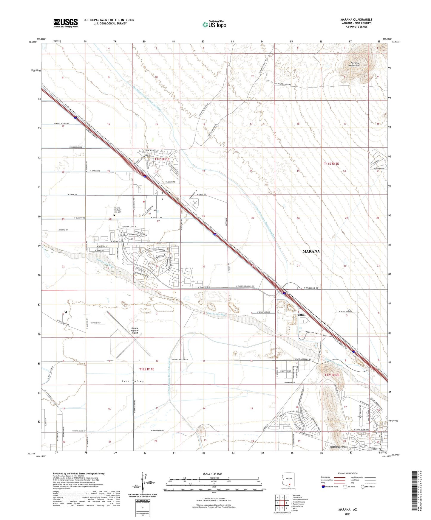
2021 topographic map quadrangle Marana in the state of Arizona. Scale: 1:24000. Based on the newly updated USGS 7.5' US Topo map series, this map is in the following counties: Pima. The map contains contour data, water features, and other items you are used to seeing on USGS maps, but also has updated roads and other features. This is the next generation of topographic maps. Printed on high-quality waterproof paper with UV fade-resistant inks.
Quads adjacent to this one:
West: West of Marana
Northwest: Red Rock
North: Desert Peak
Northeast: Tortolita Mountains
East: Ruelas Canyon
Southeast: Jaynes
South: Avra
Southwest: West of Avra
This map covers the same area as the classic USGS quad with code o32111d2.
Contains the following named places: Arizona Department of Corrections Marana School, Arizona State Prison Marana Community Correctional Treatment Facility, Bread of Life Assembly of God, Church of Christ, Estes Elementary School, KLLE-AM (Marana), KOPO-FM (Marana), Marana, Marana Career and Technical High School, Marana Community Christian Church, Marana Elementary School, Marana Middle School, Marana Mortuary and Cemetery, Marana Municipal Complex, Marana Park, Marana Police Department, Marana Post Office, Marana Railroad Station, Marana Regional Airport, Northwest Fire District Station 36, Papago Railroad Station, Pima County Public Library Geasa Marana Branch, Rattlesnake Pass, Rillito, Rillito Census Designated Place, Rillito Post Office, Rillito Railroad Station, Rillito Vista Park, Saint Christopher Catholic Church, Sun and Shield Baptist Church, Sun and Shield Christian Academy, Tangerine Landfill, Town of Marana, Tucson Electric Power Company North Loop Generating Station, Valley of the Sun Mobile Home Park, ZIP Code: 85654