MyTopo
Sonsela Buttes Arizona US Topo Map
Couldn't load pickup availability
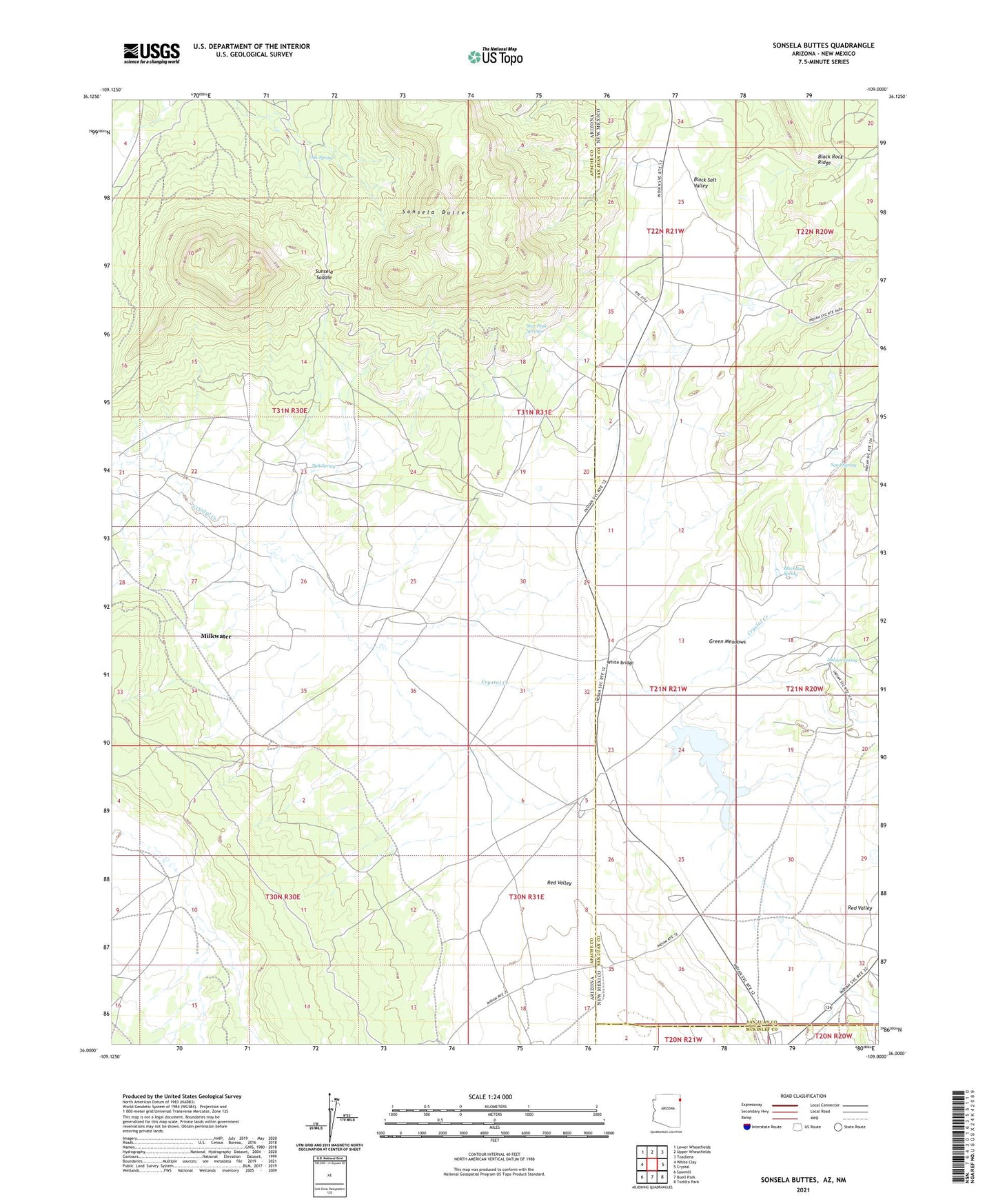
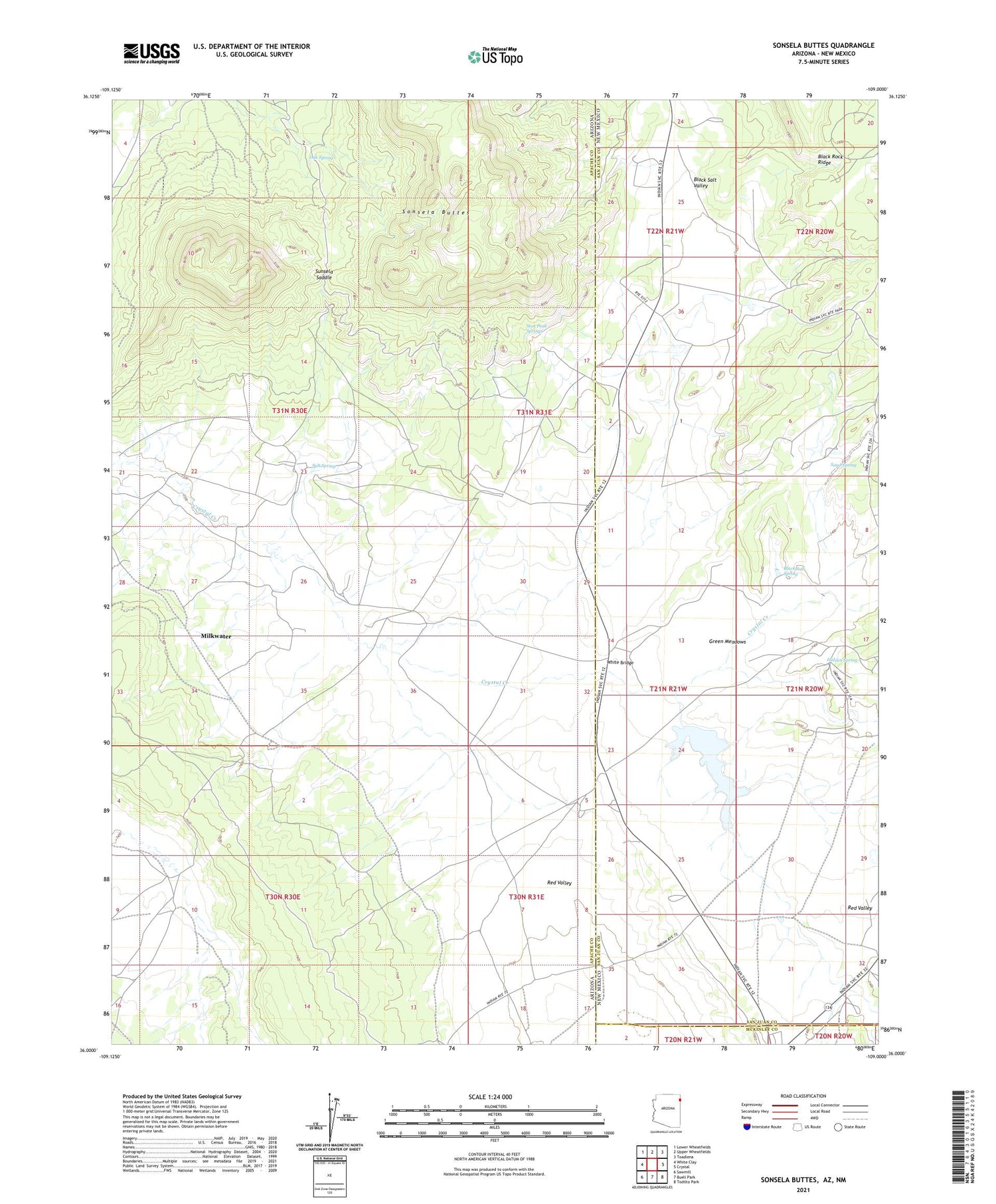
2021 topographic map quadrangle Sonsela Buttes in the states of Arizona, New Mexico. Scale: 1:24000. Based on the newly updated USGS 7.5' US Topo map series, this map is in the following counties: Apache, San Juan, McKinley. The map contains contour data, water features, and other items you are used to seeing on USGS maps, but also has updated roads and other features. This is the next generation of topographic maps. Printed on high-quality waterproof paper with UV fade-resistant inks.
Quads adjacent to this one:
West: White Clay
Northwest: Lower Wheatfields
North: Upper Wheatfields
Northeast: Toadlena
East: Crystal
Southeast: Todilto Park
South: Buell Park
Southwest: Sawmill
Contains the following named places: Black Lake, Black Rock Ridge, Black Salt Spring, Chee Dodge Ranch, Chuska Mountain, Crystal Chapter, Crystal Creek, Green Meadows, Hidden Spring, Milkwater, Oak Spring, Red Valley, Salt Spring, Sand Spring, Sonsela Buttes, Star Peak Springs, Sunsela Saddle, White Bridge