MyTopo
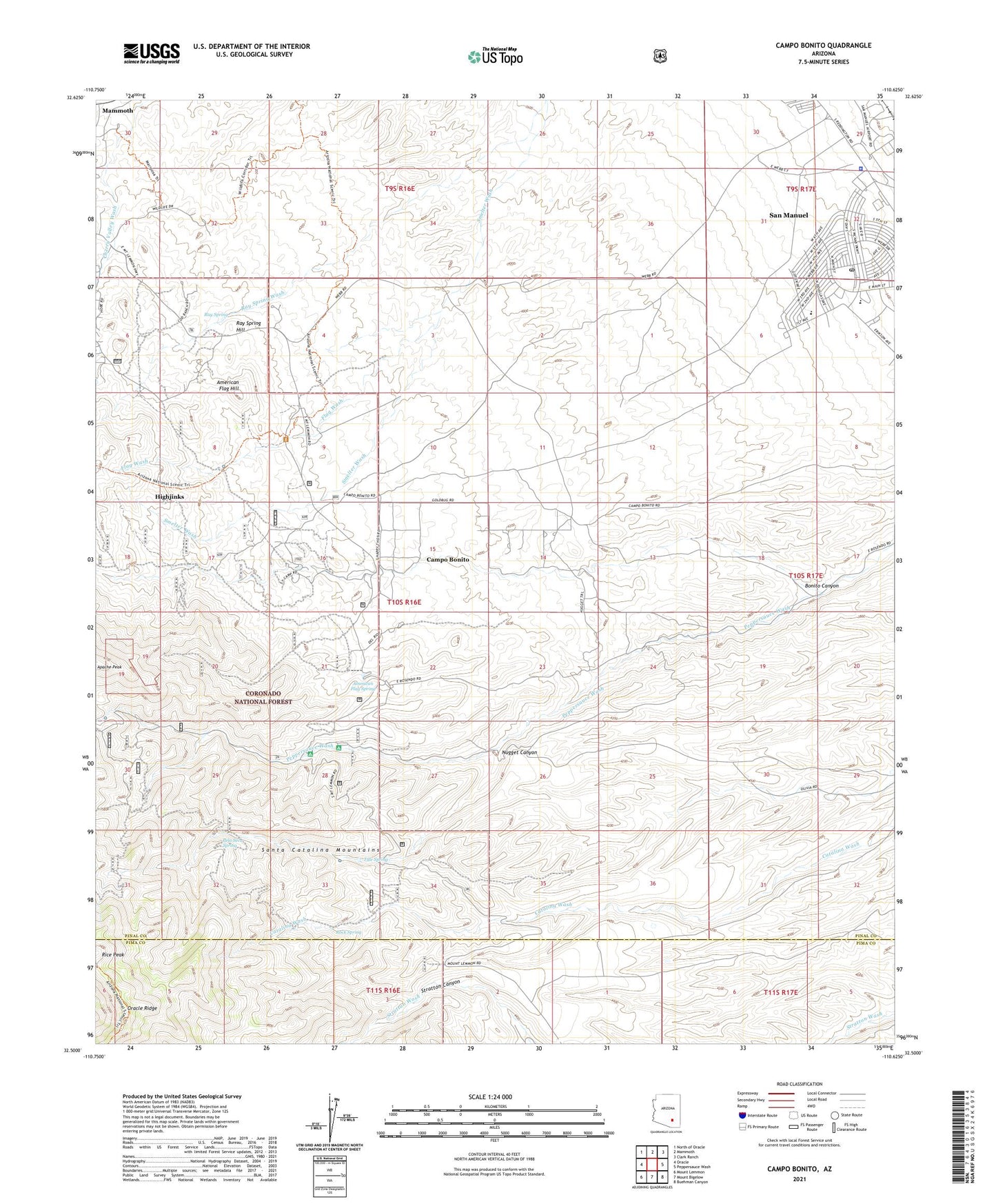
Campo Bonito Arizona US Topo Map
Couldn't load pickup availability
Also explore the Campo Bonito Forest Service Topo of this same quad for updated USFS data
2021 topographic map quadrangle Campo Bonito in the state of Arizona. Scale: 1:24000. Based on the newly updated USGS 7.5' US Topo map series, this map is in the following counties: Pinal, Pima. The map contains contour data, water features, and other items you are used to seeing on USGS maps, but also has updated roads and other features. This is the next generation of topographic maps. Printed on high-quality waterproof paper with UV fade-resistant inks.
Quads adjacent to this one:
West: Oracle
Northwest: North of Oracle
North: Mammoth
Northeast: Clark Ranch
East: Peppersauce Wash
Southeast: Buehman Canyon
South: Mount Bigelow
Southwest: Mount Lemmon
This map covers the same area as the classic USGS quad with code o32110e6.
Contains the following named places: American Flag Hill, American Flag Ranch, American Flag Spring, American Flag Tank, Assembly of God Church, Avenue B Elementary School, Bonito Canyon, Bonito Mine, C O D Ranch, Campo Bonito, Campo Bonito Census Designated Place, Chain Link Tank, Cherry Valley Ranch, City Park, Cody Trailhead, Dead Bull Mine, First Avenue Elementary School, First Baptist Church in San Manuel, Flag Wash, Highjinks, Highjinks Mine, Kannally Ranch, Mammoth Copper Corporation Hospital, Nugget Canyon, Old Maudina Mine, Pela Seca Spring, Peppersauce Campground, Peppersauce Group Campground, Pinal County Sheriff's Office San Manuel Region B, Ray Spring, Ray Spring Hill, Ray Spring Wash, Rice Peak, Rock Spring, Saint Bartholomew's Church, Salvation Army Camp Wood, San Manuel, San Manuel Census Designated Place, San Manuel Copper Hospital, San Manuel Junior Senior High School, San Manuel Post Office, San Manuel Public Library, Southern Belle Mine, Stratton Tank, Three C Ranch, Tule Spring, Young Mens Christian Association Camp