MyTopo
Peppersauce Wash Arizona US Topo Map
Couldn't load pickup availability
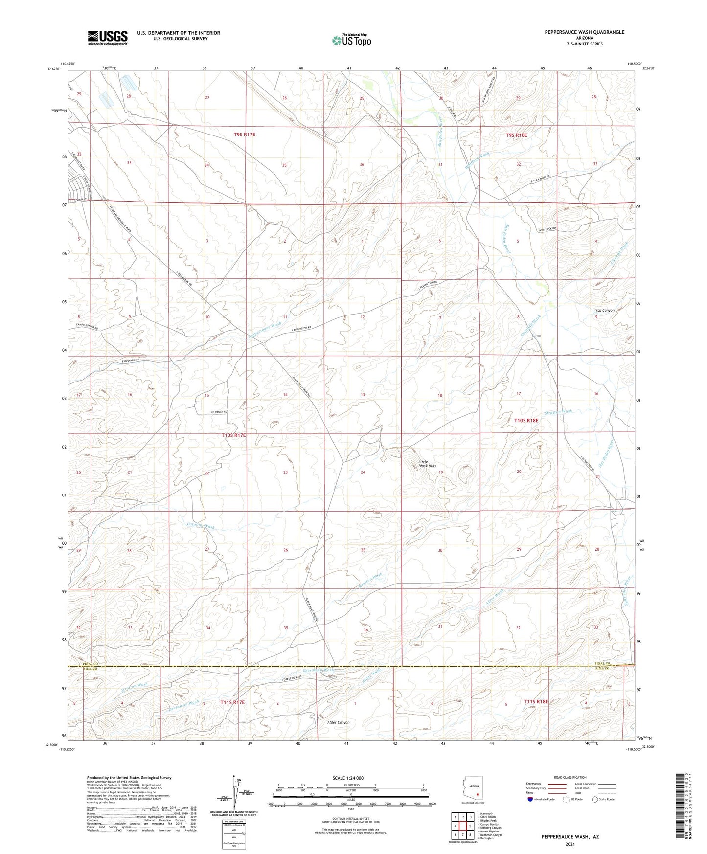
2021 topographic map quadrangle Peppersauce Wash in the state of Arizona. Scale: 1:24000. Based on the newly updated USGS 7.5' US Topo map series, this map is in the following counties: Pinal, Pima. The map contains contour data, water features, and other items you are used to seeing on USGS maps, but also has updated roads and other features. This is the next generation of topographic maps. Printed on high-quality waterproof paper with UV fade-resistant inks.
Quads adjacent to this one:
West: Campo Bonito
Northwest: Mammoth
North: Clark Ranch
Northeast: Rhodes Peak
East: Kielberg Canyon
Southeast: Redington
South: Buehman Canyon
Southwest: Mount Bigelow
This map covers the same area as the classic USGS quad with code o32110e5.
Contains the following named places: Alder Canyon, Alder Wash, Black Hills Mine, Catalina Wash, Cienega Wash, Geesaman Wash, Little Black Hills, Little Gust James Wash, Peppersauce Wash, Sacaton Ranch, Stratton Wash, Whitlock Wash, YLE Canyon, ZIP Code: 85631