MyTopo
Pine Arizona US Topo Map
Couldn't load pickup availability
Also explore the Pine Forest Service Topo of this same quad for updated USFS data
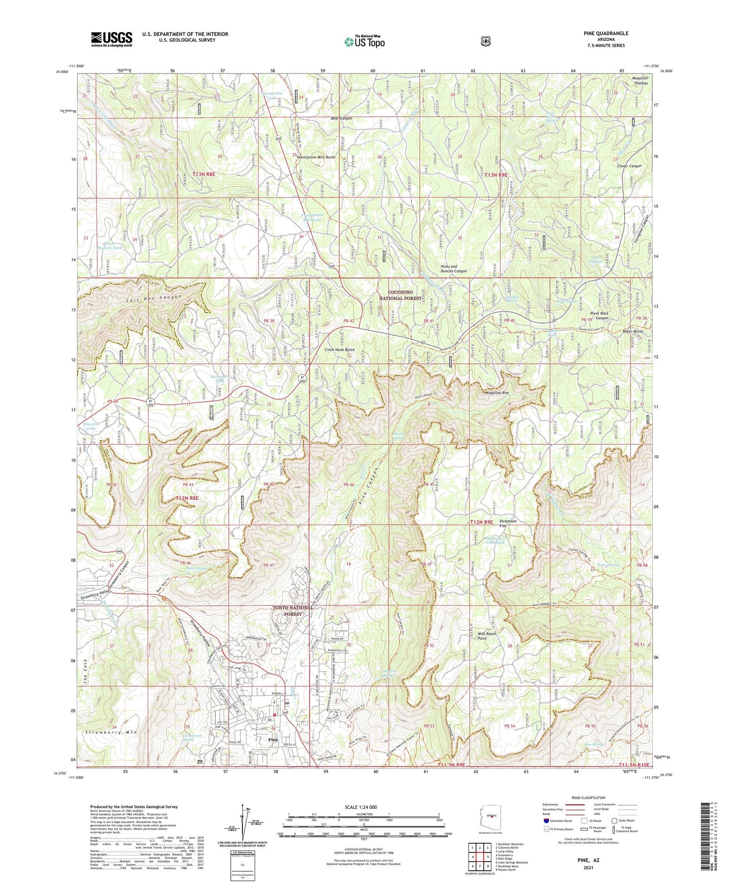
2021 topographic map quadrangle Pine in the state of Arizona. Scale: 1:24000. Based on the newly updated USGS 7.5' US Topo map series, this map is in the following counties: Coconino, Gila. The map contains contour data, water features, and other items you are used to seeing on USGS maps, but also has updated roads and other features. This is the next generation of topographic maps. Printed on high-quality waterproof paper with UV fade-resistant inks.
Quads adjacent to this one:
West: Strawberry
Northwest: Buckhorn Mountain
North: Calloway Butte
Northeast: Long Valley
East: Kehl Ridge
Southeast: Payson North
South: Buckhead Mesa
Southwest: Cane Springs Mountain
This map covers the same area as the classic USGS quad with code o34111d4.
Contains the following named places: Baker Butte, Baker Lake, Baker Spring, Camp Geronimo, Camp Lo Mia, Cinch Hook Butte, Corduroy Wash, Corner Tank, Cottonwood Spring, Dickenson Flat, Dickenson Flat Tank, Dripping Springs, First Baptist Church of Pine, Fivemile Lake, Fuller Spring, Garden Tank, Hicks and Duncan Tank, Horse Pasture Tank, Huffer Springs, Milk Ranch Point, Parsnip Spring, Pine, Pine - Strawberry Fire District Station 41, Pine Canyon, Pine Census Designated Place, Pine Post Office, Pine Ranger Station, Pine Spring, Pine Strawberry Elementary School, Pivot Rock Spring, Sevenmile Tank, Strawberry, Strawberry Canyon, Strawberry Hollow, Strawberry Mountain, Strawberry Valley, Turkey Spring, Twentynine Mile Butte, Twentynine Mile Lake, Twentynine Tank, Wildcat Spring