MyTopo
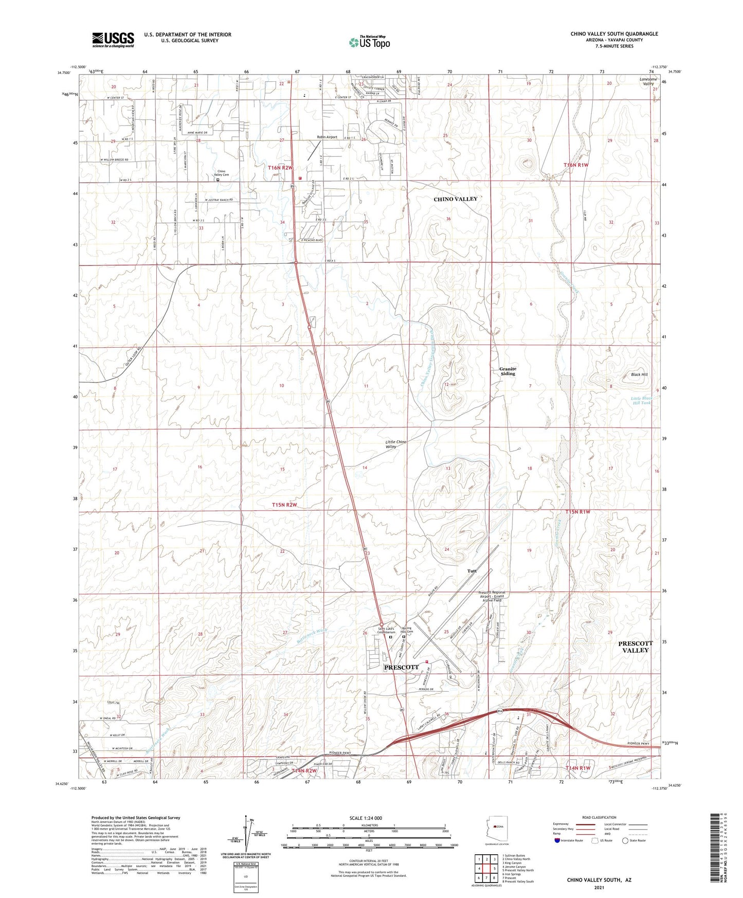
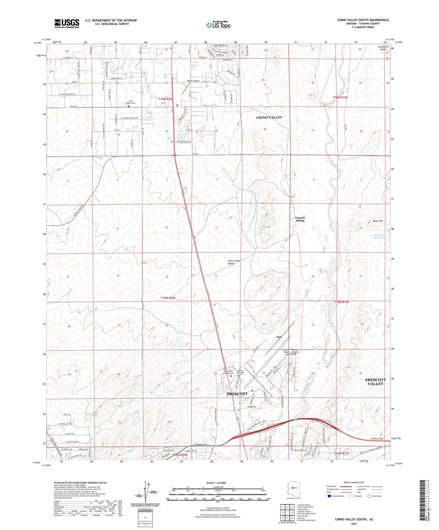
Chino Valley South Arizona US Topo Map
Couldn't load pickup availability
Also explore the Chino Valley South Forest Service Topo of this same quad for updated USFS data
2021 topographic map quadrangle Chino Valley South in the state of Arizona. Scale: 1:24000. Based on the newly updated USGS 7.5' US Topo map series, this map is in the following counties: Yavapai. The map contains contour data, water features, and other items you are used to seeing on USGS maps, but also has updated roads and other features. This is the next generation of topographic maps. Printed on high-quality waterproof paper with UV fade-resistant inks.
Quads adjacent to this one:
West: Jerome Canyon
Northwest: Sullivan Buttes
North: Chino Valley North
Northeast: King Canyon
East: Prescott Valley North
Southeast: Prescott Valley South
South: Prescott
Southwest: Iron Springs
This map covers the same area as the classic USGS quad with code o34112f4.
Contains the following named places: Antelope Hills Golf Course, Apostolic Christian Church, Black Hill, Bottleneck Wash, Bottleneck Wash Dam, Chino Valley Cemetery, Chino Valley Fire District Station 62, Chino Valley High School, Chino Valley Irrigation Ditch, Chino Valley United Methodist Church, Cooper Farm Landing Strip, Federal Aviation Administration Tower, Grace Baptist Church, Granite Siding, Little Black Hill Tank, Prescott Fire Department Station 73, Prescott Regional Airpark and Commerce Center, Prescott Regional Airport - Ernest A Love Field, Robin Airport, Rolling Hills Cemetery, Saint Luke's Columbarium, Saint Lukes Episcopal Church, Tri - city College Preparatory High School, Tutt, Westside Christian Church